The most beautiful hikes in the world

Great one-day hikes
Petr Liška
Wrote 2463 articles and follows him / her 248 travelers
The most beautiful hikes in the world
Inserted: 29.12.2016
© gigaplaces.com
They want there:

In this overview you will find a very beautiful, the maximum one-day hikes from around the world. Not only during long treks, but even with such a short hike, you can explore the beautiful and dramatic places. Unlike multiday treks you do not pull camping equipment, so you be walked lightly and comfortably.

1.
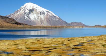
Hike Lagunas de Altura

On the way to three beautiful lagoons

Rating:
| Altitude: 5 150 m / 16 896 ft

This beautiful and surprisingly not frequently walked hike around high-lying altiplano lagoons leads on both sides of the border between Bolivia and Chile. During this hike you will enjoy not only the beautiful lagoons, but also amazing views of the surrounding volcanoes with impressive Sajama at the forefront. This description follows on the trip /way/ leading from the village of Sajama to fumaroles. continue reading

2.
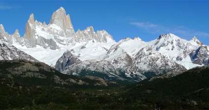
Hike to the lagoon de Los Tres

The way under Fitz Roy

Rating:
| Altitude: 1 180 m / 3 871 ft

The most beautiful, but also the most frequently walked hike from El Chalten is the one to the lagoon de Los Tres directly under the monumental granite walls of Fitz Roy. Except for this beautiful mountain you can admire on this trip also the view of the river Vueltas and surrounding wilderness. Count with about three hours to get the lagoon. continue reading
3.
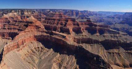
Hike Grand Canyon South Kaibab Trail

Descent to the very bottom of the Grand Canyon

Rating:
| Altitude: 1 011 m / 3 317 ft

There is probably no more world-famous place than the Grand Canyon. I had the opportunity to look at the very bottom and meet the Colorado River, which is constantly digging this canyon. The hike is almost 30 km long with an elevation gain of 3000 m, where temperature fluctuations reach up to 40 ° C. On the way down I went the South Kaibab Trail and up the Bright Angel trail. continue reading

4.
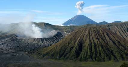
Ascent to Bromo Viewpoint

Famous volcanic panorama

Rating:
| Altitude: 2 660 m / 8 727 ft

Bromo Tengger Semeru National Park in the eastern part of the island of Java offers several relatively simple tours in an amazing volcanic landscape. The most famous of these is the ascent to the Bromo Viewpoint. The view from here of the huge ancient caldera with the gurgling Brom and the monumental Semeru volcano on the horizon are among the biggest attractions Indonesia can offer. continue reading
5.
Tongariro Alpine Crossing Tour

The most beautiful one-day march

Rating:
| Altitude: 1 880 m / 6 168 ft

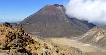
Tongariro Alpine Crossing is probably the most famous day trip on the North Island. Here you walk through a volcanic landscape used as the land of Mordor in the Lord of the Rings trilogy. The clear dominant feature of this hike is the Ngauruhoe volcano (2,287 m above sea level) in the film named as Mount Doom, which you can also climb as (the best recommended side trip on this hike). Along the way, you will also see beautiful Emerald Lakes and other volcanic formations, including the surreal Red Crater. continue reading

6.
Hike in the Red valley

World of rocks from Göreme to Çavuşin

Rating:
| Altitude: 1 050 m / 3 445 ft

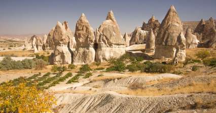
The trip starting near the town of Göreme is very beautiful and offers incredible views of the surrounding rock formations, outlooks and many mysterious caves carved into the rocks. The destination is close historic town of Çavuşin, from where you can take a bus back to Göreme. The route is relatively easy and is suitable also for families with children. continue reading

7.
Ascent to Parkachik la

Beautiful outlook of Nun and Kun

Rating:
| Altitude: 4 000 m / 13 123 ft

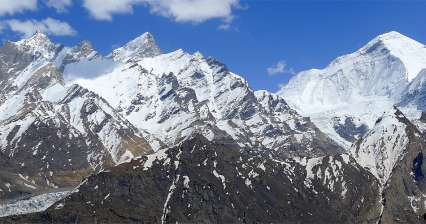
One of the best experiences in beautiful Suru valley is an easy ascent from Panikhar (3 270 m asl) to  Parkachik la pass ( 4,000 m asl) with an amazing view of the local mountain giants Nun (7 135 m asl) and Kun (7 077 m asl) and other peaks in the main Himalaya ridge separating Kashmir from Ladakh. continue reading

8.
Hike Sendero Mirador Nordenskjöld

Awesome outlook of Torres

Rating:
| Altitude: 130 m / 427 ft

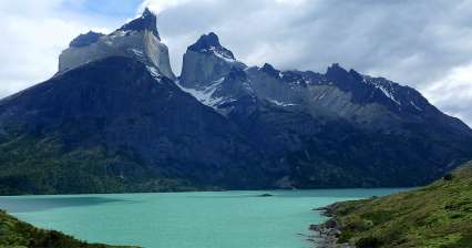
National Park Torres del Paine is famous mainly for its W-trek, but you can make here a plenty of other treks and walks with amazing outlooks of the local rock towers, glaciers and incredibly blue glacial lakes. One such shorter walk is the path from Pudeto to the outlook point Mirador Nordenskjold, where you can enjoy (relatively without much effort) the local stunning Patagonian nature and big waterfall Salto Grande as a bonus.  continue reading
9.
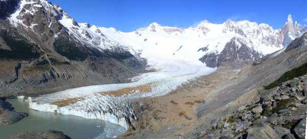
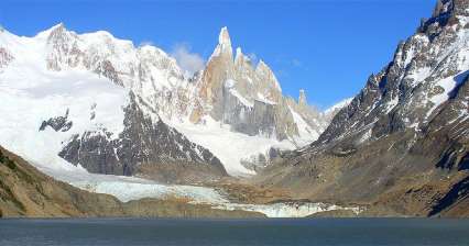
Hike to lagoon Torre

Under the sharpest spike of Glaciares

Rating:
| Altitude: 750 m / 2 461 ft

The second most popular half-day hike from El Chalten is to the lagoon Torre, above which rises the most difficult mountain throughout National Park Glaciares – Cerro Torre (3,102 m asl). The path to these towers leads through picturesque landscape modeled by glacier long ago. There is also a camp at the lagoon Torre and at the same time starting point to the South Patagonian ice field. The walk to the lagoon takes about three hours.  continue reading

10.
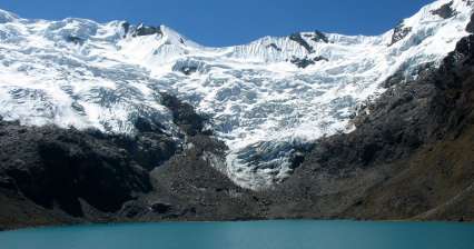
A trip to the Huaytapallana mountains

A tour of the beautiful Pocket Mountains

Rating:
| Altitude: 4 582 m / 15 033 ft

The most beautiful day trip from the picturesque town of Huancayo will take you directly into the interior of the small, yet quite glaciated Nevado Huaytapallana. This mountain range is also a regional protected natural area. This short trip describes a classic circuit in the best accessible southern part of the mountains. Along the way you will see a number of azure lagoons and beautiful more than five thousand mountain peaks in an almost deserted landscape. continue reading
11.
Ascent to Intipunku

Sun Gate above Machu Picchu

Rating:
| Altitude: 2 770 m / 9 088 ft

Machu Picchu (2 430 m asl) is not only about a tour around the Inca ruins surrounded by scenic rock cones and covered with mist forest. There are several nice hiking opportunities. One of the easiest is the ascent to the Sun Gate (2 770 m asl), which is in fact a small fortress high on the ridge overlooking both sides of the valley. This ascent is basically the last stage of the famous Inca Trail. Views of Machu Picchu and the surrounding countryside are absolutely delightful. continue reading

12.
Hike to the peninsula of Sao Lourenco

The easternmost tip of the island

Rating:
| Altitude: 100 m / 328 ft

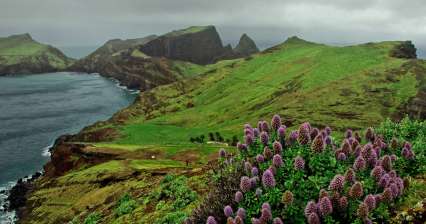
Ponta de Sao Lourenco is a popular tourist destination. While the rest of Madeira abounds in lush vegetation, this part of the island is very dry. Only in the winter months do interesting plants turn green and bloom here. The hike is not particularly strenuous, its charm lies mainly in the views of the wild rocky coast. However, the wind usually blows here continuously and in its gusts it tries to keep both tourists and landing planes, which approach the airport in Funchal through this eastern area. continue reading
13.
Trek in Landmannalaugár

With ascent to Brennisteinsald (881 m asl) and Bláhnúkur (945 m asl)

Rating:
| Altitude: 945 m / 3 100 ft

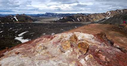
Trek in the Liparite (rainbow) mountains of Landmannalaugár, in the Fjallabak nature reserve. Views from the Brennisteinsalda and Bláhnúkur peaks to the Grænagil gorge, the valleys of the Jökullgilskvísl, Námskvísl and Brandsgilskvísl rivers. Return to the lava field Laugahraun. Elevation approx. 400 m. Starting point – camp Landmannalaugár, cottage Sæluhús. continue reading

14.
Hike from Copacabana to the island of the Sun.

Beautiful walk along the shores of Lake Titicaca

Rating:
| Altitude: 3 916 m / 12 848 ft

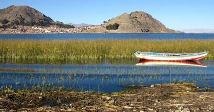
One of the most popular trips from Copacabana is a cruise to the island of the Sun. It is much more interesting to sail only one way and the other to walk along the shores of Lake Titcaca and enjoy the beautiful bays, rocks protruding from the water and interesting local life. This route is about 15 kilometers long and leads most of the road on a slightly busy coastal road. continue reading
15.
Levada Hike 25 Fontes

From Rabacal to 25 springs

Rating:
| Altitude: 1 230 m / 4 035 ft

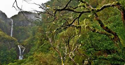
One of the most beautiful levada tours in Madeira leads through mysterious tree heaths and laurel forest with views of the high Risco waterfall to a romantic place called 25 springs. The starting point is the parking lot on the road ER110. From here, a descending narrow path leads to the Rabacal Forest Administration building. It is not such an attractive part on foot compared to the following laurel forest and levada, so it is better to take the journey on a small minibus that runs here. continue reading

16.
Ascent to Ultars meadows

Ascent high above the valley of Hunza

Rating:
| Altitude: 3 800 m / 12 467 ft

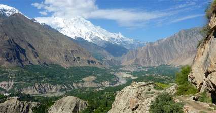
Ascent to Ultars meadows is the most popular day hike leading straight up above the narrow and steep canyon at the upper part filled up by the glacier and take you to the magical place overlooking the surrounding steep peaks and a small waterfall. Most photogenic mountain here is the famous "Lady finger ". This hike can be managed either without backpack or by staying in a small mountain hut or possibly get even higher to Honn pass. continue reading
17.
Ascent to Mannen

Around mountain lakes and snow fields

Rating:
| Altitude: 1 294 m / 4 245 ft

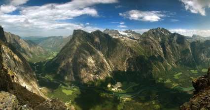
It is possible to undertake several interesting hikes to the surrounding peaks, to the glacier or mountain lakes around The Trolls' Path (Trollstigen). Difficulty of these „hikes“ is different and is indicated at the starting points on a directive in blue, red or black. In general, however, also „blue“ hikes have mostly narrow paths and rocky terrain. The indicated times are really only for very experienced hikers (and Norwegians). The ascent to the outlook peak Mannen (1 294 m asl) is not difficult, but in its last part before the summit you must overcome several rock and scree fields with confident walk and good orientation. The terrain in the valley Alnesdalen is often wet with small wetlands and even in July there may still be snowfields in the higher parts. The reward for the effort will be a bird's eye view of the valley Romsdalen and the surrounding mountains.  continue reading
18.
Tube Sillar trek

A wilderness not far from Tupiza

Rating:
| Altitude: 4 040 m / 13 255 ft

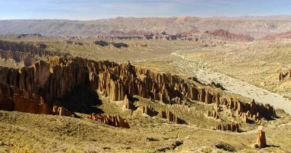
You will definitely not find this beautiful hike over the Palala Valley in any Bolivian guide, yet it offers wonderful views of the rock town of El Sillar. In addition, you will experience a drop of adventure in a completely deserted landscape full of small canyons and weathered rock towers. If you set off lightly and have to return to Tupiza that day, set off very soon, so that you can return in the light. This tour is definitely not suitable for lonely tourists, if something happens to you you will not call. continue reading

19.
Ascent to the Monastery (Ad-Deir)

The outlook up to the Dead Sea

Rating:
| Altitude: 1 065 m / 3 494 ft

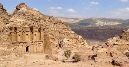
The most popular hike in the rock town of Petra is almost hourly ascent to the Monastery (Ad- Deir), which is only slightly less impressive than the main attraction of the entire town – Al-Khazneh (Treasury). In addition, only a few hundred meters away are two beautiful outlooks next to each other overlooking Wadi Araba, Jebel Haroun and the entire town.   continue reading

20.
Ascent to Pico do Arieiro

The highest position of Madeira

Rating:
| Altitude: 1 861 m / 6 106 ft

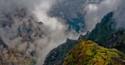
This area is the best that Madeira has to offer in alpine tourism. In addition, access to Pico do Arieiro is easy, ie by car on a mountain road to the parking lot at an altitude of 1818 meters above sea level. continue reading
21.
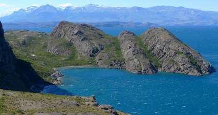
Hike from Chile Chico

Along Lake General Carrera

Rating:
| Altitude: 450 m / 1 476 ft

From the small town of Chile Chico, located on the enchanting Lake Patagonian General Carrera, you can take a beautiful expedition along the lake to beautiful beaches and rocky views. continue reading

22.
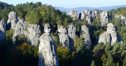
Trip to Hruboskalsko

Rock town with castle

Rating:
| Altitude: 410 m / 1 345 ft

Hruboskalsko competes with Prachov rocks for the most popular tourist rock town in the Bohemian Paradise. You can admire here beautiful panoramas not only of interesting rock formations, but also distant views of Kozákov ridge (“Kozákovský hřeben”), Giant Mountains (“Krkonoše”) and Ještěd. Except for it there is also nice castle Hrubá Skála, castle Valdštejn (“Wallenstein”) and interesting Kopic farm (“Kopicův statek”) and a short way from here also reliefs in sandstone rocks. It is possible to combine here easy hiking circuits suitable also for small children with more difficult ones, where you can expect hundreds of stairs in the center of the rock town. continue reading
23.
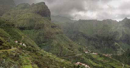
Hike in Barranca Masca

In the grip of volcanic rocks to the oce

Rating:
| Altitude: 620 m / 2 034 ft

Masca Gorge begins in the village bearing the same name. Most ordinary tourists overcome the 600 meter descent to the ocean, from where they will be taken by pre-arranged boat to one of the nearest tourist centers. But Masca is not only about going down and back. In the narrow ravine of the gorge, which is hemmed by several hundred meters high rocks, there is a microclimate even without any breeze and water supply is a must. You will be rewarded by fantastic views of the rock formations, beautiful bay and good feelings from the hike, which is shown in guides as one of the most difficult in Tenerife.  continue reading

24.
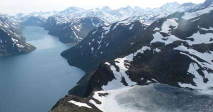
Besseggen ridge crossing

One of the most popular treks in all of Norway

Rating:
| Altitude: 1 465 m / 4 806 ft

The Besseggen ridge is located in the Jotunheimen National Park and is undoubtedly one of the most popular treks in Norway. Along the trek there are countless beautiful lakes, which are dominated by 18 km long lake Gjende. One of the most beautiful places on the trek is the view of the Bandet natural dam, which separates Lake Gjende from Lake Bessvatnet, which lies almost 400 meters higher! continue reading
25.
Hike above the gorge of Todra

Through Todra gorge into the mountains t

Rating:
| Altitude: 1 700 m / 5 577 ft

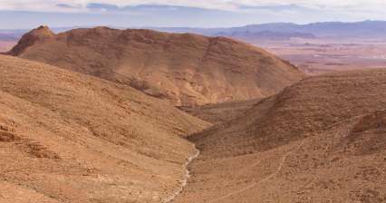
Trek through Todra Gorge is not very difficult. We get to the nomadic settlement in the mountains through interesting terrain of rocky and plastic Atlas and then return different way back to the starting point.  continue reading

26.
Hike across View Point to Runtee beach

Ascent to the most famous viewpoint of the island

Rating:
| Altitude: 139 m / 456 ft

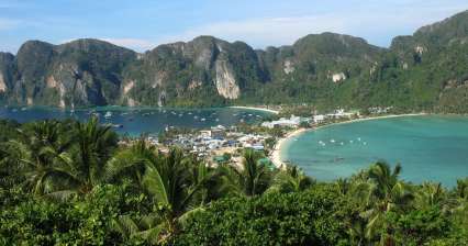
Most tourists come to Phi Phi to have a nice place on the local white beaches. However, there is one output that most of them complete – View Point. If you want to expand this path, you can continue along the jungle path to the beach Runtee (Rantee). continue reading
27.
Hike over Shigatse

Fabulous view of the monastery and fortr

Rating:
| Altitude: 4 150 m / 13 615 ft

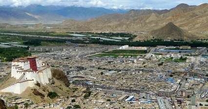
Most tourists visit only two main places in Shigatse – panchen lama monastery Tashilhunpo and the old fort, which looks like a miniature of Potala in Lhasa. The most interesting, however, is the ascent to the outlook ridge above the town, from where you have a great view of the town. Without any doubt, this trip is the best activity you can undertake in this second largest Tibetan town.   continue reading

28.
Crossing over the Pico Viejo

The best in the volcanic landscape

Rating:
| Altitude: 3 555 m / 11 663 ft

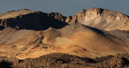
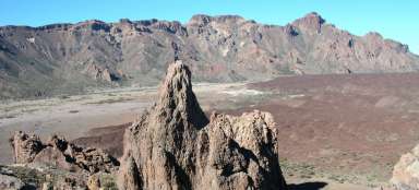
This hike is very tempting, because it takes you almost to the top of Pico de Teide (possibly up to it), guides you through the chaotic terrain of lava flows and makes you acquainted with the incredible landscape of monumental crater of volcano Pico Viejo drowsing on the foot of higher stratovolcanic Teide. There is a cableway leading to this highest peak of Tenerife and the whole Spain and it ends at a height of 3 555 meters asl. Another possible way to get there (except for the alternative ascent to Pico de Teide, for which is necessary a permit) continues with the descent. But its length and terrain is quite challenging. The descent ends at the parking lot at Parador Nacional de las Canadas hotel at an altitude of approximately 2 100 meters asl.  continue reading
29.
Hike to Monte Taborno

Matterhorn of Tenerife

Rating:
| Altitude: 630 m / 2 067 ft

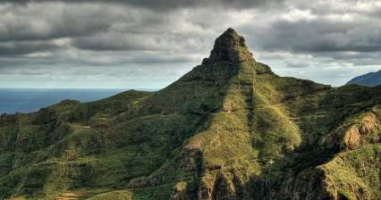
This peak, reminiscent by its shape uniqueness of a little iconic Swiss mountain, is not high – it has only 706 meters asl, But it lies close to the ocean and therefore gives very monumental impression. It is located in the northern part of the island in the mountains of Anaga. Also the access to it along the ridge separating deep valleys is very attractive. Another route that bypasses gradually the peak offer magnificent views of mountains, valleys and cliffs in the north of Tenerife.  continue reading
30.
Hike Passu - Lake Borit

Hike between two glaciers

Rating:
| Altitude: 2 800 m / 9 186 ft

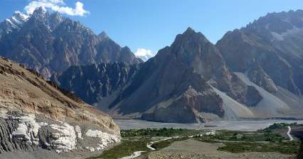
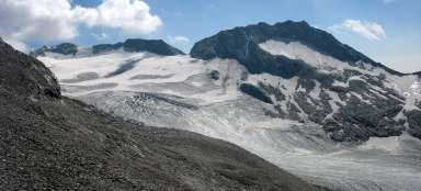
If you want to undertake a little more adventurous half-day hike in Passu, it is best to walk from the glacier Passu to lake Borit lying above the village of Hussaini. You can admire the views of two glaciers and two different lakes during this hike. But the path is in some places not very clear and you will need your own intuition. But on the other hand, you cannot lose your way completely. To the north from you is a wall of Karakorum and to the south Karakorum Highway, where you can run down if you get lost on the upland plain between glaciers. Earlier this trek led even further to the bridge of „Indiana Jones“, but everything has disappeared under the waters of Lake Attabad. continue reading

31.
Hike around Lamayuru gompa

Walk in the moonland

Rating:
| Altitude: 3 600 m / 11 811 ft

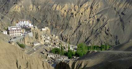
The ancient Lamayuru gompa surrounded by small town with Tibetan-looking houses is the center of Buddhism in western Ladakh. It gives the impression as a counterweight of a little hectic Leh. In addition to the famous festivals held here such as colorful Yuru Kabgyat and trekkers setting out from here for the hike to Padum, worth seeing is also the close „moon“ surroundings of the monastery. All the bustle and hustle disappears suddenly after only a few hundred meters away. continue reading

32.
Hike to Blavatnet lake

Walk to the lake

Rating:
| Altitude: 781 m / 2 562 ft

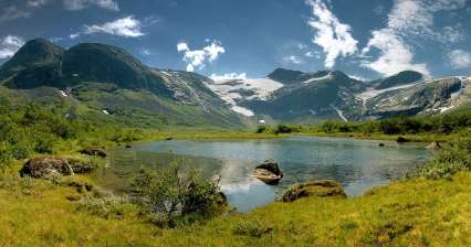
From the valley Stardalen in National Park Jostedalsbreen lead many interesting paths to glaciers and lakes. This ascent to the lake Blavatnet begins very comfortably by car – by ascending along the toll road south to a place called Befringstoylen (toll 50, – NOK). The continuation is relatively easy without any difficult ascent through low birch forest up to the lake, which is at an altitude of 781 meters asl. It is difficult to get around the lake, because it is surrounded by wetlands. It is an easy walk that will bring the views of typical Norwegian countryside, in addition, with only few tourists. And because the summer days are long, it is possible to walk in the afternoon into the very eastern end of valley Stardalen that is formed by narrow valley of Langedalselva.  continue reading

33.
Hike in Nehyeaal Danda

Views above the Lake Phewa

Rating:
| Altitude: 1 500 m / 4 921 ft

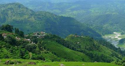
Green ridge towering from the southern shore of Lake Phewa offers beautiful outlooks of extensive rice fields on its slopes and in good weather also of the glaciated peaks of Annapurnas. In addition, you will meet here only minimum tourists and you would not even guess that right next door is the second busiest city in Nepal – Pokhara. There are basically two starting points for this trip – from World peace stupa (1 100 m asl), where you can get in a taxi or from Chatichhina (850 m asl), where you can walk along the lakeshore.   continue reading

34.
Through Velká Studená a Velická valley

Over Prielom and Polský hrebeň

Rating:
| Altitude: 2 428 m / 7 966 ft

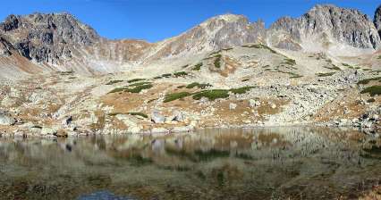
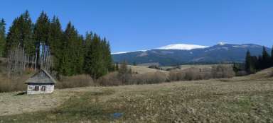
From Starý Smokovec you can set out for one of the most beautiful hikes in the High Tatras leading up Velká Studené dolina (“Great Cold valley”) to Zbojnická chata (“lit. Brigand hut”) and on over nice pass Prielom and Polský hrebeň (“Polish ridge”). The best on this hike can be the ascent to Východná Vysoká (2 428 m asl) from Polský hrebeň. The descent back leads through Velická dolina to Sliezský dom (lit.”Silesian house”) and on to Starý Smokovec. The hike is difficult especially for its length and elevation. continue reading

35.
Ascent to volcano Sabyinyo

Mountain on the border of three states

Rating:
| Altitude: 3 645 m / 11 959 ft

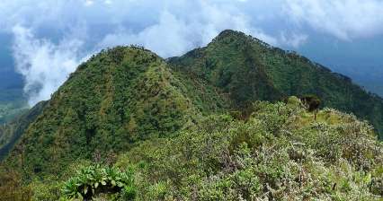
Most tourists come to National Park Mgahinga because of the very rare mountain gorillas. But you can also hike here on the local volcanoes. Although the highest mountain in the National Park is four thousand high Mount Muhabura (4 127 m asl), far more popular ascent is to Sabyinyo (3 645 m asl), whose peak lies directly on the border of three countries: Uganda, Rwanda and DRC Congo. During the ascent you will enjoy beautiful sceneries looking into all three states and also lush vegetation on the slopes of this mountain. continue reading

36.
Sail

The most beautiful mountain on the island of Senja

Rating:
| Altitude: 596 m / 1 955 ft

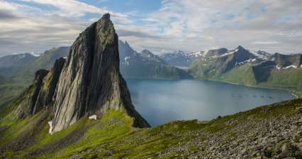
Mount ** Segla ** belongs together with the jagged ridge „Okshornan“: [https://www.gigaplaces.com/…k-okshornan/] to the most iconic places on the island „Senja“: [https://www.gigaplaces.com/ oblast-senja /] and without exaggeration it can be said that even the best in the whole of Norway. As this mountain is not as well known as other Norwegian attractions (** Preikestolen **, ** Trolltunga **), you will not meet too many tourists here. continue reading

37.
Hike to the mountains above Lake Sonkol

To an abandoned prospect

Rating:
| Altitude: 3 700 m / 12 139 ft

The most easily accessible mountain from the Bataj-Aral yurt camp, located at the northeastern end of Lake Sonkol, is a peak at the western end of a smaller ridge directly north of it. Thanks to the surrounding meadow terrain, you can set off to the ascent ridge practically in a straight line or walk less than four kilometers along the lake and then just turn. In any case, it is a beautiful path overlooking the monumental Kyrgyz ridge with good visibility. continue reading

38.
Trek across Rarotonga

Through the island from north to south

Rating:
| Altitude: 220 m / 722 ft

Cross-Island Track is absolutely the most interesting trip in Rarotonga. You will go across the whole island from north to south through tropical jungle during this approximately three-to four-hour lasting walk. You can also get a little wet and sometimes go in foggy clouds. Anyway, with a bit of luck you will have nice view of the highest peaks of the island Te Manga (653 m asl) and Te Atukura (638 m asl) from the highest point of the trek. Definitely do not underestimate shoes as there are a lot of slippery, muddy and even quite steep passages. It is possible to walk the trek in the opposite direction (i.e. from south to north) too, but it is not recommended as there is a greater risk of losing your way. continue reading

39.
Ishak Pasha Trek

Short trek through Kurdistan

Rating:
| Altitude: 2 440 m / 8 005 ft

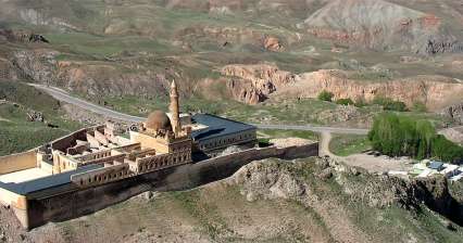
The best one day trip from Dogubayazit leads to a beautiful otomans palace of Ishak Pasha Sarayi and farther into the mountains above it. Along the way, you will have a beautiful view of Ararat and see the life in small Kurdish villages, where time almost stopped.   continue reading

40.
Hike to glacier Haugabreen

Face of the glacier to the touch

Rating:
| Altitude: 950 m / 3 117 ft

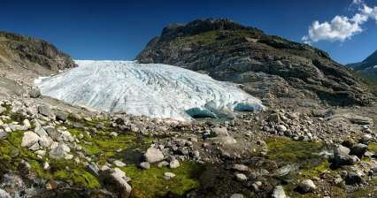
Jostedalsbreen nasionalpark offers many possibilities for hiking of any difficulty. There are also many opportunities to camp, although very nice place with spectacular view is the camp in a place that is called Hoyset and lies in the valley Stardalen. When traveling from the north along the road E39 turn left at the settlement Klakegg and continue for about 12 kilometers. Nice and not very difficult is the walk to the face of glacier Haugabreen. From the camp rises gravel paved and narrow road (toll 50, – NOK) to the parking lot Haug Stoylen. From here leads a narrow path first on flat-bottomed glacial valley and later in steeper ascent with overcoming glacial streams. It seems that there are not many tourists even in the high season, which makes the local glacial countryside even more impressive.  continue reading

41.
Hike through The Narrows Gorge in Zion NP

Wading in the Virgin River

Rating:
| Altitude: 1 395 m / 4 577 ft

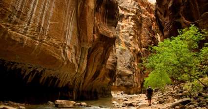
The Narrows is the narrowest part of the canyon in Zion National Park. At a height of over 300 meters and in places only 20 meters wide. Here one does not leave a trail dry. They wade through the Virgin River. Not always allowed there. If it is the rainy season. The rangers won't let in. There is a risk of drowning. continue reading

42.
Classic circuit in Huerquehue National Park

A trip to prehistory

Rating:
| Altitude: 1 249 m / 4 098 ft

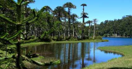
Just outside the town of Pucón is the beautiful Huerquehue National Park. It is a mountainous landscape with lots of beautiful lakes. In addition, an interesting Chilean Araucaria tree (Araucaria araucana) grows here, which is basically a living fossil – a tree that has been growing virtually unchanged for more than 150 million years. It is possible to do several differently difficult tours here. However, for a day trip it is ideal to take a classic circuit continue reading

43.
From Brévent to Flégère

Scenic route in the Chamonix Mont-Blanc area

Rating:
| Altitude: 1 036 m / 3 399 ft

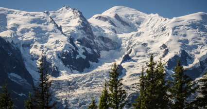
Chamonix is still busy, at any time of the year. Fortunately, the surrounding slopes and peaks are still able to absorb the great interest of skiers, climbers and tourists. The described route is a relaxing trip that uses local cable cars. However, the view of the Mont Blanc ridge, and not only it, is monumental. If you are in the area for a week, it pays to buy a card that will allow you unlimited use of not only cable cars, but also cog railways and buses. continue reading

44.
Ascent to the Tilicho lake

Journey to the mysterious lake

Rating:
| Altitude: 5 000 m / 16 404 ft

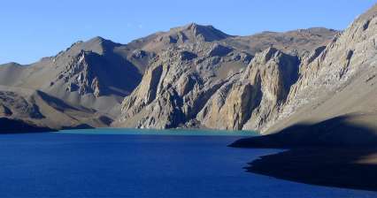
One of the nicest mountain experiences during the trek around Annapurnas is the wander to the stunning Tilicho lake. This two-day detour from the main circuit will take you to places, where the Himalayan giants are almost at touch. The lake seems to lay on the boundary of two worlds. On one hand side there is bare and weathered landscape and on the other impossibly steep sides of Himalayan peaks, towering two kilometers above the lake and directly from it. Unfortunately, there is usually the worst weather of the Manang, so there may not be always clear cloudless views of the mountains and lake. continue reading

Applaud the author of the article!
Share it on:

Articles nearby

Practical information