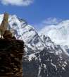
Ascent to Parkachik la
Beautiful outlook of Nun and Kun


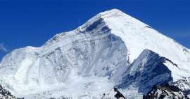
One of the best experiences in beautiful Suru valley is an easy ascent from Panikhar (3 270 m asl) to Parkachik la pass ( 4,000 m asl) with an amazing view of the local mountain giants Nun (7 135 m asl) and Kun (7 077 m asl) and other peaks in the main Himalaya ridge separating Kashmir from Ladakh.
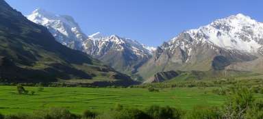
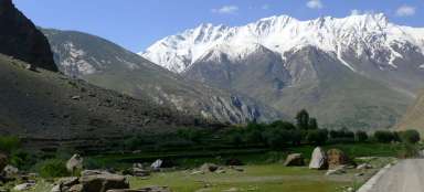
River Suru
The beginning of this ascent is in the village Panikhar, where you have to decide how to make this ascent. Each variant has its pros and cons. If you are staying here overnight, you can go into the pass without backpack, but you will need to go back later this day. Or go with backpack, cross the pass and descend to Parkachik on the other side of the ridge, or even camp in the pass and wait for the sunrise. This in turn can be quite exhausting, if you are not yet well acclimated.
The route itself is not difficult for orientation: first you have to go through an oasis of Panikhar to the river Suru and find here the only bridge that leads across it. The way is more than obvious then – straight up along herders paths. The pass on the ridge is clearly visible.

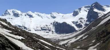
Himalayan wall
Looking south, you can admire the wall of Himalayas separating Kashmir from Ladakh.

View at Suru valley
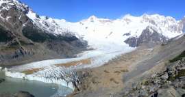
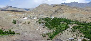
The ascent itself leads along relatively comfortable, although „endless“ slope. View of the Suru valley improves with each vertical meter. This view comes after about an hour and a half from the river. You can see here that there is a lot of greenery compared to the rest of Ladakh. The reason is bigger precipitation caused by the proximity of the main mountain ridge.

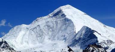
Parkachik la
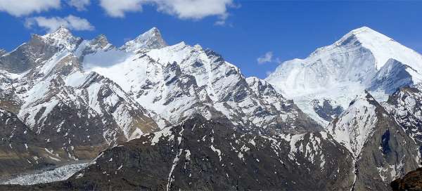
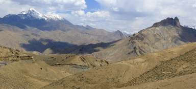
After about two hours of the ascent you will finally be rewarded with a wonderful view of the Himalayas from the pass Parkachik. Directly against you will be glacial pyramid of Nun.

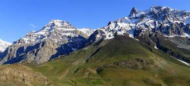
Rock crown
The ridge directly against you will give you an impression of a rock crown. The majestic peak of Kun is a little bit hidden behind it, but this entire panorama is very impressive.

Nun and Kun
After you catch the breath in the pass, you can continue on along the ridge further to the south. Although you will need to ascend another almost 300 altitude meters, the views will be even better than from the pass and you will see other mountain giants of the Himalayan ridge.

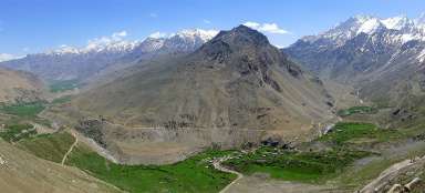
View of Parkachik
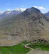
If you do not want to return the same way back, you need to descend to the village Parkachik on the other side of the ridge.

Above Suru valley
If you look back, you will realize how beautiful Suru valley is.

The borders of Kashmir
If you ascend high enough along the ridge/far from the pass, nice view of the south to the mountain wall separating Kashmir from Ladakh will open. Unfortunately, the weather worsens mostly from this direction.

Nun, the highest mountain in Kashmir
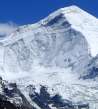
Before you set out for a relatively long and monotonous way back down to Panikhar, admire Nun for the last time, the highest mountain in the Himalayan ridge in the state of Jammu-Kashmir.

Articles nearby


Article: Hikes from Panikchar
The village Panikchar lies just a short distance from the place where river Suru radically changes its direction and turns… continue reading
Giga List: The most beautiful hikes in the world
In this overview you will find a very beautiful, the maximum one-day hikes from around the world. Not only during long treks, but… continue reading