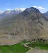
Hike above Suru valley
Above Tongul


From Panikhar you do not need to set out only to the pass Parkachik la or for extremely difficult expedition trek through Bobang Gali to Kashmir, but also for a day trip to glacier tongues on the northern slopes of the Himalayas near the village of Tongul. On the local pastoral paths high above Suru valley you will enjoy an amazing panoramic view of the bend in the river and pointed peaks including Kun without meeting here a living soul.
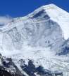
Outlook behind Panikhar
Panikhar is famous for beautiful sunrises above five and a half thousand meter high mountain in the very southern end of Suru valley. The destination of this trip is glacial valleys on both its sides.
The first part of the journey leads along dusty road heading to Padum – the capital of the Himalayan kingdom of Zanskar. Traffic is the very low here and views beautiful, so you will not mind the seven kilometers that separates you from the moraine.
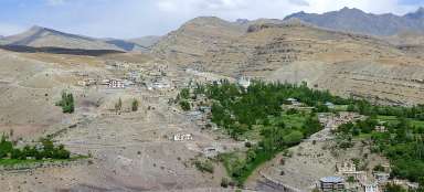
Just across Panikchar is another bridge over the river Suru leading to a small village on the other side.

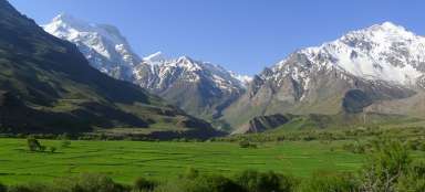
Fields under the Himalayas
Once you have the village behind you after an hour walk, a gorgeous view of the vast green fields leading almost to the mountains open.

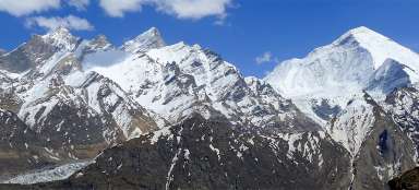
View of Nun
After a while opens also quite a nice view of Nun. Enjoy it, because you will not see it in the remaining part of the trip.

In the Suru valley
Suru valley surrounded by mountain giants is extremely picturesque.

Ascent to the moraine in Tarangoz
After an hour and a half walk from Panikchar it is finally time to leave the road and set out along the moraine to the glacier and to the beginning of the outlook path above Suru valley.
You cannot miss the turning. The road makes the first sharp bend around the moraine and in the place where it crosses it, set out up through the village Tarangoz. After a few tens of meters a nice view of what awaits you in a moment open – the ascent on the right side of the valley, then overcoming glacial river high in the slope and walk to older already green moraine and then traverse the slope.

Greenery hidden behind a fence
After you ascend above the village Tarangoz, you will get the impression that the greenery is hidden perhaps from mountains behind stone fences. All the villages along the road are supplied by sophisticated irrigation canals taking water from glacial streams.

Former glacial waterfall
Approximately at 3700 meters above sea level you get to the newly uncovered rock threshold, where must have been a glacier not long ago. The passable part of the valley ends here. However, there is no way leading to Kashmir through here. So it is time to traverse the slope to the east and finally enjoy the views of the valley of river Suru.

Glacial stream
The only obstacle to walk along the hillsides to the east a glacial stream you need to cross. It is not very wide, but it has a steep course. So it is better to try to find a narrow place instead of fording, then pray and jump.

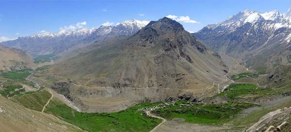
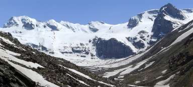
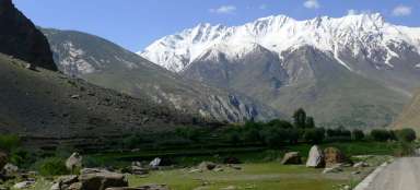
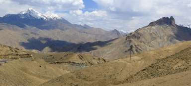
Above stunning Suru valley
Panoramic views of the bend of the river Suru surrounded by mountain giants are breathtaking /see the introductory photo of the photoreport/. It is an ideal place for a longer break or for lunch.
Below you can see village Tarangoz, from where you started the ascent, and bigger village Tongul. The way by traversing, which initially seemed ideal, is increasingly steeper and rockier. Finally, you probably have no other option than to descend by more than a hundred vertical meters to the regular path along the irrigation canal.

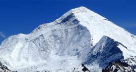
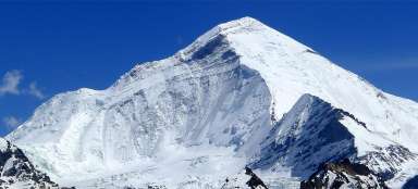
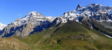
Kun
But the biggest magnet for your eyes will be an amazing peak of Kun towering high above the surrounding peaks. It is considered to be much more difficult for ascent than its higher brother Nun.

Botanical garden
If you are here early in the summer, you will sometimes feel like in some mountain botanical garden. In addition, you will see here cruising birds of prey and curious marmot peeping from their burrows. Now awaits you either descent to Tongul or continuation of the trip into another glacial valley.

Articles nearby


Article: Hikes from Panikchar
The village Panikchar lies just a short distance from the place where river Suru radically changes its direction and turns… continue reading