Drive across pass Namika la
From Muslim to Buddhist part of Ladakh


There are a few high road passes on the way from Kargil to Lamayuru, or rather Leh. The first is Namika la (3 825 m asl) located on completely deserted weathered ridge. Another interesting fact is that you will leave Muslim part of Ladakh during the ride and get into the Buddhist part full of chortens, prayer flags and white gompas. The quality of the way varies from relatively good-quality asphalt road up to places under construction, where you will drive slowly.
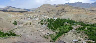
Above Kargil
You only need to drive a few kilometers from Kargil and a beautiful view of the green oasis opens.

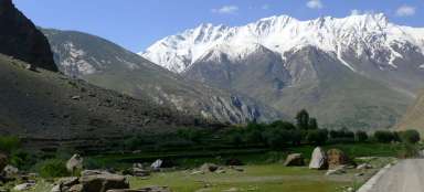
Suru valley near Kargil
In the south direction is nicely visible the valley of river Suru leading up to the main Himalayan ridge. But our road turns after a while, gets to the upland plain, bypass Kargil airport and continues through the valley upstream the river Wakha.

Valley of river Wakha
The road leads long kilometers through valley of river Wakha with scanty vegetation around the river. The canyon is most of the way narrow and sparsely populated.

In front of Mulbek
Just before Mulbek is quite significant confluence of rivers. There is a dusty road leading to the side valley and so if you have more time, you can explore it here.

Wadoo
Then follows Mulbek – the biggest settlement in the valley of river Wakha. From this point begins tourism, which is around Kargil, Dras and in Suru valley at minimum. Mulbek is famous for its large Buddha carved in the rock. Just a bit further is village Wadoo renowned by nice sceneries of rugged mountains and isolated rock surrounded by a small monastery. This oasis is the last civilization before the moonscape surrounding the pass Namika la.

Ridge Namika
The road leaves the river valley Wakha and rises along the seasonal river through the moonscape. On the horizon rises desolate ridge Namika with its flat mountains that are at about four thousand meters above sea level.

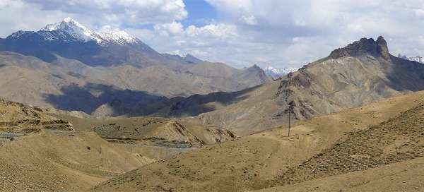
Ridges
In the south direction are visible ridges of totally different character.

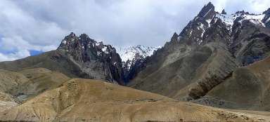
Last of the mohicans
The dominant of the area around Namika la Pass is a weathered mountain with rocky top. It would definitely be an interesting ascent and so the tip for a walk from the pass.

Ladack meadow
In an otherwise arid area you will certainly find interesting the meadow near a small mountain stream, which is completely filled up by local cattle.

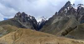
View from the pass Namika la
After several hours of riding you are finally in the pass. Apart from the necessary flags there is far away view to the snowy ridge above Suru valley.

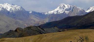
The other side of the pass
The landscape is similar on the other side of the pass. Before you is 5 500 meters high ridge separating Indus valley from the valley, through which you will drive in a moment.

At Khangral
From the pass you will drive down in smaller twists into the beautiful valley near the village Khangral and then up again towards the next pass on the way – Fotu la.

Articles nearby


Article: Kargil - Léh
The road from Kargil to Leh overcomes two high passes Namika la and Fotu la la in a typical ladack landscape of arid mountains… continue reading