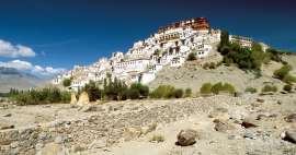
Traveling in West Ladakh
At the interface of cultures


Most travelers just pass through West Ladakh on their way from Kashmir to Leh or vice versa, or on their way to Zanskar, and that's a shame. The Suru Valley in particular, below the 7,000-meter Nun and Kun, has a lot to offer. Moreover, Western Ladakh is a little different from its more famous and visited larger part located around India. The „line of control“ border with Pakistan dividing the original territory of Kashmir between the two countries is only a few kilometers away.
1.-2. Day
Road from Kashmir to Drass
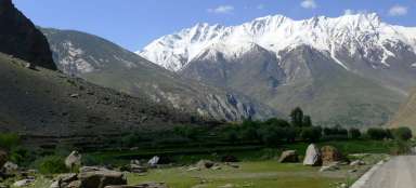
On the first day, you will have a long journey from Srinagar to Drass via the Zoji-la saddle. If you have more time you can interrupt your trip in Sonamamar and take another trip on the Kashmir side of the mountains. Drass has a picturesque surroundings and it pays to go both south and possibly north (you better ask the locals, because it's towards the Line of Control)
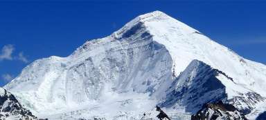
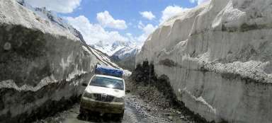
Drive through Zoji la Pass
From Kashmir to Ladakh
The famous high mountain road from Srinagar to Leh leads over several high passes. Crossing of the first one… continue reading


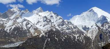
Hike over Drass
The outlook of famous Tiger Hill
Drass (sometimes written only as Dras) (3 094 m asl ) is located in the valley of the river of the same only… continue reading


3.-4. day
Road through Kargil to Panikharu
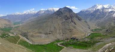
Now you have to move to the Suru Valley. Basically, you have two options: You can get there by bus with a transfer via Kargil or walk there over a ridge on a dirt road through the saddles Master (4,270 m above sea level) and Umba la (4,530 m above sea level) to the town of Sankoo. There's not much to see in Kargil itself, but a walk over it is quite worth it. In Kargil, you can take a bus to Sur, where you get off at Panikharu.
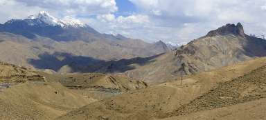
Hike over Kargil
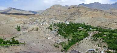
Through oasis to the east of Kargil
It is truth what is said and written about Kargil (2,700 m asl) – there is not much to see. However, if you… continue reading

Day 5 - 6
Tourist trips from Panikharu
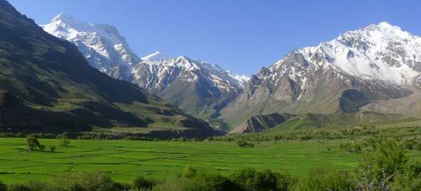
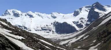
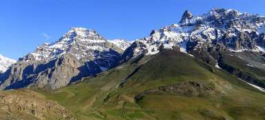
Panikhar is an ideal starting point for hiking trips in the area. The most famous is the ascent to the saddle Parkachik la overlooking the majestic Nun.
Hikes from Panikchar
The most beautiful part of Suru valley
The village Panikchar lies just a short distance from the place where river Suru radically changes its… continue reading

7th - 8th day
Road to Leh
Most travelers continue from the Suru Valley by bus via Pensi la to Padum in the former Buddhist kingdom of Zanskar. Another option is to continue to Rangdum and from there by trek across the Kanji la saddle to Lamayur. If you have less time and continue on to Leh, you need to return the same way to Kargil and from there via two saddles and Lamayura to Leh.
Articles nearby


Article: The great circuit of Ladakh
Ladakh, located in the far north of India, attracts travelers not only with its mountainous landscape with great trekking… continue reading