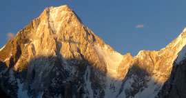
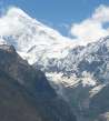
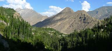
Ascent to Ultars meadows
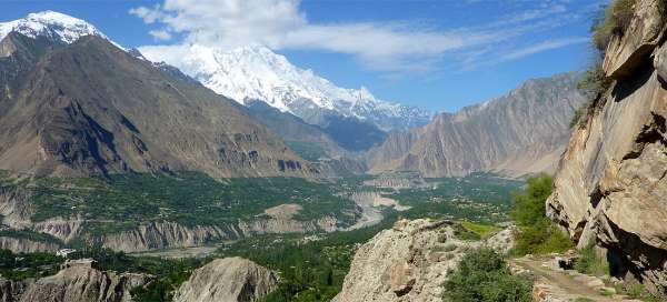
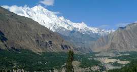
Ascent high above the valley of Hunza


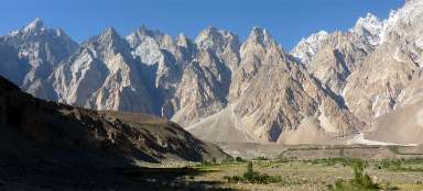
Ascent to Ultars meadows is the most popular day hike leading straight up above the narrow and steep canyon at the upper part filled up by the glacier and take you to the magical place overlooking the surrounding steep peaks and a small waterfall. Most photogenic mountain here is the famous "Lady finger ". This hike can be managed either without backpack or by staying in a small mountain hut or possibly get even higher to Honn pass.
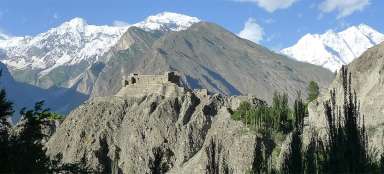
This way is not the way!
The way to Ultars meadows seems quite obvious – just straight up the canyon, but it is NOT so. It is necessary to choose the correct entry right from the beginning.
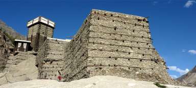
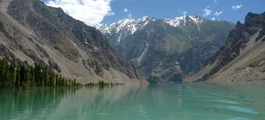
The first way you might consider leads beside the irrigation canyon near the old fort Baltit. It is definitely not the correct one, because you will get along it to the mouth of the canyon, which is after a few tens of meters virtually impassable, because it is filled by the river – see the photos. The right way leads high in the hill along the new irrigation canal.

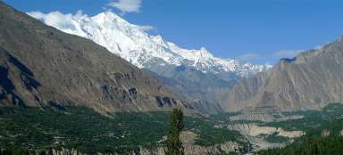
God´s viewpoint to Hunza Valley
If you do not want to walk back to the town from the canyon and find the right path, so may try to climb up to it. But it is quite dangerous and in addition, you will get only to the old path in the middle of the slope, which is in several places destroyed by landslides and impassable. View of Baltit fort, Rakaposhi and the entire Hunza valley is incredible.

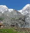
The path in the rock
The right way leads to the north through the old town and on through the gardens (Toqat Rd.). Keep continue to the north /definitely not turn west/. Finally, you will come across a signpost and climb the rock wall with up to the path leading in the rock high above the rock landslides. From there, the path is already obvious up to the mountain meadow Ultar.

Hunza valley from the bird's-eye view
Before you finally turn to the canyon along the path leading in the rock, take in the stunning views across the valley.

The trail above the canyon
Part of the ascent leading along the irrigation channel is pleasant. On the other side leads also a second channel supplying water to the neighboring Sultan Abad and Altit.

Endless ascent
The ascent to the meadows itself seems endless – path winds right up in the rubble. Irrigation canals gradually disappear far below you.

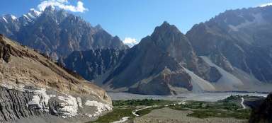
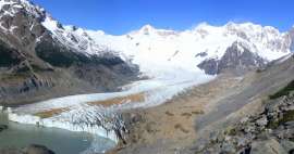
Glacier Ultar
The river is gone after a while. The canyon is occupied by a glacier covered with rubble.

Ultars meadows not far away
There is gradually increasing greenery and the highway from narrow glacier disappears in the depths – Ultars meadows are finally in sight.

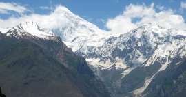
Diran peak and the path towards Hispar l
Far across the valley is beautiful top of Diran peak (7 266 m asl). The broad valley below it leads up to the pass Hispar la and famous „Snow Lake“. The top exceeds the bottom of the valley by five kilometers.

Ultars meadow
Finally you are here on Ultars meadows at about 3,800 meters asl. More than meadow there are just small pitches of grass. The hut, in which it is possible to stay overnight, is opulently known as Ultar base camp. Rock top on the left – Lady Finger, is the most famous scenery on this trip.

Glacier Ultar
If you approach the cliff, from which flows down the glacier, you have to really throw your head back, because it falls here in a small place by a kilometer.

Articles nearby


Article: Trip to Karimabad
Hunza valley enclosed by ice karakorum giants offers countless number of amazing long treks and one day trips. Also lovers of… continue reading
Giga List: The most beautiful hikes in the world
In this overview you will find a very beautiful, the maximum one-day hikes from around the world. Not only during long treks, but… continue reading
Giga List: The most beautiful trips in the Hunza Valley
The Hunza Valley is without a doubt one of the most beautiful mountain areas in Pakistan. The river has broken through the main… continue reading
Giga List: The most beautiful trips in Pakistan
Pakistan as one of the most mountainous countries in the world with beautiful highland nature offers the most beautiful trips,… continue reading