Drive across Tong la to Nepal
Across two different worlds


170 km from Tingri to Kodari at Tibetan-Nepalese border, along Friendship Highway, also known as the Roof of the World Highway, leads through like two worlds. At first you ascent over five thousand meters above sea level over arid plains with views of the Himalayas to the pass Tong la and then ascent into the green world almost four kilometers below.
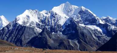
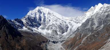
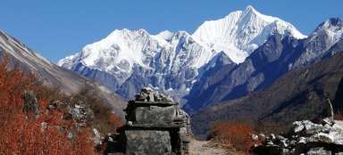
View of the massif Lapche Kang
Journey to the Nepalese border over the passes Lalung la and Tong la begins in Tingri where you came either along the main road (Friendship Highway), or from Everest BC by shortcut through the pass Lamna la. You can enjoy the views of the two-peaked massif of Lapche Kang for quite a long time.

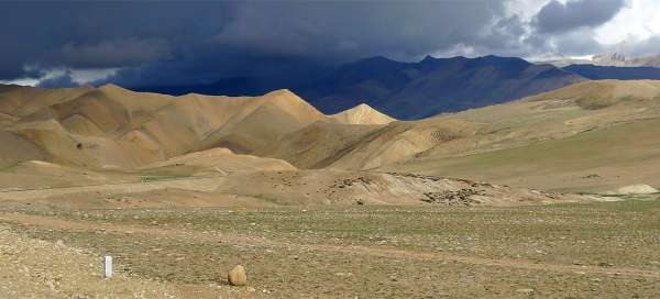
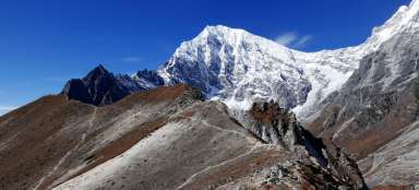
Lalung la (5 020 m asl)
The road continues on for many kilometers in the valley of the river Nien Chu to shorten then one of its huge twist through almost Martian landscape. Amid these plains there is bland pass Lalung la (5,020 m asl), which has over five thousand meters above sea level, but is not very significant.

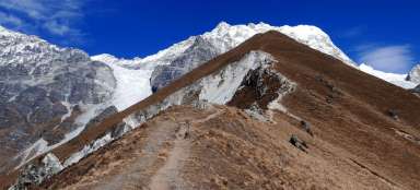
Tong La (5 130 m asl)
Then follows a short descent back into the valley of Nien Chu and right again up the hill to the last Tibetan pass on the road to Nepal – to Tong la.

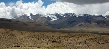
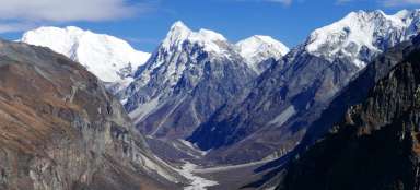
Views from Tong La Pass
If you are lucky with the weather, you will see clearly the large part of the main Himalayan ridge including Shisha Pangma (8 012 m asl). This pass is also a watershed because all the water from the southern slopes already flows into Nepal. Most people are always surprised that watershed is not formed by gigantic Himalaya, but by Tibetan hills.

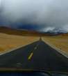
The drive down from the pass
Now follows a drive to completely different green world behind the Himalayas.

Through valley of Po Chu / Bote Khosi
The road drops sharply and is surrounded by Tibetan farming villages. With decreasing height is the surrounding area greener and in the summer are more frequent monsoon clouds. You will be passing through incredible number of curves before you get to Zhangmu (2 400 m asl) – a small town near the border with Nepal.

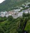
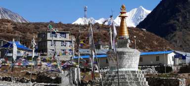
Zhangmu
Zhangmu is nestled in the green mountain slope. There are plenty of hotels benefiting from the fact that most people get here in the evening and have to spend the night before crossing the border into Nepal the next day or vice versa. Also lots of Chinese people come here on the trip.

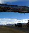
Border bridge
There are still a lot of twists and often avoiding the landslides waiting for you on the way from Zhangmu up to the border bridge at Kodari (1,750 m asl).

Kodari
On the other side of the river are already visible Nepalese houses. Also note that ends pretty Chinese (Tibetan) road and transport will be significantly slower. But the procedures at borders are reversed – quick on the Nepalese side and slow on the Chinese.

Articles nearby


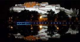
Article: Way through Tibet
Typical hiking trails through Tibet lead mainly in its southeastern part with the capital Lhasa, where stands the imposing Potala… continue reading