Trek from the Kölnbreinspeicher-High Tauern dam
Through the Maltatal valley from the highest dam around the glacier

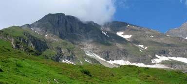
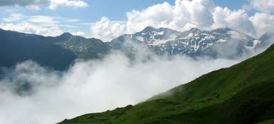
The one-day, more demanding trek, which is about 20 km with an elevation gain of just over a kilometer and the highest point at 2,670 meters, will delight you with the views but also take a toll on your body. The Hohe Tauern national park in the south of Austria is undoubtedly worth a visit. We chose this acclimatization trip for the beginning of our stay.
Exit to the upper parking lot
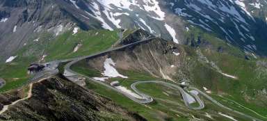
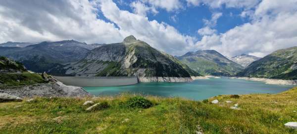
The high mountain road Malta Hochalmstraße leads through the valley, which stretches through the Hohe Tauern massif and which is lined on both sides by three-thousanders. The road is often one-way controlled by traffic lights and makes its way through tunnels carved into the rock. Passing the Galgenbichl reservoir we reached the Kölnbrein reservoir. We parked at the Berghotel Malta. There is a toll of about €20 for the entrance. The monumental dam dam of the water reservoir is 626 m long and 200 m high. In the middle, there is a glass observation platform Bella Vista installed, which we wanted to go to after returning, but there was no strength left, so sometime next time.

On the way along the reservoir
Following the marked red-yellow trail number 02, we went along the water reservoir into the interior of the High Tauern to the mouth of the Kölnbreinbach stream. From there we start to slowly climb along the stream.

Views of the peaks above the reservoir
On the straight path along the reservoir, we have time and energy to admire the peaks of the mountains that surround the reservoir. In the distance, rock massifs rise up to heights of just under 3,000 meters.
Along the Kleinelendbach stream
We will bypass the northern part of the reservoir and when we come across the mouth of the Kleinelendbach stream, we will turn right onto road 539. The road will lead us along the stream slowly upwards towards the Tischlerspitzkees glacier, which lies at an altitude of 3 thousand kilometers.
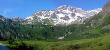
Kleinelendtal valley
We pass through the Kleinelendtal valley, through which the Kleinelendbach stream winds. At the head of the valley in front of us, the Tischlerspitzkees glacier rises and gets closer with every step. From route 539, we have a beautiful view of the glacier on our right and the entire ascent house.

Zwischenelendscharte (2676 m)
After about an hour of ascent, we reach the Zwischenelendscharte saddle (2676 m), which is our highest point of the trip today.

Glacial lakes
At the beginning of the descent, we pass several glacial lakes. Oberer-Schwarzhornsee is the first of them.

Unterer-Schwarzhornsee
Another lake, Unterer-Schwarzhornsee, lies a little further down. These azure mirrors in the middle of the mountains are photogenic in almost any weather.

Still down
From the lakes, our descent begins to descend steeply through rocky scree. So even though we are descending and the effort is less, we are just as fast in time as when climbing. Our legs are already tired and we are careful not to slip our foot and end up on our ass at best, or at the bottom of the hill at worst.

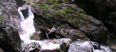
Waterfall
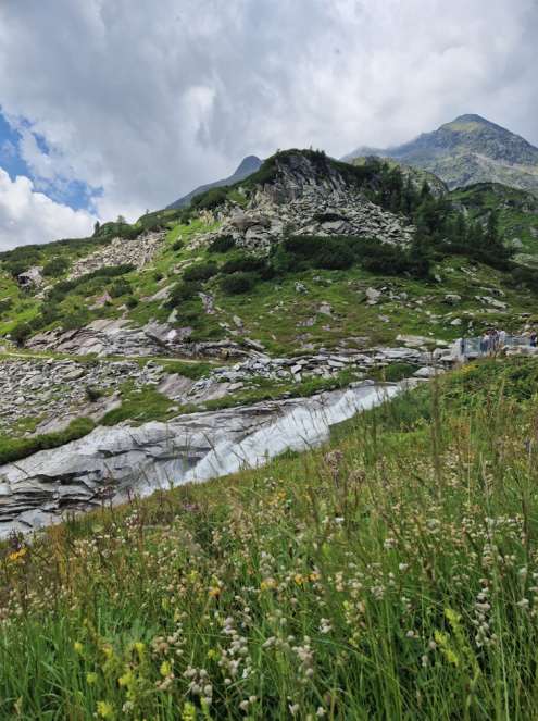
The steepest descent continues beyond the signpost, where our route 539 joins the red 02. We descend through the scree, and next to us roars a massive waterfall, which we only stop to look at.

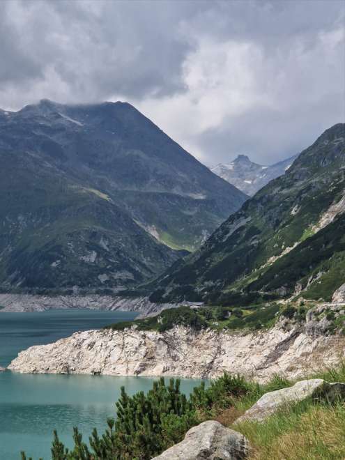
View of the valley
In front of us is the valley through which the Fallbach stream winds. It follows the waterfall we left behind. And we head to our designated rest stop, the Osnabrücker Hütte.

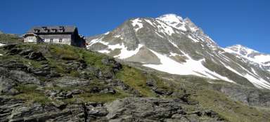
Osnabrücker Hütte
A well-deserved rest and replenishment of energy at the Osnabrücker Hütte. They have great cuisine and reasonable prices for local conditions. Above all, the views they serve are breathtaking.

Return to the Kölnbrein reservoir
I recommend starting the trek really early, because with all the stops for rest, refreshments and enjoying yourself, the route can get quite long. We started the route a little before noon, so we arrived at sunset. The advantage is that the approaching darkness spurred us on, and in the end we enjoyed a beautiful colored sunset over the reservoir. Then all we had to do was drive the serpentine road towards the lowlands.