Drive across Taglang la pass
Through Tibetan landscape of Rupshu


Leh-Manali road part I: One of the most famous high mountain roads in the world starts in the capital of Ladakh – Leh. It is rising only slowly in the beginning through wide valley of Indus to leave it in the village Upshi and rise through canyon full of colorful rocks up to the highest point on this road – Taglang la pass (5 328 m asl) surrounded by partially glaciated flat ridges. The path then leads through upland plateaus More already falling to Tibetan-looking landscape of Rupshu up to the tent camp Pang, where is usually a longer break for breakfast.
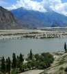
Valley of Indus
If you start your journey to Manali by an arranged jeep, you will then have to get to the bus station in Leh (where is the station for jeeps undertaking this arduous journey) around midnight. Someone prefers hiring a taxi to avoid travelling through the town at night. But if you walk, you just need to have a trekking stick for chasing off wandering dogs. Sometimes there also may be a problem to find the car in the darkness.
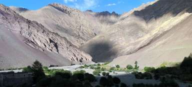
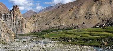
For the first fifty-kilometer journey you will go through the valley of Indus, which is in these places very wide and surrounded by a green oasis. Around you will be well-known destinations of your trips, such as monasteries Shey, Thiksey and Stakna. In the dark of the night, however, you will notice only their outlines.

Lato
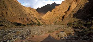
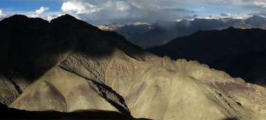
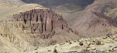
Your journey along Indus ends in Upshi (3 400 m asl). You will cross the river along the bridge and rise in narrow canyon into the mountains. On the way there are mountain slopes colored into the red, orange and yellow. The canyon ends in Lato (4 000 m asl) and before you appear rounded mountain ridges so typical for the landscape of Rupshu, part of the Tibetan upland plateau.
If you are interested in less frequently walked trek, you can ascent from Lato to the pass Lalung La (5 500 m asl) and join Marka trek on the plain of Nimaling.

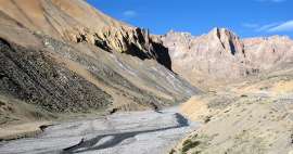
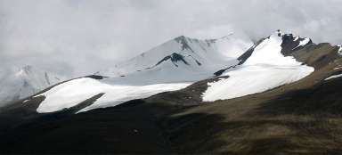
Taglang la
The road continues from Lato through relatively flat valley to the last village before Rumtse pass (4 190 m asl). From there starts another famous trek through the landscape of Rupshu: Rumtse – Tsokar – Tsomoriri. The trek leads through the valley to the east, the road continues to the south. If you come from Leh, you are still driving in the darkness and before you opens the view of the hillside as if full of fireflies. These are the trucks overcoming the pass in endless twists. To enable the trucks get up, the ascent is very low and thus long. You drive two or three kilometers, and then there is a twist and again. Finally, you arrive to one of the highest road passes in the world – Taglang la (5 328 m asl).

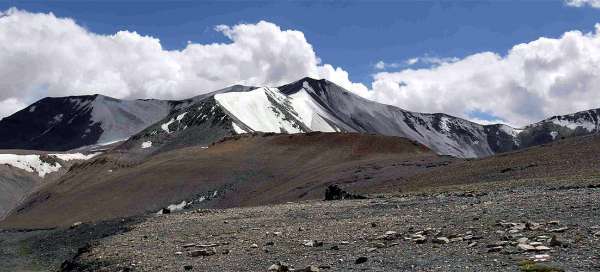
Look back
Looking back, there are clearly visible not only the twists, though which you get here, but also partially glaciated ridge culminating with famous mountain Kang Yatse.

Surroundings of Taglang la pass
To one side of the pass leads a very flat ridge reaching around 5,500 m above sea level. On the western side are the mountains higher, up to 6000 m above sea level, sometimes with a small glacier. Anyway, if you are not here within a one-day crossing from Leh to Manali or vice versa, it is an ideal starting point for easy crossings of outlook mountains around.

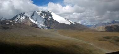
Downhill drive from Taglang la pass
Way down on the barren More plains is virtually without twists and leads above the valley of the river, which is practically all year round dry.

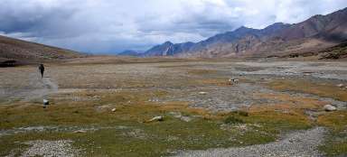
More Plains
More Plains start only a few kilometers below the pass Taglang la. It is a place where herders with their yaks and goats gather in the summer. The road leads through the plains for almost 50 kilometers still in height of more than 4,600 meters above sea level. Not acclimated people certainly get acquaint ant here with real headache and possible mountain sickness.

Driving through More Plains
The Plains seem endless. They are covered with scanty vegetation and surrounded by flat ridges and mountains of around 5,500 meters above sea level.

Above Pang
More Plains suddenly end and below you is a deep ravine with barracks and refreshment camp Pang (4 500 m asl). You will get to the bottom of the gorge in four twists.

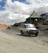
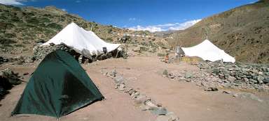
Pang
Pang serves as a place for breakfast for jeeps that come from Leh and afternoon refreshment for those coming from the other side.

Articles nearby


Article: Along the road from Leh to Manali
Long road between Leh and Manali overcomes five very high passes. The highest of them – Taglang la (5 328 m asl) is also one of… continue reading