Hike Shang Sumdo - Chuskyurmo
To the camp before canyon


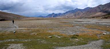
Markha Trek 2: The path along the red slopes of the mountains and weathered rock formations and long passages through rocky riverbed characterizes the second stage of the inverted Markha trek. Along the way, you go through the last village on this side of the mountains – Chogdo where you can alternatively sleep between fields, if you do not manage to come to camp Chuskyurmo.
Above Sumdo
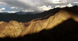
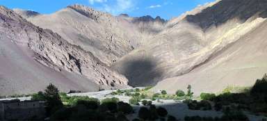
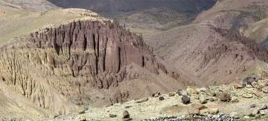
Near surroundings of Shang Sumdo is full of photogenic red mountains, particularly spectacular in the late afternoon or even better at sunset.

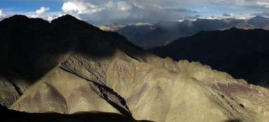
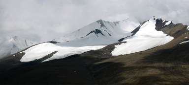
The play of light and shadow
The ridges over Sumdo are really great. If you have time and are you not under trek itinerary pressure, you will certainly find here a lot of very photogenic outlooks.

Behind Sumdo
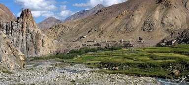
The path from Sumdo to Chogda leads along the eastern side of the river a few meters above the riverbed with views of the lonely farmhouses.

Farmhouses
Kilometer behind Sumdo lies at the confluence of the streams last buildings.

The way to Chogda
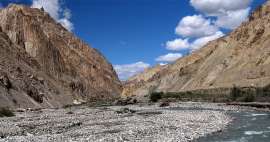
The path then quite rises above the water level, respectively, it copies terrain up and down. If the water is low, it is better to go directly through the riverbed, as the locals do so.

Look back
On the horizon in the distance you can see yet one of the last buildings in Shang Sumdo.

Fields in Chogdo
It is about 4.5 km long and slightly over an hour walk to Chogdo ( 3920 m asl), if you have to carry everything with you. It's basically just a spread green oasis, but there is even a school, so you can contribute to its operation.
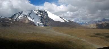
From Chogdo are visible two jagged ridges. Below the lower one there is something like a small green upland plateau where cattle graze and it's a „secret“ outlook just above the camp Chuskyurmo at the same time.

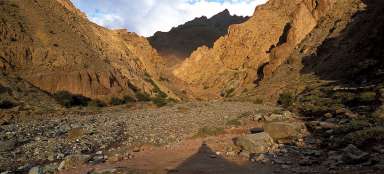
The way to Chuskyurmo
The way to Chuskyurmo from Chogdo is only about three kilometers long, but you walk most of the time along the stony bottom of the river and thus it subjectively seems longer.
Along the way are visible weathered chimneys looking thanks to the boulders on top as fungi. Anyway, the whole area looks as a lifted bottom of an ancient lake or river – rock is formed basically just by a pebble stuck together with mud, so that erosion is very fast here.

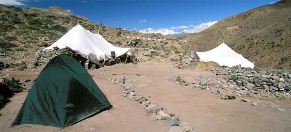
Before Chuskyurmo
At the confluence of the rivers ( 3,995 m asl) turn left (if you went right, you'd go along really an alternative path unmarked in the maps and sketches and in theory you will either be able to scramble up to the main ridge of the mountain Stok or go through a smaller pass and join the path leading under Stok Kangri from Shang Sumdo) and through riverbed now rising sharply arrive to Chuskyurmo (4130 m asl ) (see the introductory slide of the photoreport). Chuckskirmu is made of two tea tents and a lot of places for sleeping around. You will meet here especially people excited and tired from a busy crossing the pass Kongmaru la, because almost nobody walks in the opposite direction.

Articles nearby


Article: Markha trek
There is perhaps no more traditional trek in Ladakh than walk through Markha valley, during which you will see in just one week… continue reading
Giga List: The most beautiful stages of the Markha trek
Perhaps the most famous trek in Ladakh, or rather in the vicinity of the capital Léh, is without a doubt the trek through the… continue reading