Hike Nimaling - Thachungtse
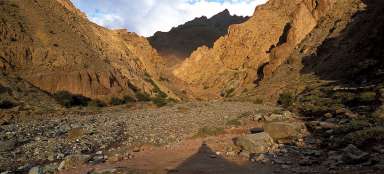
The gate to the canyon Markha


Markha Trek 5: Seven kilometers and six hundred altitude meters separate a nomadic camp and the starting point for climbers Nimaling and a small camp with a tea tent in Thachungtse. If you decide to accommodate in the camp in Thachungtse, you will sleep here probably alone, because it's not a busy place at all. The trek itself is difficult especially for its altitude rather than profile. Fortunately there are nice views of Kang Yatse on the way and weathered rock towers in the surrounding hills.
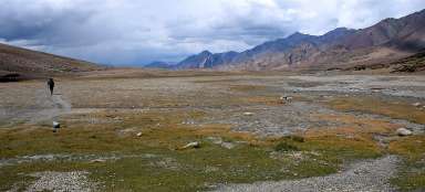
Plains of Nimaling - Looking back
The first kilometer of the walk is practically on flat land and plain Nimaling seems endless. The surrounding slopes are rounded by massive glacier that once have been here. In the middle flows lazily one of the sources of Markha river and teatents are slowly disappearing from the view.

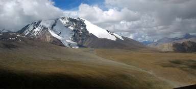
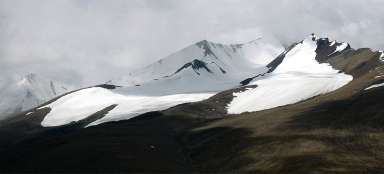
Top of Kang Yatse
The majestic glaciated peak of Kang Yatse protrudes across the surrounding rounded ridges.

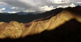
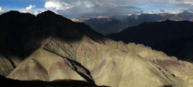
Clouds over the valley of Markha
The path is gradually moving away from the river that disappears in a small canyon. Interesting pointed mountains below you will guide you through the rest of this trek. The weather is very variable here, so you need to have luck as well.

Small lake
At the end of the gradual part of the stage is a small lake (4 676 m asl), where a hardy men can swim. Most caravans replenish here water for themselves and for animals. From here is also clearly visible the ascent path leading to trekking top before Kang Yatse.

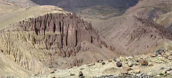
Rock towers
On the opposite side of the valley you will see the beautiful colorful weathered rock towers, probably the best view on this stage of the trek.

Before Thachungtse
The more you approach Thachungtse, the harder you descent. From the other side it must be the most difficult part of this trek. Only a few hundred meters before the camp is the first major confluence – of two sources of Markha River. Thankfully, you can just jump over this place on the stones, so you do not even have to wade through. Then opens a nice view of the small canyon that you walked around the upper way during the descent. It is a question whether you can get this way directly below the weathered rocks – in any case it's an interesting idea for an „exploratory“ trip.

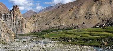
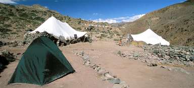
Thachungtse
Camp Thachungtse is located at the river just three hundred meters below the confluence. There is one teatent and a few places for camping. There are stone fences in the rocks overlooking the surroundings just a short walk above, working a bit like WC.

Morning in Thachungtse
Early mornings are in Thachungtse are the most beautiful. The surrounding smooth rock walls are beautifully lit. You can also see the stone fences working as an outlook point and a toilet at the same time.

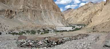
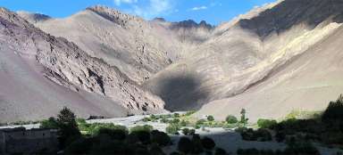
The entrance to the canyon
Only a short walk in front of you is the entrance to the canyon, where leads the continuation of the trek to the settlement Hankar – possibly the most beautiful part of the whole walk through the valley of Markha river.

Articles nearby


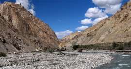
Article: Markha trek
There is perhaps no more traditional trek in Ladakh than walk through Markha valley, during which you will see in just one week… continue reading
Giga List: The most beautiful stages of the Markha trek
Perhaps the most famous trek in Ladakh, or rather in the vicinity of the capital Léh, is without a doubt the trek through the… continue reading