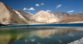
Along the road from Leh to Manali
Epic road through the Himalayas

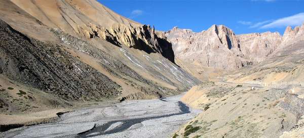


Long road between Leh and Manali overcomes five very high passes. The highest of them – Taglang la (5 328 m asl) is also one of the highest motorized passes in the world. Along the way you will enjoy views not only of Ladack „moonscape“ and high Himalayan peaks. The more you are in the south, the landscape is greener. In Lahaul valley you will see a lot of interesting waterfalls. Finally will await you passage of the pass Rohtang, which is the lowest of all, but also the wettest and muddiest, so there are a lot of landslides. Moreover, it is a popular place for Indians from lowlands, so there are incredible crowds in recent years. In addition, several places on this road are also starting points to terrific treks, so if you grow fond of Ladakh, you will pass here several times.
Drive across Taglang la pass
Through Tibetan landscape of Rupshu
Leh-Manali road part I: One of the most famous high mountain roads in the world starts in the capital of Ladakh – Leh. It is rising only slowly in the beginning through wide valley of Indus to leave it in the village Upshi and rise through canyon full of colorful rocks up to the highest point on this road – Taglang la pass (5 328 m asl) surrounded by partially glaciated flat ridges. The path then leads through upland plateaus More already falling to Tibetan-looking landscape of Rupshu up to the tent camp Pang, where is usually a longer break for breakfast. continue reading


Drive across the Lachalung la and Nakeela
Through the area full of canyons and cli
Leh – Manali road II.part: Road from Pang to Sarchu leads right through two high passes – Lachalung la (5 066 m asl) and Nakeela (4 920 m asl). The way leads thorugh beautiful canyons and there are fairy weathered rocks around. Near rather the promontory than pass Nakeela la is a great outlook into the depths of the canyon and the best known switchbacks on this road „Gata loops“. The remaining part of the journey from the tent camp Sarchu leads already in wide valley of river Tsarap, which is one of the main sources of second largest river of Ladakh – Zanskar. continue reading

Drive across Baralacha la pass
The road through the Himalayas
Leh – Manali road III. part: From the tent camp Sarchu awaits you 80 kilometer long section, during which you will overcome the main ridge of the Himalayas through Baralacha la pass (4,891 m asl). This way has a special charm especially at the beginning of the season, when there are large snow drifts around the road and you have a little bigger feelings of adventure than in late summer. In addition, you can get off in the pass and hike through the valley of river Chandra to Lahaul valley (this is preferred during the high season, when is water level in the river lower). continue reading

Drive through the valley of Lahaul
At the edge of Himalayas and Pir Panjal
Leh-Manali road IV.part: After you get over the Himalayas through Baralacha la pass, you will descend through the valley of river Bhaga in the direction of famous trekking starting point – Darcha (from here starts the hike through the pass Shingu la to Zanskar), Keylong – the capital of Lahaul up to Tandi at the confluence of rivers Bhaga and Chandra. From there the route to Manali continues through the valley of river Chandra below Rohtang pass. Along the way you will see a lot of beautiful mountains and mighty waterfalls. The landscape gives much greener impression than the mountains of Ladakh, from where you arrived. continue reading

Drive over Rohtang la pass
Pass called as Pile of corpses
Leh – Manali road V.part: After driving through the beautiful valley of Lahaul there is the last obstacle in front of you before you end your way in Manali – crossing of Rohtang pass (3 978 m asl) located on the ridge of mountain range Pir Panjal. It forms a major rain shadow and captures most of the clouds. So the valleys of Lahaul and Spiti are relatively dry and Kullu valley on the other side of the mountains is humid with lots of rainfall. A lot of people died here in the old days due to the bad weather lasting here almost throughout the year and as the result it was named Pile of corpses. Even today is the ride over the pass tricky as there are frequent landslides, snow storms and incredible crowds of Indians from the lowlands wanting to touch the snow for the first time in their lives. Therefore, the longest tunnel of India is under construction. It should be higher than 8 km and is to be completed in 2016. It will shorten the journey by 60 kilometers and several hours. continue reading

Treks, which start from the road Leh-Manali (except for those from the valley of Indus)
Possible treks go in order from north to south …
- From Lato over Lalung la to the plain Nimaling below the mountain Kang Yatse /very unfrequently walked trek/
- From Rumtse across the lake Tso Kar to lake Tso Moriri. A challenging trek along high mountain plains
- From Pang to lake Tso Moriri
- In the vicinity of Sarchu: Over Pangpo la to lake Tso Moriri or through Phirtse la to Zanskar
- From the pass Baralacha down the valley of Chandra. Trek mostly only downhill
- From Darcha: famous trek over the pass Shingu la
Articles nearby






Giga List: The most beautiful road in the world
In the world, you go to a number of roads leading through a beautiful landscape, others called death roads for their danger or… continue reading
Article: The great circuit of Ladakh
Ladakh, located in the far north of India, attracts travelers not only with its mountainous landscape with great trekking… continue reading
Giga List: The most beautiful trips in Ladakh
Ladakh is a slightly different India, not for nothing is it Little Tibet. It is a very mountainous, high-lying area. Here you… continue reading