Drive through the valley of Lahaul
At the edge of Himalayas and Pir Panjal


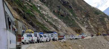
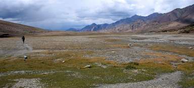
Leh-Manali road IV.part: After you get over the Himalayas through Baralacha la pass, you will descend through the valley of river Bhaga in the direction of famous trekking starting point – Darcha (from here starts the hike through the pass Shingu la to Zanskar), Keylong – the capital of Lahaul up to Tandi at the confluence of rivers Bhaga and Chandra. From there the route to Manali continues through the valley of river Chandra below Rohtang pass. Along the way you will see a lot of beautiful mountains and mighty waterfalls. The landscape gives much greener impression than the mountains of Ladakh, from where you arrived.
Deepak tal
The first place which is worth a stop when driving through the valley of river Bhaga is the lake Deepak tal (3 760 m asl). In addition, after a long journey you will be below four thousand meters above sea level.

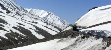
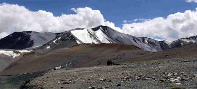
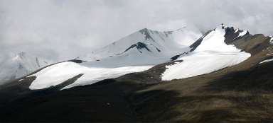
Wild valley
From the lake Deepak tal it is possible to see far into the wild side valley, through which only few people probably passed. Maybe another possible trip for adventurous ones. The difference between the northern and southern side of the mountains is clearly visible on the snow/glacier cover.

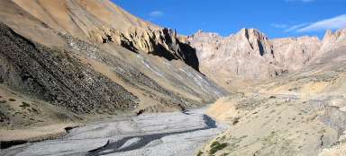
Before Darcha
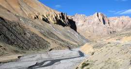
The road then leads many kilometers in traverse of the slope several hundred meters above the valley bottom. The road has here a character of a death road and if you sit on the left side of the off road, you may not feel well on such a narrow road.
Just a little bit before Darcha you will have a wide view of the valley with the confluence of three rivers – nice is typical mixing of different water colors.

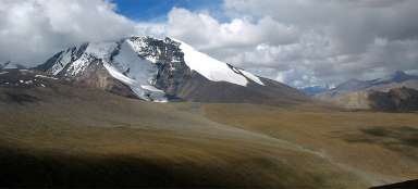
Side valley to the mountain Mulkila
Before you finally go down to Darcha, a nice view to the long side valley with huge peaks culminating with mountain Mulkila (6 517 m asl) opens. There is no path leading here shown in trekking maps of Ladakh and surroundings, but it is also definitely worth exploring.

View to Darcha
You might be surprised that Darcha (3 330 m asl), which is a famous starting point for trek to Zansksar, is comprised only of a few houses near the bridge over the river.

Small glacier
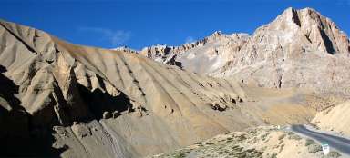
The continued journey to Keylong and on to the confluence of rivers Chandra and Bhaga is a little less interesting, but there will be beautiful mountain views then.

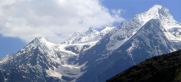
View of Shikar Beh
The southern part of the valley of river Chandra is closed by the ridge of Pir Panjal, from which stands out the peak Shikar Beh (6 200 m asl).

The way through Lahaul
The way then rises through the valley of river Chandra. The country is greener and mountain sceneries are amazing. The way continues to Gramphu, from where you can ascend to Rohtang pass. If you’re not going to Manali but to the valley of Spiti, you will continue through the valley of river Chandra up to Kunzum pass.

Articles nearby


Article: Along the road from Leh to Manali
Long road between Leh and Manali overcomes five very high passes. The highest of them – Taglang la (5 328 m asl) is also one of… continue reading