Article Death road
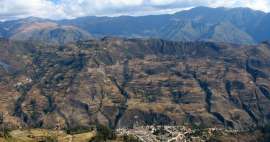
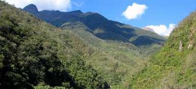
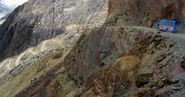
Rough road from La Paz to Coroico


One of the most famous „death“ roads of the world leads from the capital of Bolivia La Paz to Coroico lying already in misty Yungas. Today, the vast majority of traffic leads along new asphalt road, which is less deadly. The old one has become perhaps the most popular destination of the trip offered today by travel agencies in La Paz – downhill bike „Camino de la Muerte“ from the pass Cumbre (4,660 m asl) up to Coroico (1,525 m asl).
The starting point for the ride down
Cycling trip along the death road starts always the same way. Microbus with bikes on the roof cruises around the hotels in the center of La Paz and picks up people interested in this famous downhill bike. It sets out for the journey around eight. It rises to Cumbre Pass through a wide valley with slopes covered with yellow grass. There is also a toll booth, where a fee for asphalt surface is collected. Right next door is a number indicating the number of victims of the road per calendar year. And it's not low at all. Waiting times for payment come in handy for ladies selling here refreshment.After about an hour’s drive in minibus you finally see the statue of Christ – you are at the highest point of this journey – in the pass La Cumbre (4,660 m asl). Right here or a bit below the pass begins your ride straight down into Yungas. Cumbre Pass serves as a starting point of perfect Inca trail leading through the neighboring valley El Choro trek.

The first meters on the way down
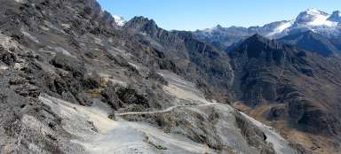
The downhill bike begins at the rocks smoothed by the glacier overlooking many twists of the old gravel road.

View back to the pass Cumbre
As soon as you quickly ride down the first vertical meters, there is a nice outlook point back to the first part of the ride. Black hills smoothed by an ancient glacier do not give an impression to be almost at five thousand meters above sea level.
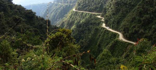
Clearly visible is the difference of the old and new road. The old gravel road falls in many twists, the new asphalt road leads in wide curves.

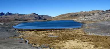
Wide valley
Looking down from the rock cliff three hundred altitude meters above the bottom of the main valley, you will see a few buildings in the distance – this is a usual first stop for breakfast.

View of the rocky cliff
From the outlook point on the rocky cliff awaits you a great downhill bike full of wonderful views of the countryside around. But do not forget to pack gloves; otherwise you'll have frostbitten fingers in a while. After a short moment, the cliff will be already far and mainly high behind you.

Below the rock walls
The road leads below the smoothed rock walls towering high above you.

The first greenery
There is more greenery with decreasing altitude.

The beginning of Yungas
The air becomes warmer and more humid and the first clouds and deeply sliced canyon are the first signs of approaching foggy Yungas and harsher part of the death road.

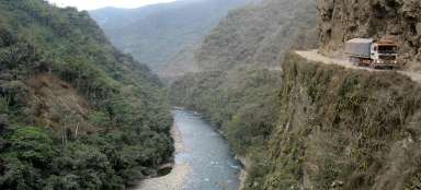
Death road
After about twenty kilometers away from the ride down (during which there was only one rising section and even this part you may be transported by minibus (depending on travel agency and specific arrangement), you are at 3 100 meters above sea level. You finally turn here off from the new asphalt road and bike along the old gravel death road among the clouds that are created here every day out of sultriness.

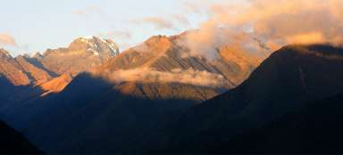
The paths to Yungas
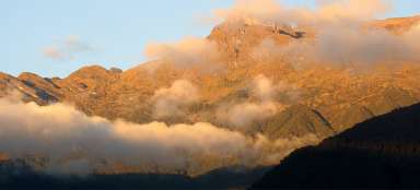
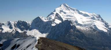
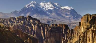
Every path or road to Yungas smacks of danger and incredible change in altitude. You will descend within a few kilometers from the passes in Cordillera Real higher than 4,500 meters above sea level to Amazon basin located about 3.5 kilometers below. You can peacefully enjoy this change during a few days trek leading along Inca trails or within a few hours on the bike or car.

Landscape of Yungas
The local misty jungle adheres to steep slopes, which are after longer rains often grooved by massive landslides. Nature is here protected by the national park Cotapata /the main reason for its establishment seems to be the opportunity to collect more money from cyclists passing here/.

View from the cliff
Road width is quite sufficient for the bike, so only elementary caution is necessary. In fact, the greatest danger is cyclists themselves, because there are around fifty of them every day here and they all ride +/- at a similar time.
Anyway, in earlier times (before 2006, when the new road was finished) it must have been a real adventure, when buses were avoiding trucks here.

Gigantic landslide
The road is stamped also in older landslides. Along the way you'll see a lot of crosses of those, who ended their pilgrimage here. And the number of trucks and buses fallen into the gorge are countless.

The final downhill bike
The more you will descend along the road, the weather will be hotter. You will finally get below the misty clouds and you will be able to sunbathe during waiting for others. The only thing that might bother you will be the crowds waiting for taking photos. So it maybe sometimes better to move a bit from the main group.

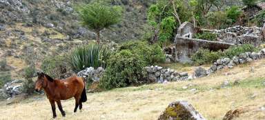
Near Coroico
The downhill bike ends after about 50 kilometers near the village Yolosa (1 200 m asl). There are plenty of bankrupt food stalls; after all, after the new road has been built, not many people pass here. The bikes are washed here and people continue on uphill to Coroico to enjoy deserved relax by the swimming pool and lunch. You will usually get to La Paz already after the dusk.

Articles nearby


Giga List: The most beautiful road in the world
In the world, you go to a number of roads leading through a beautiful landscape, others called death roads for their danger or… continue reading
Giga List: The most beautiful trips in Bolivia
Bolivia offers, thanks to the varied nature, a wide range of beautiful trips from day trips from La Paz to multi-day off roads… continue reading
Giga List: The most beautiful trips from La Paz
La Paz is famous for its incredible location of a huge valley located right on the plateau of the Altiplano. From the city you… continue reading
Giga List: The most beautiful places in the Cordillera Real
The Cordillera Real is a still heavily glaciated mountain range east of La Paz and Lake Titicaca. Here you will find a whole… continue reading