Hike Challapampa - Sandillani
Long and tiring walk through the jungle


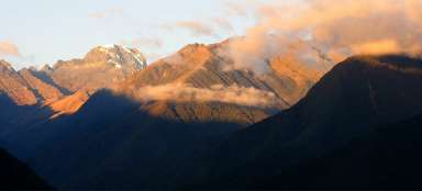
El Choro trek 4: The second day of the trek El Choro is very tiring. The Inca trail leads through damp jungle up and down, surpassing side valleys. Along the way, however, you will enjoy a nice tropical vegetation, cute hummingbirds and also beautiful views of the surrounding hills and canyons. The most beautiful and famous views are at the end of the village Sandillani, especially at sunrise.
Entry into the jungle behind Challapampa
The vegetation thickens basically just behind Challapampa and a genuine mountain jungle begins. If you are lucky, you will see also hummingbirds here.

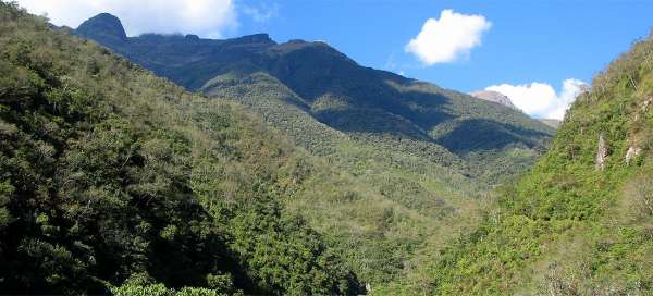
Vegetation of Yungas
Along the way, you can admire the surrounding jungle lush vegetation – several meters high ferns, creepers and many other plant species.

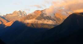
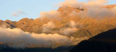
View of the cliffs above the jungle
Compared to the previous stage with countless number of mountain views, there are not many of them today. But even so, a mountaintop occasionally peeks out from the jungle.

Fabulous jungle
Some places that you see during the descent to the village of El Choro, have almost fairytale atmosphere.

Outlook of El Choro
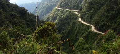
After more than two hours of slightly tedious journey you are finally before the village of El Choro (2 200 m asl), which gave the name to this trek. In the village you need to refill water bottles, because there will be a problem to get drinking water for the next few hours.

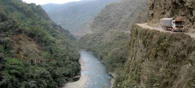
Bridge over the river Rio Chucura
Just below the village is a sturdy bridge over the river Rio Chucura. Behind it awaits you the first major ascent on this trek. Even if you get up early in Challapampa, you cannot escape the hot weather also here. From the bridge and following way are very nice views of the river valley.

Fired slopes
It will take you about half an hour and 200 altitude meters before you ascend to the outlook place over the valley. From there will await you the walk along the contour line. There will be quite often isolated cottages, whose owners make a living by firing the surrounding hillsides.

High above the river Tiquimani
For another two hours you will still walk along the contour line more than 400 meters above the bottom of the canyon. While looking back, this trail is pretty clear.

The path to the valley of river Jucumari
This stage of contour path is ended by joining large side valley of the river Jucumarini.

The way through the forest along the riv
The way drops from sunny slopes without any trees into the valley of fierce river Jacumarini still surrounded by lush jungle vegetation. From there awaits you shorter ascent again. You might be surprised that you can encounter resting livestock here.

Over the valley of river Jucumarini
From the river you can expect the ascent of nearly 150 vertical meters back to the „contour“ path. During the ascent opens a lovely view of meanders of the river Jucumarini in dense forest.

Far view
It took almost an hour to descend and then ascend again from the river Jucumarini before another far view opens. Your „contour“ path stretches far to the horizon, but mainly you already now see that before you is one more deep valley that will cross your path.

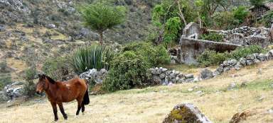
Bungalow near banana boxes
Lonely cottages with small banana boxes on the way are really romantic.

Valley of river Coscapa
You'll definitely be quite tired after a day's walk with all the backpack and in front of you appears another obstacle in the form of river Coscapa, whose deep valley you have to overcome.

Sandillani
Bridge Colgante across the river Coscapa lies at an altitude (1 670 m asl) and from there you can expect ascent of 250 + 150 vertical meters before arriving to Casa Sandalini (2 000 m asl) at the end of this long trekking day.

Articles nearby


Article: El Choro trek
The most famous Bolivian trek leading along the old inca trail is El Choro. Within just a few days you pass several vegetation… continue reading