The most beautiful tours in Europe
The best of tourism in Europe

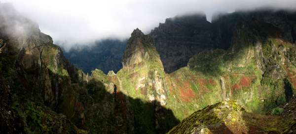


Although Europe cannot boast such high mountains as other continents, you will still find beautiful hiking trails and ascents. In addition, there is the largest number of kilometers of marked hiking trails.
Ascent to Pico do Arieiro
The highest position of Madeira
This area is the best that Madeira has to offer in alpine tourism. In addition, access to Pico do Arieiro is easy, ie by car on a mountain road to the parking lot at an altitude of 1818 meters above sea level. continue reading


Lake path
Popular hike with views of the Matterhorn
The lake path around Zermatt with views of the Matterhorn is very popular. You can help yourself with the underground cable car to Sunnegg, where there is a beautiful view of this mountain and now the lakes Leisee, Mosjesee, Grindjisee and Stellisee are waiting and back. It's a beautiful day trip continue reading


Four passes between Switzerland and Italy
Overlooking Grand Combin and Mt. Vélan on one and the Mt. Blanc on the other side.
Wandering through the four passes between Switzerland and Italy – Pas de Chevaux (2716 m asl) – Col de Chevaux (Col du Bastillon, 2754 m asl) – Fenêtre de Ferret (2698 m asl) – Col du Grand-Saint-Bernard (2473 m asl) ), with views of Grand Combin and Mt. Vélan on one side and the Mt. Blancu (Mt. Blanc – Grandes Jorasses – Aiquille de Triolet – Mt. Dolent) on the other side. Starting and finishing point – Hospice St. Bernard. continue reading


Ascent to Pico del Teide
Ascent to the highest mountain in Spain
Pico del Teide, currently an inactive stratovolcano 7,500 meters high (from the bottom of the Atlantic; the tenth highest in the world) is the highest mountain on the island of Tenerife and at the same time the highest peak in Spain with an altitude of 3,718 m above sea level. 1) a two-day ascent with an overnight stay in the cottage (Refugio Altavista) 2) comfortable with a cable car. continue reading


Ascent to Faulhorn (2681 m asl)
Part of the Faulhornweg hiking trail in the Bernese Alps
A classic classic, alpine hike with views of the Wetterhorn, Schreckhorn, Eiger, Mönch and Jungfrau peaks and the Thunersee and Brienzersee lakes. Starting point – Grindelwald (1047 m above sea level). Elevation approx. 1634 m. Support points: cottage Berggasthaus Waldspitz (1903 m above sea level), cottage Bergrestaurant First (2166 m above sea level), cottage Berghotel Faulhorn (2669 m above sea level) continue reading

Ascent to Monte Cinto
To the highest mountain of Corsica
Monte Cinto 2,706 m above sea level (Corsican Monte Cintu) is the highest mountain on the island of Corsica, in France. It is located in the Haute-Corse department between the Asco valley in the north and the Golo valley in the south. On the south side of the mountain is the mountain lake Lac Cinto. continue reading


Hike Mezní Louka - Pravčická gate
To the largest sandstone rock gate
The Pravčická Gate is located in the Bohemian Switzerland National Park and is the largest sandstone rock gate in Europe. Its height is 16 meters and is 26 meters wide. The Pravčická gate is very photogenic and some of the most beautiful photographs are taken here and in the vicinity. In the past, the trip to the Pravčická Gate was one of the first hiking trails in the Czech Republic and was covered by the Czech Tourist Club. continue reading


Hike to the Morteratsch Glacier
Road to the largest glacier of the Bernina massif
The Morteratsch Glacier is the largest glacier in the Bernina massif, located in the area of Sv. Mořice in the Swiss Alps. The road to it is gentle and pleasant, suitable for even less able pedestrians. Along the way, individual stops are made with educational boards, which shows the retreat of the glacier from 1900. continue reading


Hike through Mlynická and Furkotská valleys
Beautiful Tatra valleys
The crossing of the Mlynická and Furkotská valleys can be described as one of the most beautiful and also one of the most demanding tourist routes in the High Tatras. The crossing begins and ends at Štrbské pleso and lasts approximately 6–7 hours, depending on the number of people, the route is 15 km long and overcomes a climb of over 1,000 meters. continue reading


Hike to Kjeragbolten
The most famous stone
Kjeragbolten is located in the Lysefjord area, which is one of the most visited tourist destinations in Norway, located several tens of kilometers east of Stavanger. Kjeragbolten in the translation of the Kjerag wedge is an interesting geomorphological toy of nature under the top of the Kjerag hill. It is a several-ton round boulder, which is stuck in a gap between two cliffs. The starting point for hiking is the Øygardstølen car park at an altitude of 640 m above sea level. The hiking itself takes about 5 hours and is very well marked, passing over the top of Nesatindane. The very beginning of the tour is pretty much out of sight, when it is necessary to overcome the first ascent of about 165 meters. Chains are set up to help in the rock, and in case of rain or icing it is the most unpleasant part of the hike, then the last one is to descend into a small valley and climb the smooth rock steeply up to the top plateau, followed by relatively flat terrain. The boulder is wedged above an abyss 980 meters deep and below it flows the 25th highest waterfall in the world Kjeragfossen. continue reading


Ascent to Massanella
The second highest mountain in Mallorca
1364 meters in height determines the second place in the competition for the highest mountain in Mallorca. In clear weather, you can verify that you are really on the island. And you will certainly not be disturbed by anyone. continue reading


Ascent to Kristínartindar
View of the highest mountain in Iceland - Hvannadalshnjúkur.
Kristínartindar (1126 m above sea level) is a mountain rising between the slides of the glaciers Vatnajökull, Skaftafellsjökull and Morsárjökull. From the Sjónarnípa lookout point, a beautiful view of Iceland's highest mountain – Hvannadalshnjúkur – opens up. Elevation gain about 1100 m. Starting point – camp Skaftafell. continue reading


Winter ascent to Ginger
Beautiful view of the High Tatras
The winter ascent to Ďumbier (2,043 m above sea level) is something new for all mountain lovers, it does not follow the same route as the summer one, especially from Chata Milan Rastislav Štefánik you do not have to go around the top, but you climb vertically upwards, so there is no significant time difference and you can cover the whole route in a comparable time as in summer, even if it gets worse. Winter views in nice weather are just as fascinating if not more beautiful than summer ones. continue reading

Hike through the rocks of Hruboskalsko
Walk in the interior of rocks
Compared with entirely relaxing walk along the red tourist trail from Hrubá Skála to Wallenstein (“Valdštejn”) is the walk through the interior of Hruboskalsko rock town a little more challenging. You can expect not dozens, but hundreds of steps up and down. Expended effort is rewarded with beautiful views not only of the rock town, but also of the hills and mountains north of the Bohemian Paradise. continue reading

Ascent to Babi hora
The highest mountain Beskydy
Babí hora (1,725 m above sea level), Babia Hora or Babia Góra is the highest mountain in the entire Beskydy Mountains and is located on the Polish-Slovak border. Compared to other Beskydy peaks, it is more reminiscent of the peaks of the Low Tatras or Malá Fatra. The climb to the top is a great, not too demanding, all-day hike. continue reading


Hike to the peninsula of Sao Lourenco
The easternmost tip of the island
Ponta de Sao Lourenco is a popular tourist destination. While the rest of Madeira abounds in lush vegetation, this part of the island is very dry. Only in the winter months do interesting plants turn green and bloom here. The hike is not particularly strenuous, its charm lies mainly in the views of the wild rocky coast. However, the wind usually blows here continuously and in its gusts it tries to keep both tourists and landing planes, which approach the airport in Funchal through this eastern area. continue reading


Hike in Barranca Masca
In the grip of volcanic rocks to the oce
Masca Gorge begins in the village bearing the same name. Most ordinary tourists overcome the 600 meter descent to the ocean, from where they will be taken by pre-arranged boat to one of the nearest tourist centers. But Masca is not only about going down and back. In the narrow ravine of the gorge, which is hemmed by several hundred meters high rocks, there is a microclimate even without any breeze and water supply is a must. You will be rewarded by fantastic views of the rock formations, beautiful bay and good feelings from the hike, which is shown in guides as one of the most difficult in Tenerife. continue reading


Hike through the White Elbe valley
A hike full of waterfalls
One of the most popular hikes leading from Špindlerův Mlýn is the ascent through the Bílé Labe valley to Luční bouda. Along the way, you will meet a number of waterfalls, and at the end you will also have wide views of the Krkonoše Mountains. continue reading

Ascent to Triglav
Ascent to the highest mountain in Slovenia
Triglav (2,864 m above sea level) is the highest mountain in Slovenia and the entire Julian Alps. Several routes of varying difficulty lead to the top. We chose an easier route from Rudna Polje through Vodnik's house and Planika's house. The last about 300 m of ascent is still secured by steel ropes. continue reading


Ascent to Karleskopf and Polleskogel
March opposite the glacier arena
The hike from the Braunschwaiger Hütte mountain hut to the Karleskopf and Polleskogel hills is a short yet amazing view. However, if you have this as a day trip from Mittelberg „at the bottom“ of the Pitztal valley and back, it will definitely take you. A short detour leads to Karleskopf (2,902 m above sea level) from a relatively pleasant mountain path leading to the Pitztaler Jöchle saddle (2,996 m above sea level) – the starting point for a short ascent along cracked stones to the top of Polleskogel (3,032 m above sea level). continue reading


Levada Hike 25 Fontes
From Rabacal to 25 springs
One of the most beautiful levada tours in Madeira leads through mysterious tree heaths and laurel forest with views of the high Risco waterfall to a romantic place called 25 springs. The starting point is the parking lot on the road ER110. From here, a descending narrow path leads to the Rabacal Forest Administration building. It is not such an attractive part on foot compared to the following laurel forest and levada, so it is better to take the journey on a small minibus that runs here. continue reading