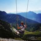
Follow highway 395 around the lakes
On the way between the mountains from Death Valley and through Tahoe


Not very well known and frequented is the road leading through the valley from the south to the north from Death valley to a mountain lake at South Lake Tahoe. The road passes through several natural zones and the landscape changes from the desert, through a temperate zone to the mountain climate. We traveled this trip in two days, and although the distances are enormous in America, it was worth it. On the route, we made several stops at attractions such as a drying salt lake, lakes, waterfalls and natural thermal baths.
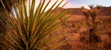
Death Valley
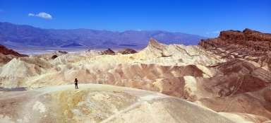
You will find a separate article about Death Valley National Park here, so here I will mention this unforgettable place, as such a starting point. The desolation of this lunar landscape is truly breathtaking. Not surprisingly, Americans produce so many extraterrestrial films. Here they really have a lot of material for the landscape like from Mars.

Endless road
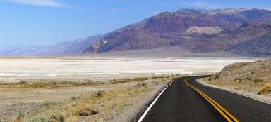
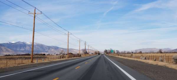
In America, there are no regulations like ours in the EU that every road must not go more than a few hundred meters straight ahead, so there are views we know from movies and photos. A never-ending road with a yellow dividing line painted to the horizon, as per the ruler. The road is not busy in any way, so it is not a problem to stop at the curb for a photo.

Large sand dune
The dominant majority of the desert in the Death Valley National Park is formed by sand whipped by the wind and natural conditions in the form of rocks or solid surfaces. But there are also small islands where this is not the case. One of them – Big Dune or Big Dune we met on the way. At the dune you will find a large parking lot, where most of those passing by stop to enjoy the view and have fun in the soft sand dunes.

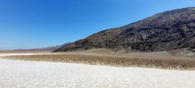
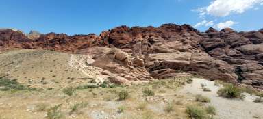
Drying salt lake
The next stop we had to turn to was a drying salt lake, where the snow-capped peaks of the surrounding mountains were reflected in the remnants of its water level. White salt crystals and the ubiquitous salt abrasion then only completed this unusual scenery. Most tourists build another lake a little further away, but it is completely dry and there is only a salt plain with typical octagonal prisms on the surface.

Termání lázně - Hot Springs
Just before stopping at the accommodation, we had a trip around the natural thermal baths, one of many in the area. We enjoyed a pleasant warm-up in the hot water flowing into the pool directly from the spring. Hot water was injected into the larger pool through the air so that it cooled down a bit and you could swim in the pool. Next door, however, was a small relaxation pool, where the water was really boiling. In the winter, when it was outside a few degrees above zero during the day, the thermal baths were a pleasant diversion on the way.

A typical American town
On the way we pass through small towns stretching along the main road, where you will find a few houses, a motel and a gas station, mostly with a small grocery store. The towns with their typically American character are thus a reminder of times long past, when cowboys rode on horseback here. In one such town – Bishop, we spent the night in a typical motel. A pleasant surprise was the local small bakery, which had a great assortment.

Road through the valley between the mountains
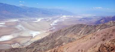
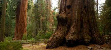
From the salt lake, we enter the valley between two mountain mountains, which lined our path on both sides almost to Lake Tahoe. Gradually, we pass the back side of Sequoia, Kings Canyon, Sierra National Forest and Yosemity National Parks on our left west side. I call it the back because most of the main driveways run from the side of the ocean. There are so many popular valleys and paths for tourists. Of course, several crossing routes lead from this eastern side as well, but because we were here in the winter and also because of the temporarily unapproved state budget, which cut off all state employees, including the park administration, from their salaries, these roads were closed.

The peaks of the majestic mountains
The path is really something to enjoy. The tops of the snow-capped mountains and their steep slopes look straight down the road into the valley, which intertwines gracefully.

Lake Crowley
The first in a series of lakes on our journey was Lake Crowley. The smaller natural lake was a pleasant, albeit short, stop because the gate was closed on its way, probably due to the unapproved state budget. We quickly fell in love with the lake still shrouded in the morning frost and continued on our way.

The back of the Yosemites
On the way in the valley between the mountain massifs, we also passed the famous Yosemites along their eastern side. Unfortunately, due to the snow, it was not possible to cross this iconic park from this side, so we pressed a tear and drove at least a few kilometers to the first closed gate. In an effort to get closer to this giant among national parks a little closer. The view of the snowy peaks illuminated by the sun was a reward for us.

Mono lake
Arriving to another of the lakes on our way was downright magical. Mono lake was shrouded in mist just before noon, as if a waterman were boiling a mist in a giant pot. We arrived just in time for the warm rays of the sun to overcome the cold morning. Literally with every moment, the fog melted somewhere. On our short walk along the nature trail around the lake, we had before our eyes a constantly changing scenery.

Crossing the mountains to South Lake Tahoe
At the end of the valley we drive across a straight into a wide plain. In front of us, at the end of it, the hills rise and with a coniferous forest, which we are looking forward to as a pleasant change after a few days in the desert landscape. We are lucky that the road through the mountains is not snowy and so it is freely passable. From the top of the pass there is a view of the straight ironed plain below us, which we have just crossed.

Lake Tahoe
Lake Tahoe is located near the mountain town or rather the tourist resort of South Lake Tahoe. The city is full of hotels, restaurants and all kinds of entertainment ready for visitors. People come here in winter to ski resorts and in summer for hikes in the hills and also for fun on the lake. The lake greeted us in an icy robe, where its shore and the lower part of the pier were covered with ice and icicles.

View over Tahoe Lake
However, the unique view of the lake is from the rocky view point above it. Along the way, we were surprised that the American-style roads were relatively narrower (but still did not have Irish mini-roads) and sometimes without curbs or barriers, which was not pleasant in places where there is only a free slope below you. However, everything was suddenly forgotten when looking at the lake in its entirety. You could sit for hours on the lookout and enjoy the view, but we wanted to catch up with the lights to see the waterfall above the lookout.

Waterfalls at Lake Tahoe
The waterfall with the romantic name Horse tail is located just a few meters above the parking lot, where we stopped at the lookout. Under normal conditions, it is a journey of up to 15 minutes of walking. However, we had a path turned into a warrior thanks to a continuous layer of ice that covered all the stone steps to the top. Cats would be very welcome here, and we were even more surprised by who tried to climb everything and with what shoes. The waterfall was largely frozen, but in this case the road was the destination.

Pyramid Crest trail
On the way from Lake Tahoe towards Sacramento, we descended from the mountains down into the lowlands and did not make a few more stops in the Eldorado National Forest. We stopped at the beginning of the trek called the Pyramid Creast trail and went through at least a small circuit for an hour's walk. The path led through the forest around small waterfalls and then up a rocky area uphill, where another large waterfall descended in the distance from the foot of the hill above us.

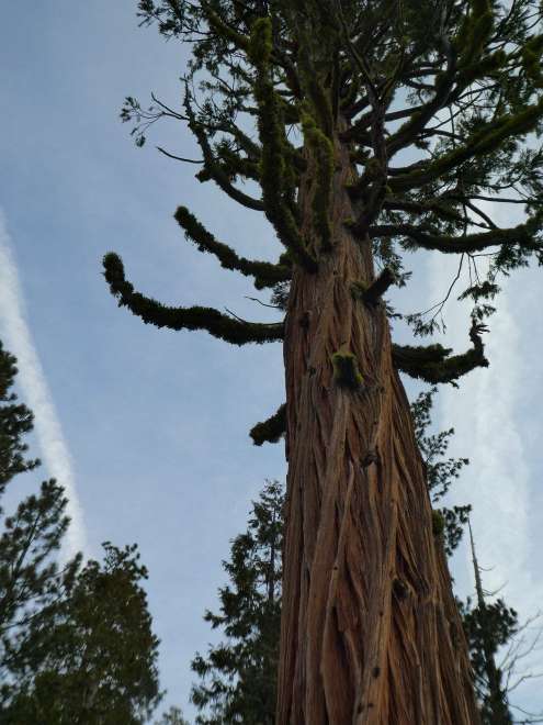
Conifers covered with moss
The conifers with their frost-twisted and cracked trunks were majestic guides on our route up and back down to the parking lot. The green shaggy moss has grown carefully around the twigs one by one, creating a natural, vivid image that cannot be bothered.
Eagle river access
The road leading to the Eldorado National Forest further down into the valley is crossed in several places by the Pacific Crest trail. This hundred-kilometer trek leading through the western states of the USA depicts the film Wild in its diversity, which I can only recommend to all travelers. We stopped for a short stop by the river at a place called Eagle river access, where we descended from the road down to the riverbed. We enjoyed the hum and bubbling of the river, which took on a greenish tinge in the shade of the mighty trees.

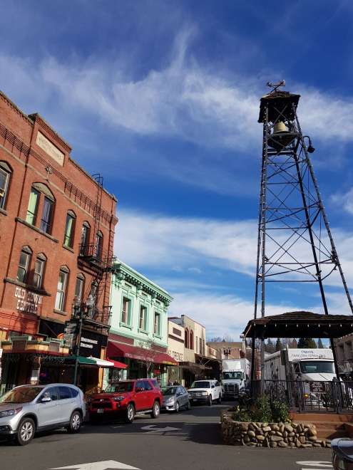
The historic town of Placerville
The last stop before crossing into the California capital Sacramento was the historic town of Placerville, where time seemed to stop. The shop windows, the architecture of the houses, the flags on the windows and the peaceful character of the city gave a taste of what it must have looked like 100 years or more ago in the Wild West.