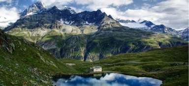
Chamonix - Zermatt crossing
Haute Route


Ski mountaineering tour across the Alps. 7 days, 120 km, 9.5 thousand meters. From France to Switzerland. From Mt. Blanc to Matterhorn. Through mountain saddles and passes. Across the valley and the rocks. Across the endless snow plains. Weekly trip with accommodation in cottages Trient, La Fouly, St. Bernard, Valsorey, Chanrion and Vignettes. We really had the mountain massifs completely in front of our eyes. End of March 2019.
Haute route
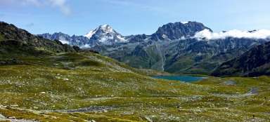
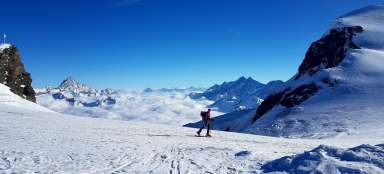
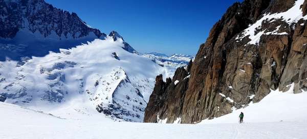
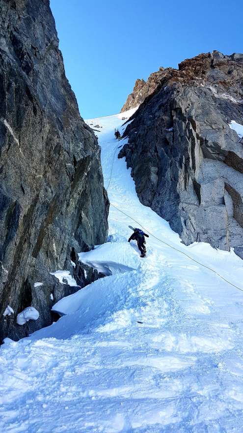
The Haute route has several variants, in the summer you can also walk, we chose the variant called „pure“, without any transport assistance, through the valley of La Fouly and the monastery of Saint Bernard, through the cottages Valsorey, Chanrion and Vignettes. When the Matterhorn amazed us with his closeness and presence on our way to the last saddle, we were tense if we could do it all and the ride to Zermatt was a real treat. The photo shows the first ascent, the first day, the ascent to the Col du Chardonnet saddle (3,300 m above sea level), when the afternoon sun was shining on us.
When don't you go there
If you want to complete the Haute route, you need to be not only skiers, but also partially climbers, or you need to be used to climbing something from time to time, not to be afraid of exposure and to prepare for spending a week in a seat hung with glacier equipment. You also shouldn't mind that you don't wash for a few days (there is no water in the cottages); when we brushed our teeth with snow on the fourth day, a friend said that it was starting to irritate him …
Powder, crust and firm
Of course, don't go on a trek unless you have a clear forecast for the week and an acceptable avalanche level, ours was even 2 to 1, so we started to worry that there would be no dust. Fortunately, he was, left on the northern slopes. However, we rode down the same crust, firm and even completely frozen, hardened and, moreover, furrowed snow. We enjoyed such riding the most the second day of the trek, on the way to La Foula, where we descend to the valley (1,700 m above sea level). In addition, there was white blindness that afternoon. The prospect of having 2,000 meters down in front of you in such conditions, sometimes at an inclination of 40 degrees, will not please you completely. On the other hand, we were given a beautiful powder two days later, after a thousand-meter hike to the Col de Proz and Col de Montorge saddles and also the very last day below the Matterhorn. Video: https://youtu.be/rli__NFHLgM

Ride or abseil
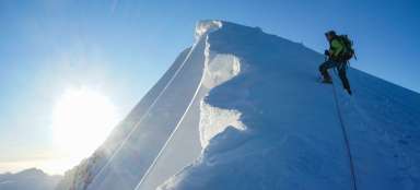
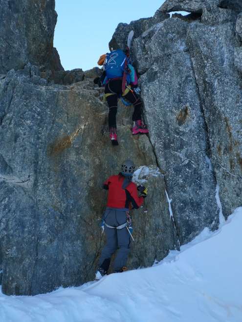
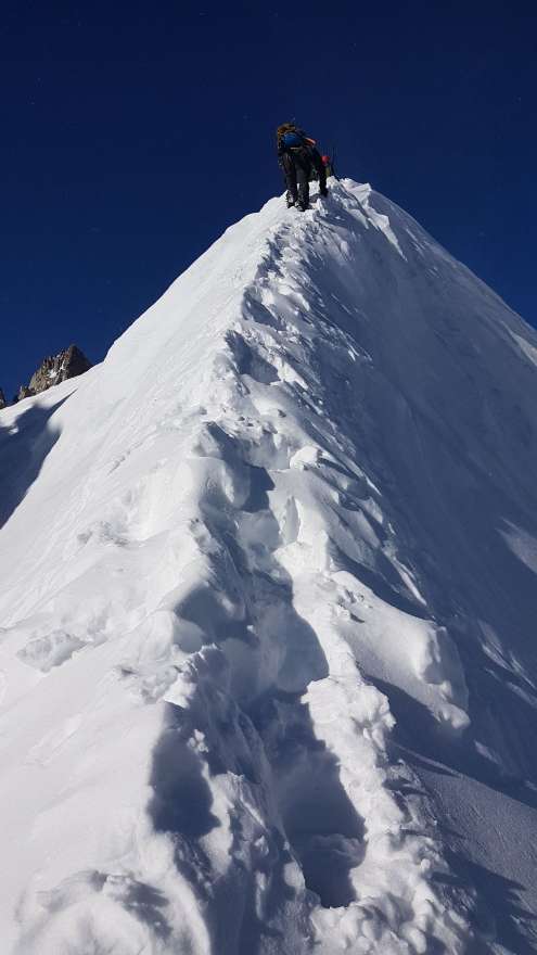
We used the rope only once during the whole day, on the first day, in the Col du Chardonnet; the saddle, which rides under ideal conditions, was one ice and quite reliable fixed ropes were placed here. Many places elsewhere on the route were clearly covered with ice (without harshajzen, ie cats under skis, we would be sad). Sharper sections are, of course, walked on cats and with an ice ax on standby. We were surprised by the small number of cracks that we encountered along the way, so they didn't meet, the glacier seemed to be mostly compact flesh all the time.
Which way this way
With regard to map materials, in today's developed technological age, there are several ways to prepare for the trip and have secured navigation even if it is not visible for a step. Personally, I consider it most practical to upload a gpx trek to a downloaded offline map, whether to a mobile phone, gépéeska or watch (for sure, at least two). However, electricity is saved in the cottages, so they typically let you charge only one device, a maximum of an hour, then it even goes out in the cottage and you go not only to kadibudka with a headlamp … ( the fact that the paper must not be thrown into the „hole“, but into the basket next to it, so that it does not roll in the mountains…)

A week on the go
It should be noted that a thousand altitude meters at the height at which we moved (ie in saddles up to about 4 thousand m above sea level), is a little different than in the low mountains. I consider the most demanding ascent for me to be endless pedaling in the afternoon sun to the cottage Valsorey eight hundred meters high. That day our total daily limit was close to 2000 m elevation gain, which I consider to be borderline and I would not want to walk any more, however, there are fighters who will manage the whole Haute route in two days.

Technical tweaks
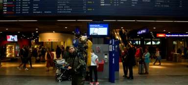
The location of the car at the very beginning should be considered the first technical tweak. In a week you will cross the mountains and you have the car either at the start or at the finish (or you have two cars, but you drive there and back the next day). The train option is offered, but it is surprisingly the most expensive. The cheapest and most convenient in the end was to leave the car at the destination and order a public taxi from Visp to Argentiere, where we had already secured the first night. The photo shows the arrival to the monastery and hospice of St. Bernard, ie no usable road in the winter months. But the accommodation there was luxurious, served by the Order's brothers. The history of the monastery is connected with the origin of the Bernardine dog breed, bred entirely for the purpose of rescue in the mountains.

Cottages
Accommodation in mountain huts must be booked well in advance, at the last minute they can be canceled, the huts allow it due to a change in weather. The capacity of the cottages varies quite a bit – from the tiny Valsorey for barely 40 people, to the big Vignettes with lots of tourists and an online booking system. Electricity has already been talked about, the idea that you will be able to recharge both your mobile phone and something else is more from the realm of dreams, guidi also have priority. We were one of the few groups without a guide and there were five of us. The sixth member, who dropped out due to illness, was still a ghost with us, especially in the mountain huts booked in his name (we thank him once again for a flawless booking, ordering beer, for someone who is not there, is especially fun.)

Do not snarl into the crack
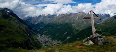
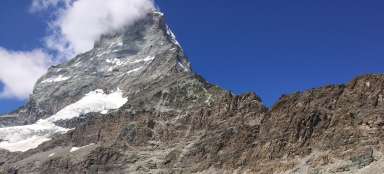
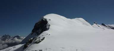
When I mention that we haven't been in the rope team all this time, it will sound like a total disregard for the rules of movement on the glacier, but the truth is that we didn't feel the slightest need, there were no cracks along the way. It was possible to fall somewhere only at the descent to Zermatt, where we made a wrong turn in one place, it was difficult not to stare at the Matterhorn, which was so close that we recognized the individual climbing passages of the Lion's Trail and tried to estimate exactly where (on the contrary on the other hand) it goes down on skis.

And what about avalanches!
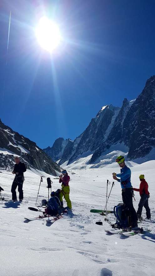
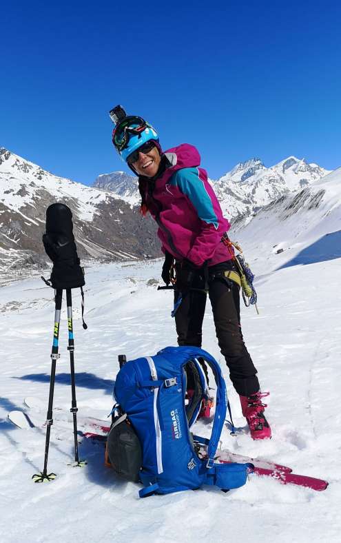
Avalanche backpacks had three of us, three out of five, when you already have it, it doesn't make sense to leave it at home. However, the internal arrangement of the avalanche backpack and the overall construction of the back is worse than with the clever outdoor backpacks, not to mention the weight. If you have a backpack with a volume of 30 liters, like us, nothing much will fit in it, because a large part is occupied by airbags and cartridges. In principle, you have all your clothes on all the time and in your backpack with cats, harshayns, a probe and a shovel. You can bring almost no food, because it can be bought in cottages, so there is a thermos, a pharmacy, hygiene supplies in a miniature package and one dry T-shirt for changing clothes. You will spend the week in jumping jumps and chateau slippers.
When it all works out
I wonder what story to add at the end, whether here, how Honza forgot at the ski bus stop in Argentiere skis, how the members of the expedition did not agree on the usefulness of carving, or how I froze the most at the Chanrion hut. Actually, there were several happy events, but the important thing is that we never pulled out a pharmacy during the whole time and we didn't have a single situation where we could.
Kilometers, elevation ...
DAY 1 – 15 km, up: 1570 m, down: 1197 m, Argentiere → Trient DAY 2 – 15 km, up: 933 m, down: 2470 m, Trient → La Fouly DAY 3 – 14 km, up: 1285 m, down: 422 m, La Fouly → St. DAY 4 – 18 km, up: 1927 m, down: 1427 m, St. Bernard Bernard → Valsorey DAY 5 – 13 km, up: 1024 m, down: 1581 m, Valsorey → Chanrion DAY 6 – 15 km, up: 1688 m, down: 1044 m, Chanrion → Vignettes DAY 7 – 29 km, up: 1332 m, down: 2815 m, Vignettes → Zermat
Advertising photo at the end
The picture comes from the Chanrion hut. The reason why I froze in it so much is that we simply arrived too early and it was not hot in the cottage in the afternoon or in the evening.