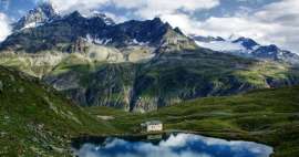
Ascent to the base camp below the Matterhorn
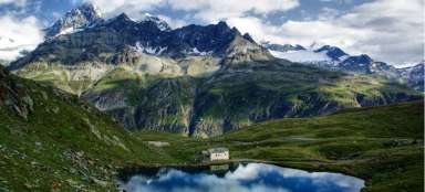
Hörnlihütte base camp 3260 m above sea level


We took the cable car from Zermatt to Schwarzsee at 2583 m above sea level. Our journey continued with the descent to Zermatt 1602 m above sea level
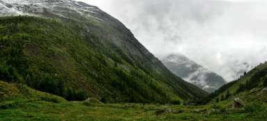
We climb from the lake Schwarzsee
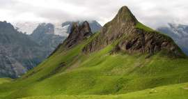
After a few minutes of our climb, I have this beautiful view in front of my eyes

So here we have it
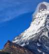
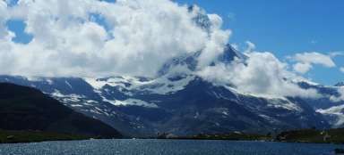
I began to call the Matterhorn a shy old lady. He never reveals his face. Always in the morning or in the evening.

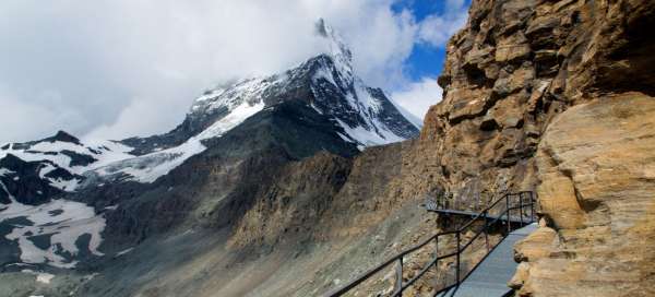
Road on bridges
In order to move on, we need to cross this canyon and get to the other side of the massif.

Under the mountain itself
Here I am already around 3000 m above sea level. The first signs of mountain altitude sickness may already appear here. It occurred to me that it was here that she signed a little on me, when I was really sick.

View of the Hörnlihütte
It can already be seen. Just walk through that rock to her.

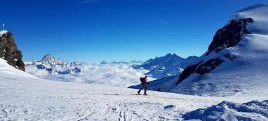
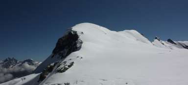
View of Monte Rosa
View of the Monte Rosa massif and its glacier

We literally crawl up
The last 100 meters of elevation gain looks like this. The temperature at this altitude in summer is around 5 ° C.

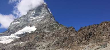
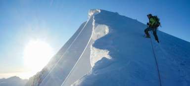
Here begins a sharp ascent to the Matterhorn
From here, climbers begin to conquer the Matterhorn

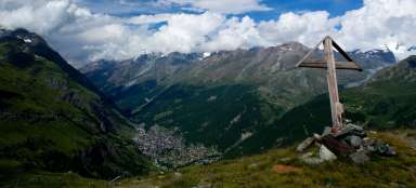
Back to Schwarzsee
Beautiful panorama from the Schwarzsee

View of Zermatt
All that remains is to go down

View of the Gornery river valley
A river that disappears in the middle of a hill. there is a mine dam and all the water ends underground.

Ascent to Base Camp below the Matterhorn
Hörnlihütte base camp 3260 m above sea level
From Zermatt we take the cable car to the Schwarzsee stop. From here, we calculate that we will complete the base camp in 3–4 hours. But we still have a 700-meter elevation gain. Unfortunately, the road markings are not quite the best here, as everywhere around Zermatt, where one can easily catch a long route. So after about a kilometer we coaled badly and Hirli took a completely different route, which was really steep. There is no stream on the way up, so there is nowhere to get any water. From Hirli we are waiting to cross the local canyon, the path of bridges and ladders is used for that. This will get me to the other side of the massif. Here along the contour line to the Matterhorn. I am located around 3000 m above sea level and they are sometimes even critical. Illness and nausea can occur. It was the only day I felt really sick here for about 30 minutes and I thought I would whistle it, but somehow I was relieved. Here I waded through the rocks. But the glances back were beautiful. Watching the Monte Rosa massif with its glacier. It won't get bored. We came all the way to Hörnlihütte so I could hum the famous Matterhorn song. A lifelong dream has come true. Here I had cookies for lunch, which I shared with the mountain coffee, and we slowly set off again. They reached Lake Schwarzsee and from there they descended to Zermatt.
Articles nearby


Giga List: The most beautiful tours in Switzerland
Mountainous Switzerland is an absolute paradise for mountain hikers. Almost every corner of the country offers breathtaking hikes… continue reading
Article: Hikes and mountain ascents in the Valais Alps
The Valais Alps offer countless beautiful hikes and mountain ascents. The highest peak of the Valais Alps is Dufourspitze (4,634… continue reading