Article Barrando de Erques
Trek through the Erques River Gorge

A shorter but slightly more physically demanding trek through the gorge of the Erques river can be found in the west of the island of Tenerife, near the city of Adeje. The start of the route is in the small town of Vera de Erques and the journey took us about 2–3 hours. The advantage is that part of the route leads through the dry bed of the river Erques, which is buried deep in the rocks, so you will be sheltered in the coolness of the strong Canarian sun.
Vera de Erques
The start of the route is in the town of Vera Erques. We arrived by car and parked in a couple of parking spaces above the church. But there is also a bus that goes here, just look on google maps or the local titsa website from where and at what time.

View into the canyon
Before we start the trek, we have the opportunity to enjoy the view down and have refreshments at rest areas with benches. There is a really good view of almost the entire length of the canyon from here, so you know what to prepare for and where the route roughly leads.

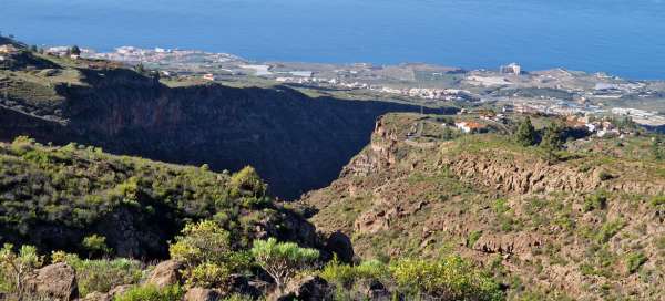
View of Gomera
We slowly climb up the route. First, we pass a few houses where they have goats in their sty and dogs tied to their kennels. Then the path continues past a few mature pine trees, which is quite unusual here in the south, such larger trees do not tend to have much moisture here. Looking back, I have a beautiful view of the nearby island of Gomera. We were also lucky to have good visibility, as it is often partly covered in cloud or haze.

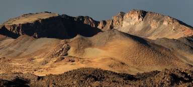
Erques River Canyon
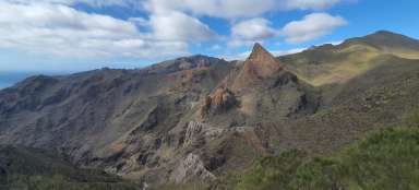
At the highest point of the trek, we go around the rock massif, the path is not marked with colored markers, but sometimes you have to look for the right footpath among the vegetation. Here and there you will find so-called mužiks, stones piled on top of each other, which mark the route.

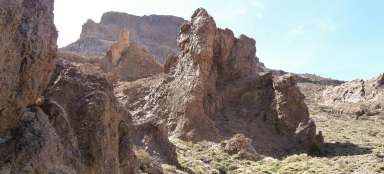
Rock flat
Under the overhang of the rock we found and glimpsed the rock flat. The massive wooden furs and doors were still preserved. The rest of the room is already empty, only the remains of the fireplace are still visible. But the local residents had a great view from the rafters.

Vegetation in the canyon
Then we slowly descend the scree path down into the canyon. Thanks to the shade and higher humidity, we find really lush green vegetation here by local standards. You can even see tufts of grass and blooming bushes and cacti here.

At the bottom of the canyon
We finally descended to the bottom of the canyon. It rained a lot recently, so it's dry here, only sometimes we find small lakes where the water hasn't drained or dried up yet. The path is fairly consistently marked by men.

They don't travel by road
The originally planned route was to take us along the opposite side of the precipice for a while. We saw the road, but we didn't find a completely suitable place to get to it. But since we knew it was only a short distance, we went straight through the canyon floor. Sometimes we had to overcome larger stone formations.

Footpath up
We finally managed to pass the bottom of the canyon unscathed. Except for one small climb down a 3-meter rock, it was a relaxing trip. After a few meters, we finally came across the original route, which led us back up out of the canyon. On the way we pass blossoming agaves.

Return to the village of Vera de Erques
Then we only had to return along the road to the village of Vera de Erques. As the locals drive their cars even on this small road, we were glad that we left the car in the parking lot in the center. I would not like to drive through those narrow and steep roads here. In this way, we enjoy the surrounding architecture more, which blends with the blossoming fences.