Article Ascent to Guajara
An inconspicuous peak


The ascent to this 2,718-meter-high peak begins at the Cañada Blanca information center, while the descent continues to the village of Vilaflor. In total, it will climb less than 600 meters during it, but then it is necessary to descend by 1,400 meters. The route, with a total length of approximately 16 kilometers, passes through several vegetation zones and is also interesting from a geological point of view.
Introduction
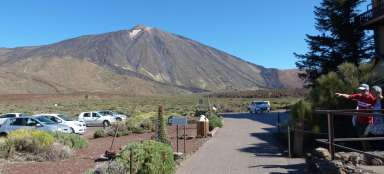
The ascent begins with a gradual ascent from the parking lot towards the top, which bypasses from the left.

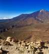
Volcanic landscape
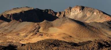
The whole road passes through a beautiful landscape created by the eruption of volcanoes that lifted the island from the bottom of the ocean.

First points of interest
After a few minutes' walk, wonderful views of the surrounding countryside open up.

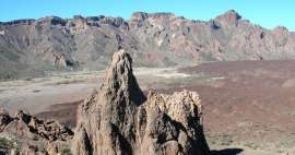
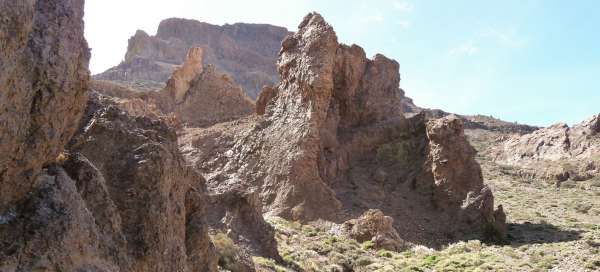
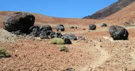
Volcanic rocks
The whole road is lined with interesting volcanic formations. Most of the trek passes through open country without the possibility of hiding in the shadows.

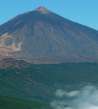
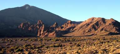
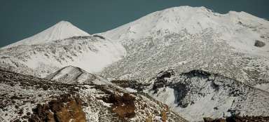
Pico del Teide
The top of Pico del Teide has been hidden in the clouds since morning, but the view of it is still impressive.

The first climb
The first and most difficult ascent begins after about an hour of walking and it is necessary to ascend to the „saddle“ from which the ascent to the top begins.

Ocean view
During the ascent there are wonderful views of the ocean.

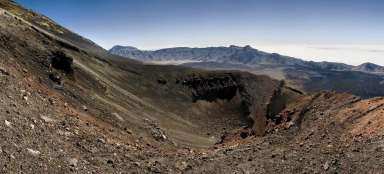
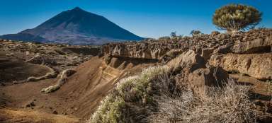
Geological attractions.
Along the way you can see the deposition of layers of volcanic dust that was deposited in different periods which can be seen very nicely based on the changing color and structure of the layers.

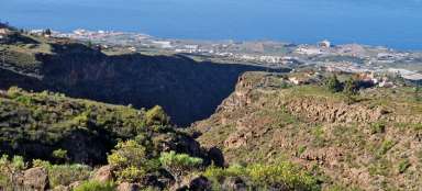
Morra del Río
Opposite is the less visited peak of Morra del Río.

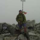
The top of Guajara
The peak of Guajara is larger than most of the hills and it is possible to walk here and enjoy the views of the surrounding countryside.

Views from the top
In the background you can see not only the ocean and clouds, but also the neighboring island of La Gomera.

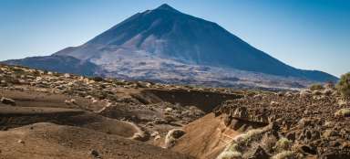
Endless desert
When looking into the interior of the island, one feels that one is in the desert or on Mars.

The first forests
On the way from the top to the village of Vilaflór, the first sparse coniferous forests appear in the background.

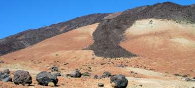
Black "sand"
The road gradually passes not only through the „yellow desert“ landscape but also through the black „sand“.

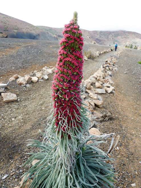
Symbol of Tenerife.
Snake (Echium wildpretii) is an endemic that grows only in the interior of the island of Tenerife in its driest areas at altitudes around 2,000 m above sea level
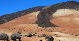
Black desert
Gradually, the route passes through an area formed by black colored volcanic dust.

Pine forests
The road passes through very sparse pine forests, which provide occasional shade.

Dense forests
At lower altitudes, more and more trees are gradually being added, which brings new and fascinating views of the surrounding landscape.

Distant views
At the end of the trek to see in addition to the beautiful surrounding landscape, the ocean and the agglomeration located on the south side of the island.

Hard life
As the road comes to civilization, the first terraced fields appear on which in the past the locals tried to grow agricultural crops.

Vilaflor
After 6 hours the journey ends in the small village of Vilaflor.

Articles nearby


Giga List: The most beautiful tours in Tenerife
Tenerife is famous for its beautiful nature. Outside the volcanic center with the mighty Pico de Teide, you will find huge cliffs… continue reading
Giga List: The most beautiful hikes in the Canary Islands
The Canary Islands offer a variety of beautiful tours not only in the volcanic landscape, but also in the misty forests or along… continue reading
Giga List: The most beautiful hikes in Teide National Park
The whole center of the island of Tenerife is occupied by an inhospitable volcanic caldera from which rises the highest mountain… continue reading