Article Arenas Negras
On the edge of the central caldera

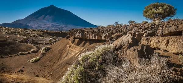


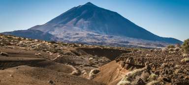
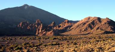
A circular route through the eastern part of the central caldera will take us into an attractive volcanic landscape with nice views of the dominant stratovolcano Pico de Teide.
Vegetation
We start at the visitor center of the national park, from where the marked path No. 4 leads, leading along the southern edge of the central caldera. After about 300 meters we turn left onto road no.2. The light of the low December sun highlights the local vegetation.

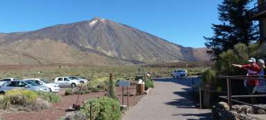
Astronomical observatory
We are constantly ascending and white buildings with domes appear in front of us, hiding the equipment of the Izaňa astronomical observatory.

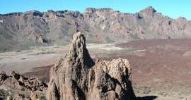
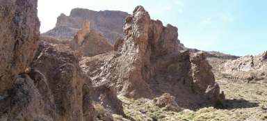
Arenas Negras
After the turnoff, from which the road leads to the astronomical observatory, we turn sharply to the right and after the final ascent we reach the saddle, where the peak of Montaňa del Cerrillar (2346 m above sea level) is west of us, east of Montaňa Maja (2361 m above sea level). Teide reappears in front of us.

Volcanic landscape
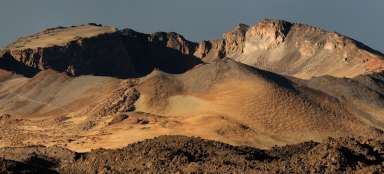
We turn sharply back west. The Fortaleza ridge appears and the gorge and the rock wall of the Risco de las Ventanas begin immediately in front of us.

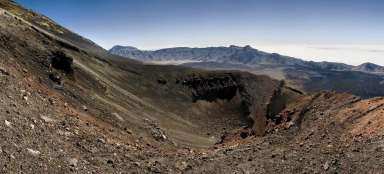
Central caldera
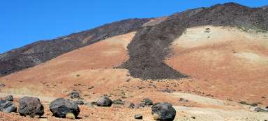
We begin a relatively sharp descent to the bottom of the central caldera, whose southern walls in the afternoon sun contrast sharply with the azure sky.

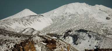
Cerrillar Mountain
We leave the top, which we gradually walked around, behind. Road No. 2 clashes with Road No. 4 and after 1.5 km another walk we return to the information center of the national park.

Articles nearby


Giga List: The most beautiful hikes in Teide National Park
The whole center of the island of Tenerife is occupied by an inhospitable volcanic caldera from which rises the highest mountain… continue reading