
Ascent to Pic de Casamanya
Magic mountain in the heart of Andorra


Pic de Casamanya actually has three peaks separated by shallow saddles. The main peak is considered to be Pic Oest de Casamanya with an altitude of 2,746 m, the highest is Casamanya Nord with a height of 2,757 m and in the middle between them is the lowest Casamanya Mig with a height of 2,731 m. The peaks are quite easy to reach and the whole trip can be managed 5 hours.
In the begining
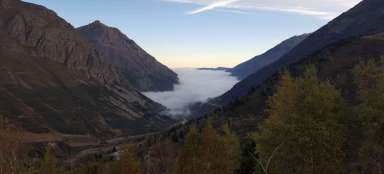
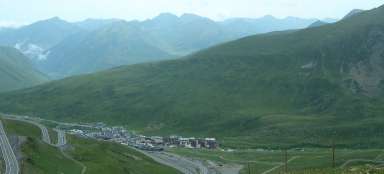
There are a number of possible starting points – Canillo, Ordino, Ansalonga, Arans and others. Probably the easiest way to the top is from the car park, which is in the saddle between the towns of Canillo and Ordino. The parking lot itself is at an altitude of almost 2,000 m above sea level, so the elevation that must be overcome is not dramatic. We left the parking lot, which is a little lower towards Canillo, and we had to walk about 1 km down the road to the saddle. However, the traffic was not great and looking back we had our goal in the palm of our hand.

Above the forest border
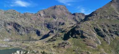
The hiking trail is already starting in the saddle. First, it gradually climbs through the forest. Above the upper border of the forest opens a view of the surrounding mountains and valleys.

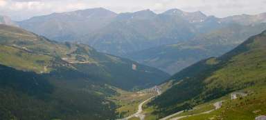
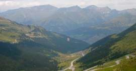
The road ahead
At the same time, you can see a large part of the road that is still ahead of us. However, the apparent peak in the photo is not yet a real peak (peaks). It is still hidden, resp. one of the peaks peeks a little between this apparent peak and the side ridge.

In higher positions
The path continues along a paved path along a wide ridge overgrown with grass, the slopes of which on both sides initially fall slightly, later sharply. In higher positions, rocky outcrops are also beginning to appear.

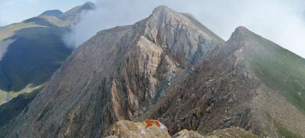
The first peak
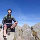
After less than two hours of constant ascent, the first peak is in sight – Pic Oest de Casamanya. While the eastern slope is still overgrown with grass, the western slope is covered with a rocky sea, which soon turns into a rock face. A stone mound has been built at the top and there is a beautiful view from all sides.

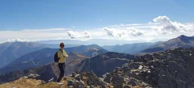
View from the top
View from the top to the north.

Pic Oest de Casamanya
The trail turns east at the top and descends to the saddle in front of Casamanya Mig. Looking back, the difference between the southeastern and northwestern slopes stands out even more …

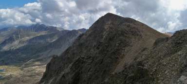
Casamanya Nord
… and looking ahead we have the highest of the three peaks – Casamanya Nord.

Casamanya Mig
Finally, a retrospective view of the middle peak (including the first peak in the background). The trail only bypasses him, but you can also climb it.

Before the storm
After ascending to Casamanya Nord, the weather began to change quickly. The wind blew clouds, approaching the rain. On the other hand, we had a beautiful spectacle in front of us – one side of the ridge shrouded in thick clouds, on the other side, the sun was still shining.

Descent
The trail continues across the top plateau to the Col d'Arenys saddle, from where it is possible to descend either eastwards to Canilla or westwards along a path that is then divided into several directions leading to various towns or villages in the valley. Due to the deteriorating weather and the need to get back to the parking lot from which we came, we chose to descend the same route as we came. As soon as we got to the first trees, a storm came. Fortunately, it was short and soon faded.
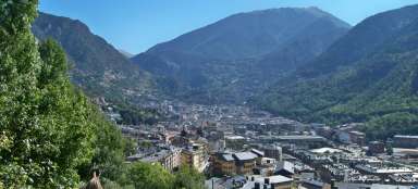
Viewpoint Mirador Roc de Quer
On the way back to Canilla, it is definitely worth stopping at the Mirador Roc de Quer viewpoint. The viewing platform is located on a rock high above the town and offers an almost aerial view of the valley below us.

Articles nearby


Article: Trip to Andorra
As a small state sandwiched between Spain and France, Andorra offers, thanks to its location, mainly mountain hiking and skiing… continue reading
Giga List: The most beautiful mountain ascents in Andorra
Although Andorra is only a small country, due to the fact that it is practically surrounded on all sides by the Pyrenees, it… continue reading
