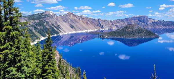
Crater Lake National Park
The deepest and cleanest lake in the USA


Crater Lake National Park was established on May 22, 1902, making it the fifth oldest national park in the USA and its area is 741.5 km². The national park is located high in the Cascade Range in southwestern Oregon and is about a 7-hour drive from San Francisco. Indian tribes called the area Giwaas – the most sacred place, a trio of white gold diggers first arrived here on June 12, 1853 and named the place Deep Blue lake. The current name has been used since 1869.
The park is open year-round, but access to the lake is restricted in winter. The best time to visit is in the summer when the weather is mild and the lake is easily accessible via the ring road.
Amazing lake
The dominant feature of the park is Crater Lake with incredibly clear, deep blue water. The water in Crater Lake is very clean and clear. This is because the lake is fed only by rain and snow water and has no inflows or outflows. All this gives the lake its unique turquoise color.
The lake is surrounded by high mountains and forests and is considered one of the most beautiful lakes in the world. It has an area of 53 km² and is 592 meters deep, making it the deepest lake in the USA. At the same time, it is the deepest volcanic lake in the world. The lake has no tributaries, so all water comes only from snow and rain. This area is known for its high snow cover, with up to 13 meters of snow per year.

The lake does not freeze
An interesting fact is that this lake is the only one in the USA that does not freeze. Although the weather here is very cold, the lake freezes only in extremely cold weather. The last time this happened was in 1949. The reason for this peculiarity is that
the lake is very deep and this helps it to remain unfrozen even in winter. The lake is also surrounded by high mountains, which retain heat and prevent the penetration of cold.

The site of a huge volcanic eruption
The lake is located in the caldera of the former stratovolcano Mount Mazama, which exploded 7,700 years ago. The massive explosion lowered the volcano by about 1,600 meters and the aforementioned lake was formed at the top. Another eruption over 7300 years ago created Wizzard Island. The last recorded eruption occurred 4800 years ago. Since then, the volcano has been sleeping, but no one knows when it will wake up again.

Sinnott Memorial Lookout
The highest point in the Crater Lake area is now Mount Scott at 2,636 meters, the lowest point is at 1,220 meters in the southwest corner of the park. You can go around the entire lake by car or by bike along the 51 km long mountain road Rim Drive. However, it is passable only in summer, approximately from the end of June to mid-October (depending on the weather and snow layer).
However, most visitors only head to the Sinnott Memorial Lookout at the Visitor Center, where they have the entire lake in the palm of their hands. Wizard Island, the only island located near the western shore of the lake, can also be seen beautifully from here. The more active can go on a sightseeing cruise on the lake. They have a choice of two itineraries, a standard two-hour one and a half-day one, which also includes a tour of the island.

Observation tower
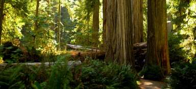
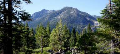
This national park is a popular spot for hiking, camping, fishing and kayaking. Visitors can admire the lake from several vantage points or take a boat ride on its surface. There are also several hiking trails around the lake that lead to mountains, forests and waterfalls and offer views of the lake and the surrounding area.
Several routes of different lengths are prepared for hikers. Very popular is the section along the western ridge leading through the Discovery point to the Watchman Lookout Station.

View of the island
On the cliff below the tower is the wonderful Wizzard Island overlook. The popular Pacific Crest Trail also passes through part of the park – a 4,260 km route that runs from the Canadian border to the Mexican border.