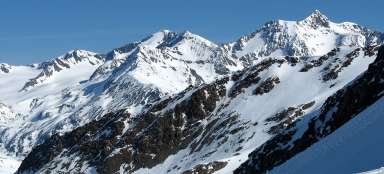
Ascent Similaun Hütte - Similaun
Final ascent to mythical mountain


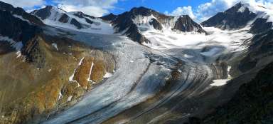
The ascent to beautiful Similaun lying directly on the border of Austria and Italy is another amazing trek that can be undertaken in Ötztal Alps. Height of Similaun is different in different sources. Some sources state (3 606 m asl), other only (3,599 m asl). Anyway, it is the sixth highest mountain in the state, so a popular destination for climbers, ski alpinists or adventurous tourists. Views from him are awesome. During the summer season it is accessible only in crampons, ice axes and for groups linked to the rope. At the end of winter it is in good conditions accessible only in hiking boots /the path is beaten by ski alpinists/, but remember that the path leads along the snow-covered glacier, so the risk of falling into a crevasse is still there!
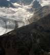
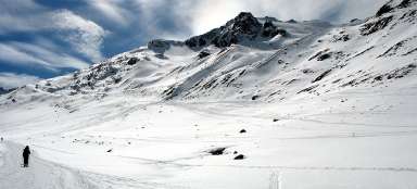
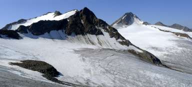
Ascent path to Similaun
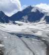
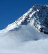
The winter ascent route is obvious already at the hut – it leads as far as possible from the rocky ridge. The most dangerous part is (in the picture in the shade) in places with the biggest number of cracks, on the glacier. It is important to stick here to paths well-trodden by ski alpinists. The steepest is then a final steep slope and sharp ridge at the end.

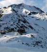
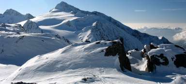
Top of Similaun
If you come closer to Similaun, you can clearly see that the slope just before the peak is really the steepest and people going in snowshoes have here quite problems.

Similaun Hütte / Rifugio Similaun
If you ascent only a few tens of meters, you can already see the whole Niederjoch Pass (3 016 m asl) and hut Similaun if you look back. Horizon is dominated by another high mountain on the main ridge – Finailspitze (3 514 m asl). Now we still have almost 600 vertical meters to the summit.

Relaxation above 3 251 m asl
The first relax and photogenic place is above the first icefall. Nameless spot (3 251 m asl), which looks from Similaun hut like a nice pyramid dividing the glacier into two parts, looks from here just like a small ridge. On the right towers also the top of Marzellkamm.

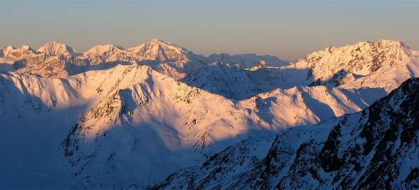
View of Niederjoch
Looking back and down, the trodden path from ski alpinists looks like as rolled by a snow cat. If you set off early, you will not fall in the frozen snow even if you have only hiking boots on – but trekking poles are, however, a minimum requirement. The massif of opposite Finailspitze is becoming more monumental.

Similaun in sight
The way is quite quick in these places and you can pretty clearly see the cross on the top. There is still one terrain wave of glacier, steep slope, the final ridge and you are at the top.

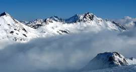
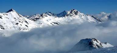
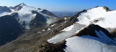
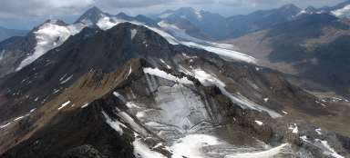
Marzellkamm above inversion
If there is an inversion, it is advisable to get over it and enjoy the sunshine. Today it was necessary to get over three thousand meters above sea level. On the horizon you can see the second highest mountain in Austria – Wildspitze.

Under the steep slope
Under the steep slope begins the most difficult part of the ascent. In addition, you need to really be careful, ideally put on crampons.

On the ridge
During the zigzag ascent in steep hillside you can look from the edge of the ridge into the depth below you. Hut Similaun is still visible.

Final ridge
Steep hillside ends in a flat place, where you can relax for a while before the last ascent.

Final ridge
If you look back, you can see either the flat place above the steep slope used for relaxation or the way along the final ridge.

The cross on the top
After about three hours you finally ascent to the top, where you will be rewarded by great views.

View of the valley Niedertal
From the top you can see the entire valley Niedertal as at your fingertips.

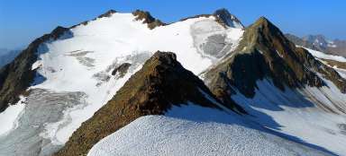
View to Hintere Schwarze
The view to the east direction is of extensive upland ice plain leading to even higher mountain Hintere Schwarze (3 624 m asl). A significantly less frequent alpine ski trail disturbing otherwise virgin-looking area leads to it as well.

View to Italy
View to Italy and of the dam Vernagt stausee is better just below the summit.
The way back is the same, or alternatively via Marzellkamm.

Articles nearby


Article: Ascent to Similaun
Similaun (3 606 m asl) is one of the most popular and highest mountains in Austria. Moreover, it is not very difficult, so a… continue reading