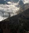
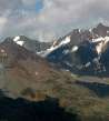
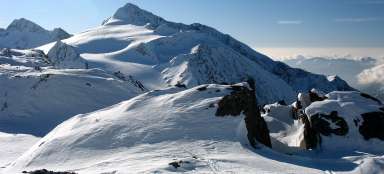
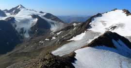
Ascent to Saykogel from the east
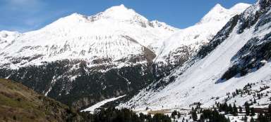
Connection between two valleys


You can ascent Saykogel by two ways – either from the Niedertal or Rofental valley. Most of the tourists take this advantage and plan the circuit not to have to return back through the same valley. So the mountain does not serve just like a beautiful outlook, but also as an interesting connection of hiking paths. Extreme tourists can do this circuit in a single day from Vent. Most tourists, however, go with more comfortable pace and spend one or two nights in this area. This photoreport describes the way from Martin Busch Hütte to the top of the mountain.
Sunrise over Saykogel and Hauslabkogel
Significantly less trodden path to Saykogel branches off from the main tourist highway to Similaun Hütte basically just a few meters behind the hut Martin Busch. It slowly rises in traverse across the grassy slopes to the long rocky arm of Saykogel. The mountains are colored red in the morning.

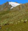
Alpine meadows
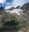
Rocky shoulder is slowly approaching after half an hour of comfortable ascent from the hut. In the meadows along the path you can see a lot of sheep. The main view is still of the icy northern slope of Hauslabkogel.

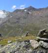
View of Niederjoch
Down on the bottom of the flat valley is visible the main road leading to Niederjoch, on which the hut Similaun stands. Ridge of Marzellkamm is covered for quite a long time by beautiful Similaun.

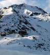
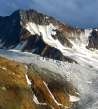
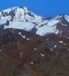
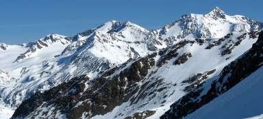
Hauslabkogel (3402 m asl)
The path begins to rise sharply to the ridge after reaching the rocky arm. Views of Hauslabkogel are very nice.

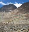
The view down
The ascent along the rocky shoulder is sharper and in much worse terrain than previous passage through the meadows. Deep down you can see Martin Busch hut.

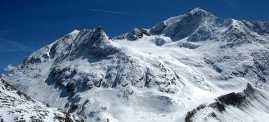
Similaun (3606 m asl)
You can finally see the local king Similaun with the increasing height.

Niederjoch (3016 m asl)
You can gradually see over Niederjoch far into Italy.

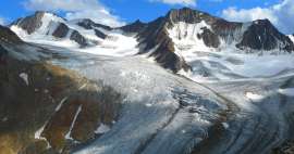
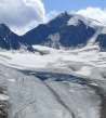
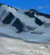
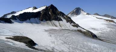
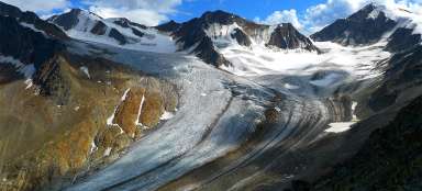
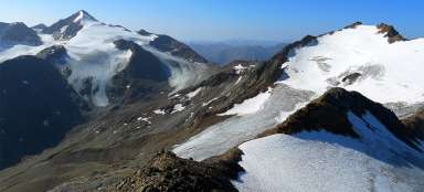
Kingdom of ice
After about two and a half hours you finally ascend to the ridge connecting Hauslabkogel and Saykogel. You can have here suddenly spectacular views to the huge glacier arena. From here the path continues to rise about 15 minutes just close to the peak, where is the turning into the valley Rofental and the way leads along small sharp ridge peeking out over the glaciers. On the horizon above the ice arena peeks out the beautiful Finailspitze (3514 m asl).

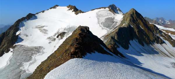
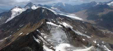
The eastern horizon
Eastern horizon is dominated by a myriad of mountains – the closest is from an ancient glacier cut long ridge of Marzellkamm. Behind it rises from left Mutmalspitze (3522 m asl), Hintere Schwärze (3624 m asl), Marzellspitze (3555 m asl) and Similaun (3606 m asl).

Wildspitze and northern ridge
In the north direction continues this forked ridge from the main ridge above the town Vent. Right next there is Sennkogel mountain (3400 m asl). Far away on the horizon towers the second highest mountain in Austria – Wildspitze (3774 m asl).

Weißkugel / Palla Bianca (3738 m asl)
The western horizon is dominated by the third highest mountain in Austria Weißkugel.
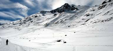
- For return you can use the same way to the hut Martin Busch and possibly descend to the Vent by Niedertal valley
- Or „go over the mountain“ and walk down to the mountain hut Hochjochhospiz (2412 m asl) and return to Vent by the more interesting way through the valley Rofental.

Articles nearby


Article: Hiking in the valley Niedertal
Niedertal valley is one of the most beautiful valleys in Ötztal Alps. It is dominated by beautiful Similaun (3 606 m asl) and… continue reading
Giga List: The most beautiful ascents in the Ötztal Alps
The Ötztal Alps offer hundreds of 3,000 peaks accessible from three main valleys: Ötztal, Pitztal and Kaunertal. It is literally… continue reading