A one-day trek around Ollantaytambo
Part of the multi-day trek Lares


The trek is an ideal variant for a 1-day alternative variant of the well-known Inka trail, which are, however, with a paid permit, in a group with a guide and very often booked long in advance. The trek leads from the alpine village of Patacancha over two mountain saddles and ends with a long descent to the village of Yanahuara down in a valley almost by the Urubamba River. The difficulty of the trek is quite considerable due to the high altitude and its length.
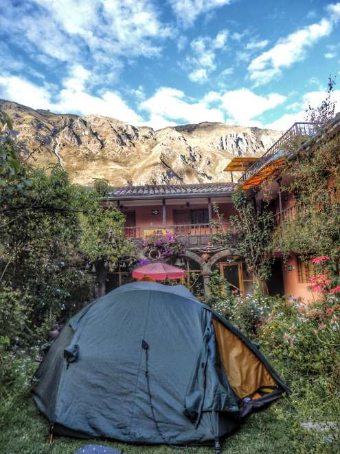
Overnight in Ollantaytamb
Because we had a tent with us, we used cheap accommodation hostel / camping through booking – where we pitched a tent on the lawn in the atrium of the hostel.
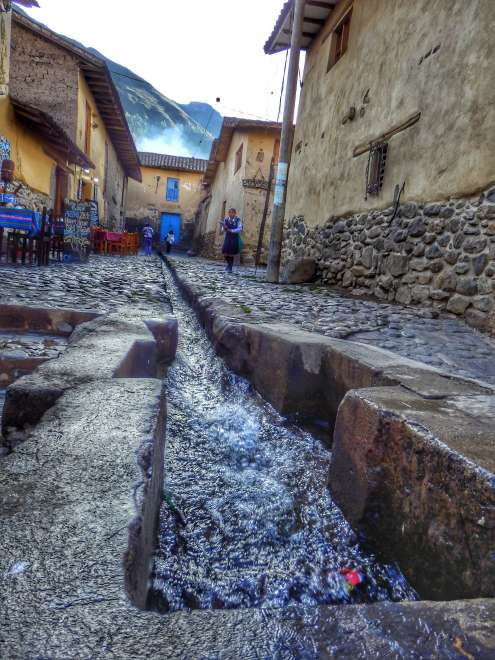
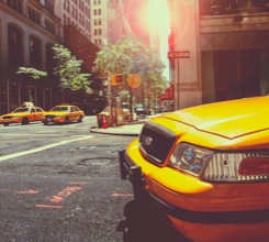
The city of Ollantaytambo
The town itself is like a small open-air museum. The cobbled, narrow paths lead across the city, and most have a canal in the middle to drain water from the mountains that surround the town. We started our trek early from here early in the morning. We had information that from there a minibus runs in our direction to the mountains, which we stopped after about 15 minutes of walking up the road.
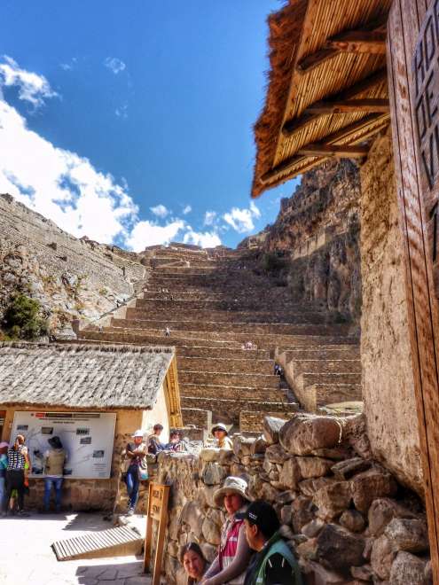
Inca settlement in Ollantaytambu
There is also a large archeological site of an Inca settlement on a steep slope with typical terraces. Admission will be similar to the entire Machu Picchu complex (about 1000 CZK), while the view of the whole complex is relatively sufficient from the street in front of the gate.
Village of Patacancha (3800m.nm)
The minibus dropped us off in the village, which is a couple of houses and a school where children run around. From here, our trek starts up into the mountains, although according to the altitude of the village, it would seem that it may not be possible even higher, but the hills all around suggest the opposite. Along the way we meet only a few people, in addition to about one group of tourists, we also come across locals who have this alpine trek, as a normal way home.

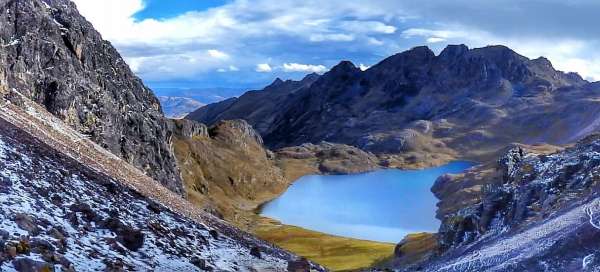
Ipsayqocha lake
We climb to the first pass and the path leads around Ipsayqocha lake. The ubiquitous llamas, which belong to a nearby building, graze around. Every height meter is known and it is often necessary to build, breathe and replenish fluids. We did the trek at the beginning of the winter season, sometime in the second half of May. Traveling in the summer season is not entirely suitable due to heavy rains.

Abra Ipsay (Condor pass 4500 m)
A view from Abra Ipsay's passport back to the path we had honestly trodden. Upstairs we meet a group of tourists with a local guide who helps us navigate to the next part of the trek. The map shows a possible route through another passport, but we'd better make sure. After all, we wouldn't want to come back all the way from an even higher passport.

Alpine farmers
We will ascend to the waist again a few meters down to the valley, where there are several houses and the locals farm here. They have a couple of llamas in the stone pens, and we'll say a few words to the master in the field cultivating the potatoes. We don't understand a word in Spanish, and the fact that despite the bulging face stuffed with coca, the natives can't be articulated much, we don't mind so much. We will be satisfied with a pantomime, which we will explain to him where we are headed.

Such a normal way home
After a snowfall swept over us, which fortunately was not very heavy, we saw a small multicolored moving point in the distance in front of us. After a few minutes, a young lady appeared in front of us, walking from the village and back home across the passport where we were headed. I wonder what condition the woolen traditional clothes might have been after the snowstorm. We were happy for our outdoor equipment that served its purpose.

After rain
Fortunately, the weather calmed down for a moment, and the sight of the passing clouds tearing at the tops of the surrounding hills stood behind the effort and overcome the hardships.

Pas Abra Wakawasi (4650 m)
The last ascent to the second, last and highest pass of our trek, to Abra Wakawasi, remained. In order not to make it so simple, in addition to overcoming the altitude, which weighs down every step, small hail began to snow and fall again. Fortunately, it overcame as we scrambled to our waists. However, the view from the waist down on the turquoise alpine lake and the valley was more magnificent.

View of the defeated passport of Abra Wakawasi
After a steep descent down from the waist, we stop at the lake for a while and bask in the sun before we go down to the shadow of the valley.

On the way down
All that remained was to run down to the valley in the distance. Which may have seemed closer than it actually was. The first steep descent from the waist, when stones mixed with gravel and remnants of melting snow slid under our feet, was replaced by a pleasant walk between the lakes and finally a little more or less straight. The view of the sunlit peaks of the five-thousanders was breathtaking.

Yanahuara
On the way, we accidentally led a herd of llamas, which was standing on the road about 3 km lower, into the valley, so they ran in front of us on the way down. The descent through the valley to the destination station of the trek town of Yanahuara was really longer than we expected. From the lakes below the waist another about 10 km through the wooded area of Mantanay all the way down into the city. We arrived for about an hour in the dark, because during the winter season it was getting dark in the area before 7 pm.