Hike to glacier Haugabreen
Face of the glacier to the touch


Jostedalsbreen nasionalpark offers many possibilities for hiking of any difficulty. There are also many opportunities to camp, although very nice place with spectacular view is the camp in a place that is called Hoyset and lies in the valley Stardalen. When traveling from the north along the road E39 turn left at the settlement Klakegg and continue for about 12 kilometers. Nice and not very difficult is the walk to the face of glacier Haugabreen. From the camp rises gravel paved and narrow road (toll 50, – NOK) to the parking lot Haug Stoylen. From here leads a narrow path first on flat-bottomed glacial valley and later in steeper ascent with overcoming glacial streams. It seems that there are not many tourists even in the high season, which makes the local glacial countryside even more impressive.
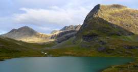
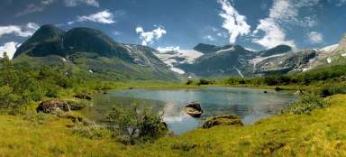
Stardalen
The morning sun illuminates the meadows of valley Stardalen with a panorama of glacier Jostedalsbreen. From there rises northward a narrow gravel tolled path up to the small parking lot.

Hauga Stoylen
After leaving the parking lot continues in the north direction a narrow path. In the hillside above us, we pass the local typical houses.

Glacial valley
The trail copies the bottom of the glacial valley Haugadalen along mountain glacial river. When you reach the wooden bridge across the river, you need to decide about the destination of the ascent. On the right across the bridge you can ascend to the lake Storevatnet (1 051 m asl), which is hidden behind the terrain wave from our perspective at the right top.

Glacial river
We observe from the bridge for a moment rushing waters of glacial river. Our destination is, however, the glacier: we descend from the bridge back and follow the trail to the left.

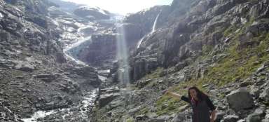
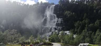
Waterfall
The trail slowly descends at first, and later steeply rises. To the right roar the fierce waters of waterfall, which is amply supplied with water from melting glacier.

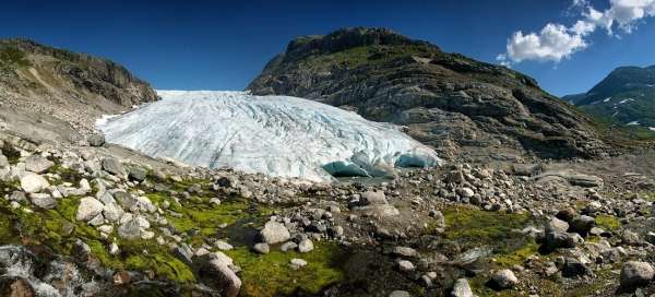
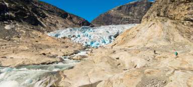
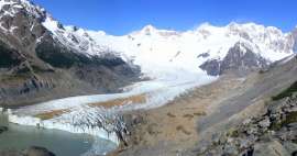
Haugabreen
The glacier Haugabreen appears in all its glory suddenly in front of us behind the last rock.

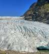
Face of the glacier
The official trail ends here. If you want to look closer, you must come down to the face of the glacier through free terrain.

Bursting ice
Only from close is nicely visible how huge mass of ice it is. From inside the glacier flows glacial river …

Glacial river
… on which bits and pieces of melting ice giant quietly flow away.

Melting
Detailed exploration of glacier interior reveals its wonderful colors. We, of course, do not dare to go inside and respectfully stand on the threshold of the big hole into the ice kingdom.

Under the glacier
The way back leads the same way. Alternatively, you can gently get closer to the thundering waters of waterfall beneath the glacier.

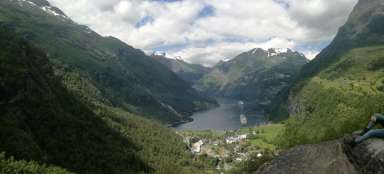
Stardalen
The way back to the main valley Stardalen: afternoon sun brings out the edge of glacier Jostedalsbreen.

Articles nearby


Giga List: The most beautiful hikes in the world
In this overview you will find a very beautiful, the maximum one-day hikes from around the world. Not only during long treks, but… continue reading
Giga List: The most beautiful tours in Norway
Norway is a very mountainous country and offers incredible opportunities for tourists. Due to the harsh weather, the local tours… continue reading