Over Sognefjorden to Huldafossen
By car through around fjords with ascent


The way in car in the area of the National Park Jostedalsbreen towards the south, the ferry across Sognefjord to town Fresvik will take about 6 hours with all the stops. There is nowhere to hurry, the surrounding countryside is beautiful. Indeed, it is not possible to rush on the Norwegian roads (that are in excellent condition) with all the bends, tunnels, bridges and occasional ferry anyway. It is possible to find a place for a tent on the right behind Fresvik in the direction to the mountains and afternoon use for a little walk to the waterfall, or rather a pair of waterfalls Huldafossen.
Stardalen
Early in the morning we leave Hoyset and Stardalen valley in the National Park Jostedalsbreen. We get onto the international road E39 and keep here until the town Skei.

Kjosnefjorden
We continue left along the road No.5. Above the mirror waters of Kjosnefjorden stretch wisps of fog.

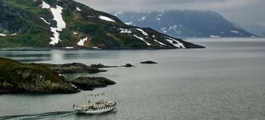
Sognefjord
We continue on the road no.55 from the town Sogndalsfjora along the fjord Sognefjord up to the ferry port at the settlement of Hella. Within half an hour we are on the water.

Sognefjord
The surrounding mountains along the fjord rise steeply, the top of Tjugatoten pictured on the left has a height of 1 098 m asl. Also here leads a path.

Kvinnefossen
Only from the ferry are nicely visible the waters of waterfall rushing on the rock, below which we have recently passed.

Fresvik
After landing in Vangsnes we continue on the road No.602 and later No.182 back east along Sognefjord up to the town Fresvik.

Camping by the river
From Fresvik we head along the narrow road in the southwest direction into inland. The asphalt road is replaced by paved road and tents can be placed somewhere near the mountain river Storelvi.

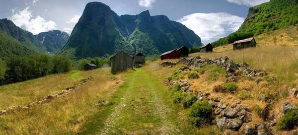
Engi
It is possible to use the afternoon for a shorter walk up the valley. After about 1 kilometer we get to the typical small buildings and pastures for sheep. We continue away from them along a narrow path up.

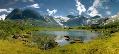
Tundalen
On the left opens a beautiful view of the valley Tundalen. A path leads through it along which it is possible to ascend up to the countryside of glacial lakes at an altitude of about 1300 m asl. It's a nice day hike.

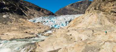
Fresvikbreen
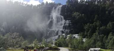
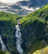
After another gradual ascent along the path leading between the trees appears a view of the destination of this hike – a pair of waterfalls Huldafossen, over which is visible also the source glacier Fresvikbreen.

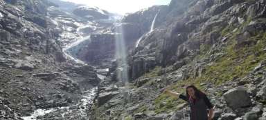
Huldafossen
We can gradually get closer to the waterfall along the narrow path. Further continuation is already in free terrain and depends on courage.

Storedalen
Below us also opens the view back into the valley Storedalen, through which proceeded to the waterfall.

Next to the roaring waters
Enjoy the waterfall means getting as close as possible. It depends on the passability of terrain and the level of resistance to the omnipresent water fragments.