Walks by Bygdin lake
On the south of national park Jotunheime


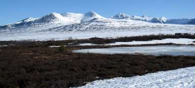
Starting point fort Bygdin is Fagernes. You can see here snow covered peaks of the southern part of Jotunheimen National Park. Bygdin consists of one hotel and a few other houses serving for accommodation and is located between two large elongated lakes Bygdin and Vinstre. It is possible to undertake a series of interesting hikes in the surroundings, not only along the shores of mentioned lakes, but also ascent to one of the surrounding peaks.
Jotunheimen National Park
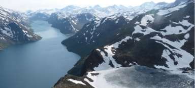
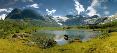
About 15 km before Bygdin opens from road no. 51 a view of the southern part of national park Jotunheimen. In July, the mountain peaks are still partially covered with snow.

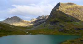
Synshorn
After getting to Bygdin we first pass on the left mountain hotel, behind it after about 200 meters exit from the road to the left onto a narrow road leading among small houses. In the background dominates the top of Synshorn (1 475 m asl).

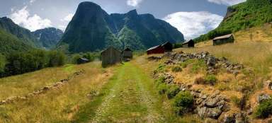
On the shores of Lake Bygdin
Camping is possible on the shores of Lake Bygdin by exiting the narrow asphalt road onto the sandy path. It is usually deserted here, possibly only with 1–2 campers.

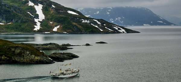
On the lake
It is possible to undertake a small boat trip on the lake Bygdin. The boat goes from Bygdin to Torfinnsbu and Fondsbu at the western end of the lake. From both points lead attractive routes into the interior of the southern part of Jotunheimen.

Walk along the lake
It is possible to undertake a series of interesting trips from Bygdin, e.g. ascent to the already mentioned top of Synshorn. Another alternative is an easy walk along the lakeside with ascent to one of the surrounding peaks. At first, the way leads along the narrow asphalt path Bygdisheimvegen to the guest house Bygdisheim.

Bygdisheim
We need to turn along the narrow rocky path right up behind the buildings of the guest house.

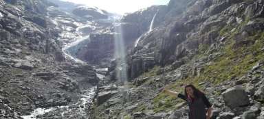
Over mountain stream
The narrow path waves in the terrain and overcomes several mountain streams and marshes (good boots, poles and improvisation needed).

Ascent in the free terrain
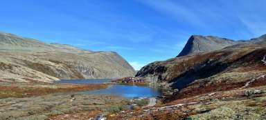
In front of the pass at a height of about 1,200 m asl joins to the path from the right other path, leading from small lake Heimrich Fagerdalstjernet. It is hidden between the surrounding peaks and may be another trip destination. Behind the pass turns the path to the right to the top of Heimre Fagerdalshoe (1 510 m asl), from which we can continue to the aforementioned Synshorn and walk back down to the camp. If, however, the clouds are low, it is necessary to choose a lower outlook point. We set out in the free terrain to the left from our path. We need to expect slightly damp marsh terrain.

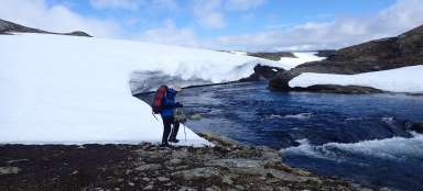
Snowfields
We ascend to the top of Synsbekknuppane (1 297 m asl). The last section is a bit steeper and there are still snowfields.

On top of Synsbekknuppane
From the top is spectacular view of the lake Bygdin below the fast-flowing low clouds. In the southeast direction is visible distant guest house Bygdisheim and a narrow separating the main part of the lake with cove, where is our campsite.

Endless landscape
The view to the west offers endless waters of Lake Bygdin and distant mountain peaks of Jotunheimen National Park.

Reindeer herd
We descend back from the summit in free terrain in the north slope into the gutter with a stream and necessary wetlands. After reaching the narrow path obstructs our way a herd of perhaps 80 reindeer. Further on is the way back to the camp the same.

Articles nearby


Giga List: The most beautiful tours in Norway
Norway is a very mountainous country and offers incredible opportunities for tourists. Due to the harsh weather, the local tours… continue reading