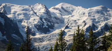
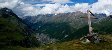
Vallée Blanche & Haute route

We had to postpone our haute route by two due to a four-level avalanche (the fourth level of avalanche danger). We thus missed the first two stages – the ascent from Argentiere to the Trien hut and the descent to La Foula via the Col de la Grande Lui saddle, but instead extended it by the descent to Arolla and the ascent to the Bernol hut. The total length was thus similar to the original, a little over 100 km and an elevation gain of 10,000. m. Route: La Fouly – St. Bernard – Valsorey hut – Wignettes hut – Bertol hut – Zermatt. Sixteen-year-old Matěj – the youngest „participant of the tour“ – was also the youngest „guest“ at all the mountain huts, where the average age is over 40 (young people simply don't go to the mountains). Not only did he give the whole thing famously, but he also handled the transition with great grace – he took Kateřina Tučková and Tolkien with him (or brought him out).
understand two books – Žítkov's Goddess and The Lord of the Rings The two towers in the original. It was despite my objections and experienced advice, but I did not succeed.
He honestly spent a few minutes with them by the light of his headlamp before going to bed. The truth is, however, that both books weighed no more than a more powerful power bank.
I complicated the whole event with inflammation, which appeared already on the way from the Czech Republic, I put him on three-day antibiotics and took the first day off. However, due to further activity , the inflammation moved to my sinuses. I had to disconnect from the group for two days and go down to the valley below the monastery of Saint Bernard, to then reconnect in Arolla. At least I took the car to the destination in Visp and spent one amazing day in the castle and in the city of Sion.
Vallée Blanche descent
The avalanche forecast on Saturday – April 1st, when we left the Czech Republic, was at the border of France and Switzerland at four, so we opted for an alternative plan – skiing in Verbier. I tried to miraculously heal that day by staying in our accommodation near Martigny.
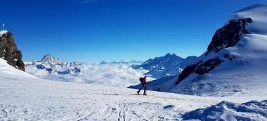
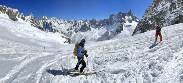
On Monday, we planned the famous Vallée Blanche descent, which is the world's longest freeride of 22 km, which you ride from a height of 3800 m from the Midi di Aquile cable car to Chamonix.
Glacier on the Vallée Blanche
The descent is not technically demanding, it is rather exceptional thanks to its views.
You will find recommendations everywhere to hire a guide for the glacier crevasses and they will scare you properly. However, the reality is that if you are used to walking on a glacier, the crevasses will not surprise you, and we had clear weather

For opponents of global warming
At the end, you can climb into a glacier cave and face the reality of glacier retreat. You have to climb 200 meters to the train to reach the level of the glacier in 1988. As you climb you can see where the glacier was in which year, definitely a good slap in the face for all the global warming naysayers. Unfortunately, from my own experience, I have to state that the glacier is disappearing almost before my eyes, where I experienced it four years ago, it is simply not there anymore, suddenly you are on bare rock.
It is also worth adding for the sake of practicality that a ticket to Aquille du Midi costs 73 Euros (this includes the local train) and you need to book tickets in advance. People ride the cable car just for the view, Mont Blanc is right in the palm of your hand from here.

Crossing the mountains
We had to postpone our Haute route by two because of a four-level avalanche (the fourth level of avalanche danger). We thus missed the first two stages – the ascent from Argentiere to the Trient hut and the descent to La Foula via the Col de la Grande Lui saddle. Instead, we extended the route by the descent to Arolla and the ascent to the Bernol hut. The total length of the hike was around 100 km and the elevation gain was around 10 km. Sixteen-year-old Matěj – the youngest „tour participant“ – was also significantly the youngest „guest“ at all the mountain huts (the average there is over 40). Not only did he do it all famously, but he also handled the transition with great intellectual grace – he took Kateřina Tučková and Tolkien with him, meaning two books: The Žítkov Goddesses and The Lord of the Rings in the original – the second part – The two towers. It was despite my objections and the „experienced“ advice of a mountaineer and mother. He honestly spent several long minutes with them by the light of his headlamp before going to bed. To be completely fair, it must be stated that the mentioned books together do not weigh more than a more powerful power bank.
I complicated the whole event with inflammation, which appeared already on the way from the Czech Republic. I put him on three days of antibiotics and took the first day off. However, due to further activity, the inflammation moved to my sinuses, which I don't wish on anyone, especially high up in the mountains. I had to disconnect from the group for two days and go down to the valley below the monastery of Saint Bernard, to then reconnect in Arolla. At least I took the car to the destination in Visp and spent one amazing day in the castle and in the city of Sion.

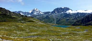
From La Foula to the monastery of St. Bernard
This is how you travel in the mountains, where you will not meet anyone, but you will appreciate the recognizable trail. Above the monastery – on the descent from the saddle (Fenetre d'en Haut / Col de Fointente) there was of course a crust, because the sun burns on the slope all day.

Arrival at the monastery
On the traverse to the monastery, you are already fed up, there is still a short section ahead of you through the tunnel and then the path around the lake, where it was quite windy. There were relatively few guests accommodated than I remember from four years ago, after all, this year's conditions on the Haute route were not ideal, or rather it could not be reliably planned, which was reflected in the absence of many groups with mountain guides.

Grand Saint Bernard
The approach around the lake looks the same today as it did back then. The monastery and hospice is located high in the mountains at an altitude of 2450 m. In winter, you can only get here from the valley on skis. In the accommodation, you will be served by the peculiar brothers of the order, and first of all they will invite you to the evening or morning prayer. However, a visit to the chapel and museum, where the origin of the St. Bernard dog is explained, among other things, is worth it. Some Haute routes skip this place, or choose the route via Verbier and transport by bus, but it is certainly a shame when you add the fact that the accommodation is pleasant and there is a shower.

When you have to go down for two days
I complicated the whole event with inflammation, which appeared already on the way from the Czech Republic. I put him on three days of antibiotics and took the first day off. However, due to further activity, the inflammation moved to my sinuses, which I don't wish on anyone, especially high up in the mountains. I had to disconnect from the group for two days and go down to the valley below the monastery of Saint Bernard, to then reconnect in Arolla. At least I took the car to the destination in Visp and spent one amazing day in the castle and in the city of Sion.

Over the saddles
I did the route four years ago, so the planning was easy, I also estimated that a newly sixteen-year-old junior who climbs, skis and has quite a lot of stamina can handle it. I already booked the cottages for Christmas, and the Vignettes cottage was not available even three months in advance (although it is easily accessible from Arolla). That's why I thought of a variant via Bertol from the beginning, which – taken in one go from the Chanrion hut – would be quite exhausting. The vignette was released two days in advance, so I just sent a message to the guys that they should head straight for it from Valsorejka and that they should also get enough in their bodies by the way.
The photo shows the Col de Proz saddle.

Descent from the Col de Montorge
aa

Valsorey Cottage
The view from the cottage is amazing and the best view is from the cabin below it. Whoever climbs up there has had enough. It is after a pleasant descent that the Col de Montorge is a slave in a fairly sharp zig zag of 600 meters in height. At the same time, you can see the cottage far above you and it is only slowly approaching. The sun is burning you, or vice versa (it's always like that in the mountains, you either invoke it or curse it). The photo shows Viki's self-made skis, which, of course, go uphill by themselves. The hut is tiny and there is no water, just like the other huts on the route.

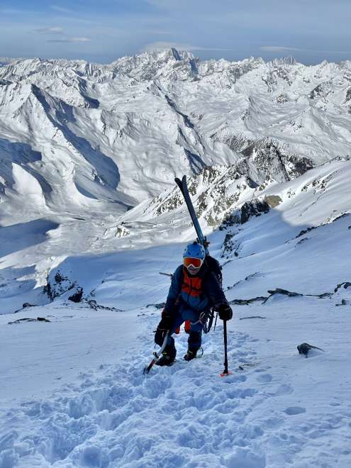
To the saddle above Valsorey hut
Everyone goes to the saddle of Dol du Sonadon 3520 m in the morning from the hut. Matěj is captured in the photo, and the slope is not as flat as it might seem, you have to switch to crampons and an ice axe.
Col du Sonadon
And one more shot from the saddle, from here you go down the glacier to the Chanrion hut at a beautiful height of 1200 meters and powder is guaranteed here.

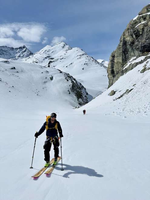
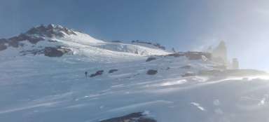
After the Otemma glacier
On the other hand, after the Otemma glacier to the Vignettes hut, it is an annoying cross-country ski run that has no end – in ten kilometers you climb only 800 meters in height. The stage from Valsorey to Vignettes can be done in one day, but it is a physical challenge with a total elevation gain of 1800 m and a length of 22 km. They called me from the cottage at about five in the afternoon, where we are, that they have crowds of interested people there, I assured them that the group would definitely arrive. At the time, I was sitting in my car in Visp, looking for a place to park it for two days. The plan was to take the train in the morning and the bus to Arolla, where I joined the hike again.
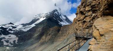
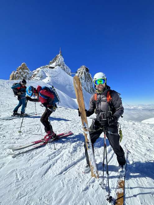
Cottage Bertol
This is how you enter the Bertol hut (3300 m). The skis are left below in the niche in the rock below the ladder. We started climbing at ten in the morning from Arolla and the 1200 meters of altitude took us five hours. At times it snowed heavily and the wind blew. It's a full day trip at the lodge and the Arolla – Zermatt crossing is a typical weekend affair. As in other cottages, only French ruled here and nobody cares if you don't understand much.

Matej with a headlamp
Dormitory at the Bernol cottage, which can accommodate about twenty people. There is no light, and when you arrive it is also bitterly cold – before human warmth takes over.

View from Bertol hut
They kicked us out of the cottage at seven in the morning. (The photo shows the ice ax storage area.) The sun was rising in the east and the Matterhorn was peeking out. By stairs and ladders we set off on our last day to the Tete Blanche pass (3589m).

Jumpers, socks, pinkies, etc.
This photo serves as an illustration to give you an idea of what it looks like in the entrance to the cottage. Imagine the heat from unwashed bodies for a week (and you just have to take off your socks at least in the evening), one to let your sweaty ones dry again, one to check your little toes, newly shaved after the next day, and to treat other parts of your feet. Merino anti-stink socks work like that for the first two days, and you can have the jumpers as baked and worn as you like, you still get blisters. Of course, we women stink far less, but then again, there are few of us in the cottages. Matej had a leg spray with him, for which the rest of the men's crew laughed at him, but I praised him, not that the spray helped that much.
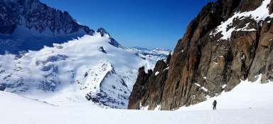
From Bertol hut to Tete Blanche
Now the photos from the photographer's super selection are coming. At the very back, under the rock tip, you can also see the Bertol hut. The shot captures the point where it starts to climb. It was a beautiful day, the temperature at seven in the morning was –15 degrees.

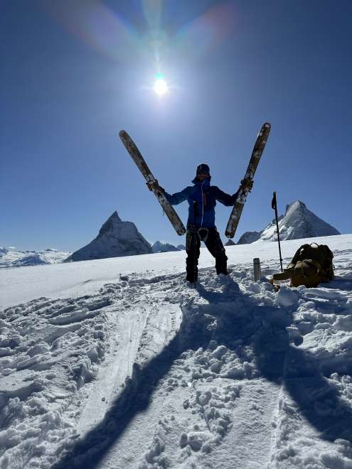
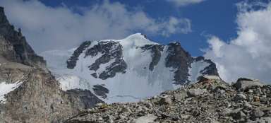
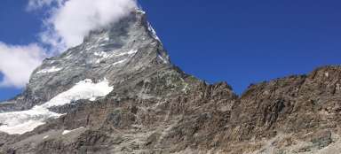
Aunt Blanche
This is what it looks like when it reaches its destination. That is, to the destination of the ascent, before us was a descent of several kilometers to Zermatt. Unfortunately, the boys didn't believe that we were supposed to drive between the cracks where there is no track, so we (following the track and behind the group with the guide) tromped another three hundred meters to the saddle of Tete de Valpeline (3802 m), only to then descend it again back.
Aunt de Valpeline
3802 m. From here, you have two 4,000 meters – Dent de Herens and Matterhorn right in front of you. What's even better is that at least a thousand meters of powder await you. It is then another few kilometers of gradual descent to Zermatt.

From the Mattehorn down
There are a lot of cracks on the slope, so you have to carefully follow the route and ideally someone's tracks.

At the finish
Reaching the slope above Zermatt and the final radler. From the practical point of view, it remains to mention that parking the car in Martigny is not a bad choice at all in the case of the Haute route, because the trains between Visp, Sion and Martigny literally whiz by. On the other hand, it takes an hour to get from Zermatt to Visp and it will cost you 37 CHF. We will try to plan the next Haute route after other huts. I'm glad that it worked out in the end despite all sorts of complications. Thanks to Libor for the great photos.