Hike Vent - Martin Busch (Winter)
Ötztal at the beginning of spring


The hike from Vent to the hut of Martin Busch in the early spring has completely different atmosphere than in the high summer season. You will meet here groups of skialpinists rather than hikers. If there is not fresh fallen snow, then the way takes only a little more than in the summer, because it is quite well ploughed and trodden thanks to the hut supplies. Even so it is a good idea to consider whether to take snowshoes, especially if you plan to go well beyond Martin Busch hut. If the weather comes out well, then the tops covered with snow contrast beautifully with the azure sky and this trip is really enjoyable. (summer tour version here).
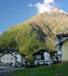
Vent - parking at the cableway
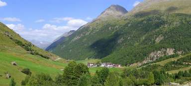
As well as in the summer the hike starts from the village of Vent, so you can compare how it looks like here at in different time of the year. So you will find only information related to this „low season“ walk in this photoreport.
This view is from the parking place next by the cableway and is of the two bridges over glacial stream.

Walk to Rofen
After passing through the town and starting point of the ascent up the hill above the canyon, which serves as a ski slope in winter, you can see the path to the neighboring valley Rofental. Creek Rofenache between Vent and Rofen flows in a nice small canyon.

Wildes Mannle (3023 m asl)
Right above Vent rises spreading mountain Wildes Mannle – one of the easiest alpine three thousand high peaks, especially if you use a small cableway to the meadows of Stablein (2356 m asl), whose upper station is also nicely visible.

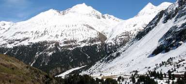
Vent at the beginning of the ascent
The southern slopes are mostly free of snow in early April even at a height of over 2,000 meters above sea level, but gray grass is not as picturesque as dark green in early summer. So hurry up to enjoy the snow :-)

The way to the small pass
After overcoming the steepest slope at the piste the path into an outlook pass to Similaun surrounded by scrub pine rises now only slowly.

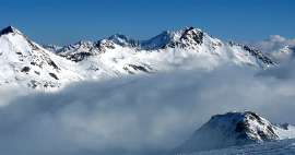
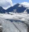
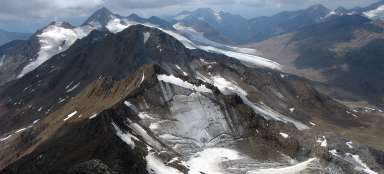
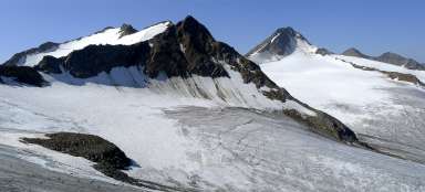
Similaun and Marzellkamm
As well as in the summer the most beautiful moment of the entire hike is the ascent to outlook point of the remaining part of the way through the valley to the hut of Martin Busch.

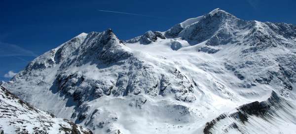
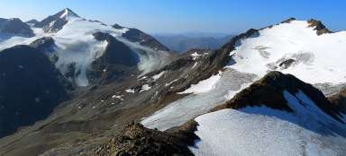
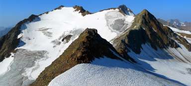
View of Weisser kogel (3407 m asl)
There is an interesting view not only of Similaun, but also back to the ascent path and the massive of Weisser kogel on the horizon.

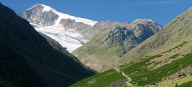
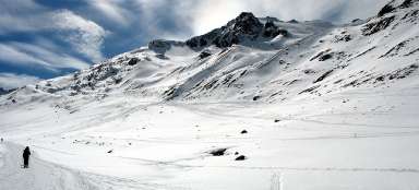
The path through the valley Niedertal
The way through the valley Niedertal with views of Similaun is very romantic. There are significantly fewer tourists than in the summer and only a few people do not take snowshoes or skialpi with them, even though the path to the hut of Martin Busch can be done just in hiking boots.

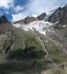
Remains of small avalanche
Anyway, it is important not to underestimate this at first glance very easy hike and check the avalanche situation. Along the way you mostly pass the remains of small avalanches, which fall here every year during this time.

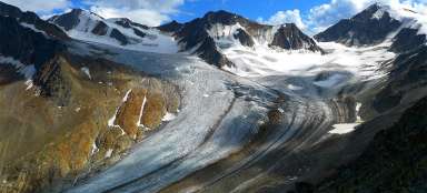
Beautiful Mutmalspitze (3522 m asl)
Just in front of the hut Martin Busch you cannot see Similaun anymore. But beautiful Mutmalspitze is practically within reach.

Hut of Martin Busch
Finally appears the final destination of the hike – Martin Busch hut. The most of the surrounding hills will not be accessible for tourists until the summer.

Articles nearby


Article: Ascent to Similaun
Similaun (3 606 m asl) is one of the most popular and highest mountains in Austria. Moreover, it is not very difficult, so a… continue reading