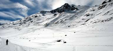
Hike Vent - Martin Busch Hütte
Beautiful walk through the valley Nieder


The village of Vent (1,890 m asl) is one of the best starting points of hikes throughout Ötztal and also one of the highest located villages in Austria. It lies at the confluence of two rivers – Niedertalbach and Rofenache. Through Niedertal valley gradually rises wide path to mountain hut Martin Busch Hütte, from where you can ascend to some of three thousand high tops. (winter tours version here)
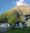
Village of Vent
In front of the village ofVent there is the car park, from where there is the view of the pretty nice church and mountain of Talleitspitze (3406 m asl), which basically makes panorama to the entire Ventertal valley. There is no marked tourist path leading to the top of this mountain. There is the cableway station to the pastures of Stablein (2356 m asl) in the village, which significantly accelerates the onset under the main climbing destination – Wildspitze. There is another car park near the cableway. The asphalt path then continues on to the small hamlet of Rofen (2011 m asl), but only locals or those accommodated here are permitted to enter here by car.

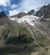
The ascent over the canyon behind Vent
After passing through the village and crossing over the bridge of the river Niedertalbach you get to the crossroads, where roughly half the tourists continues a comfortable journey along the river Rofenache to Rofen and beyond. Our way however rises the most sharply for the first time on the route to the hut of Martin Busch. It is necessary to ascend about 100 vertical meters when you go to the promontory above the canyon through the meadows.

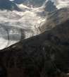
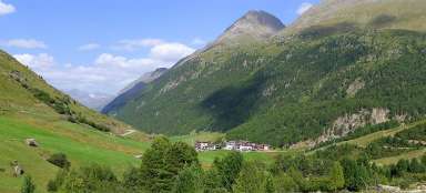
Vent from the meadows above the canyon
You can nicely see the whole Vent, the confluence of rivers and the starting point of the trip at the bridge from the hillside.

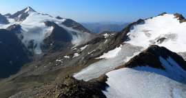
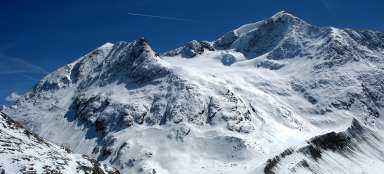
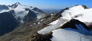
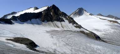
Similaun and Marzellkamm
A beautiful view of basically the entire rest of the way to the hut of Martin Busch opens after ascending above the canyon. The whole valley Niedertal is practically a straight line and above it towers mighty Similaun and on the right tourist ridge of Marzellkamm, which is actually only a rock shoulder of Similaun smoothed by the glacier on both sides. You cannot see the trip destination from here – it is hidden at the end of the valley behind a small fold.

Trip path
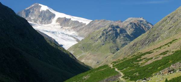
The path through the valley is wide comfortable jeep way. Fortunately, only suppliers to the hut of Martin Busch drive on it. You can gradually see not only Similaun, but also „icy rocky throne“ Mutmalspitze (3522 m asl) on the left.

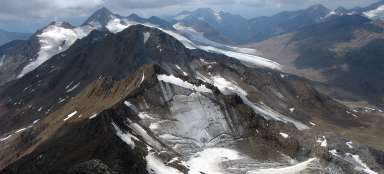
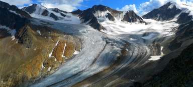
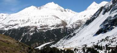
Niedertal
Look back on the ascent path through the valley. The path rises relatively slowly, so you would not guess that it takes to the hut altogether 600 vertical meters.

Martin Busch Hütte (2505 m asl)
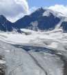
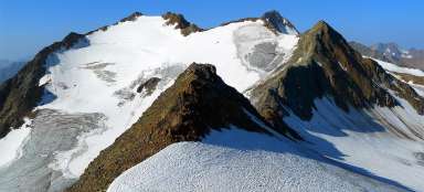
After seven kilometers and less than two hours walk from Vent you finally come to the hut of Martin Busch. It is situated tactically at the crossroads of hiking trails directly below the massive of Marzellkamm above a small canyon of the creek Niederbachjoch. There are a lot of ascent possibilities to the tops that can be undertaken directly from here: Marzellkamm, Kreuzspitze or Saykogel are really at your fingertips. Who wants to sleep even above, plans to climb Similaun or go to Italy continues through the valley to the Similaun Hut

Articles nearby


Article: Hiking in the valley Niedertal
Niedertal valley is one of the most beautiful valleys in Ötztal Alps. It is dominated by beautiful Similaun (3 606 m asl) and… continue reading