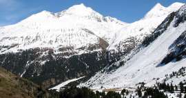
Hike Vent - Rofen - Hochjochhospiz
Walk in the valley Rofental


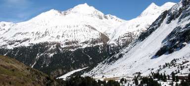
Very pleasant about 2–3 hour lasting walk from Vent to the intersection of hiking trails – Hochjochhospiz leads in a varied landscape of alpine meadows with views of the surrounding three thousand high greats and around wild canyon. Along the way there is a nice gasthof village Rofen – one of the highest located in Austria. The path is passable practically all year round, every time with new experiences.
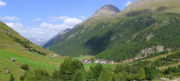
Above Vent
The starting point of this hike begins in the town of Vent (1,890 m asl), about which you can find more information here. After crossing the bridge over the creek Niederbach you continue along another river called Rofenache. Just a few meters away there is a crossroads where tourists split roughly into two halves – one half of them continue in our direction to Rofen and further, the second half ascents sharply the hill to the headland and on towards the hut Martin Busch. Our path is wide and slowly rises to the settlement Rofen (2 030 m asl). This walk from Vent to Rofen is popular also among families with small children. Looking back you can see Vent in the back and above it Ramolkogel (3 549 m asl) towering in the back.

Rofen
After about twenty minutes’ walk you will reach the homestead Rofen. It's just a small chapel and a few gasthofs directly at a small side canyon, through which flows a wild stream Rofenbach. Along this stream leads steeply upward tourist trail in the direction Bresaluer Hütte. Here in Rofen ends also the asphalt road, along which can drive only people accommodation here.

Canyon Rofenache
One of the attractions in this hike is a huge suspension bridge over a deep canyon Rofenache. The nearest similar bridges can be seen for example in Nepal. The outlook into the canyon from the bridge is great. You can also realize here that trees survive here due to frequent avalanches only around rivers and streams canyons.

Picturesque Rofen
Rofen looks very picturesque. There is also a chance to have a snack before the continuation.

Rofen from the top
You just need to ascent a few meters along the path leading to Breslauer Hütte and you can see whole Rofen together with suspension bridge panoramically.

Waterfall on stream Mitterbach
After almost a kilometer from Rofen there is another very nice place – you pass another nice small side valley, this time with a waterfall.

View of Rofen
There are nice meadows around the rising path and Rofen gradually disappears on the horizon in the distance.

Behind small valley of Platteibach
Around the isolated building you can come to a deep valley of stream Platteibach. Here basically ends up walking terrain suitable for small children. Continuation of the hike now is going to be a little more challenging. After crossing the small valley you begin to ascent to the rocky headland.
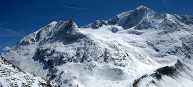
On the horizon towers lonely pyramid of Wildes Mannle (3 023 m asl) /Wild hubby/, which is one of the easiest three thousand high peaks in the Austrian Alps.

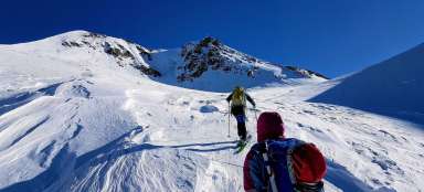
Secured path
Some airy passage are secured by steel cables on the rocky headland. In early April roughly from these places starts here and there snow cover.

Above the canyon
The most beautiful passage of this hike is crossing the mentioned rocky headland with steel cables and subsequent way above the canyon (in the picture is view towards the headland).

Traverse above the canyon
The path then traverses more than a kilometer above the canyon up to the biggest side tributary of Vernaglbach.

Bridge over Vernaglbach
Vernaglbach is most of year quite a wild river, so it would be quite a challenge to get to the other side without this sturdy bridge (2 154 m asl).

View of the canyon
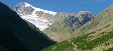
It is just two kilometers from the bridge to the hut, but almost 300 altitude meters, so this passage is the steepest in the entire hike.

Hochjochhospiz
Finally, on the horizon peeks out the destination of this stage – mountain hut Hochjochhospiz (2 412 m asl). Mountain towering behind the hut is Oberer Rofenberg (3 010 m asl). The hut is situated at the big crossroads of routes, so you can take a lot of trips from here, or cross into the neighboring valley over Saykogel.

Articles nearby


Article: Hiking in the valley Rofental
Rofental valley in Ötztal Alps is popular mainly due to a variety of ascents you can undertake from it. In addition, the canyon… continue reading