Hike across the pass Gara Gara
From Alpamayo to Pucajirca


Alpamayo BC trek 5: The fifth day of the trek awaits you overcoming of Gara Gara pass (4 830 m asl) famous for frequent bad weather. It can snow here also in the highest season. By its overcoming you leave extremely isolated valley of Quebrada Alpamayo and get into the area, from where you can more easily get to civilization. At the end of this walk awaits you even easier ascent into the pass Mesapata (4 460 m asl) and decision whether you set out for another side trip to the lagoons Safuna and Pucacocha or walk the standard route of Alpamayo trek.
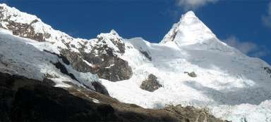
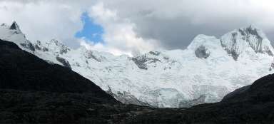
Sunrise over Alpamayo
It is worth to get up very soon for the crossing of pass Gara Gara, because the weather is mostly stable at this time. The journey begins at the bridge over the creek and then awaits you the ascent of 600 vertical meters into the pass. With increasing altitude opens nicely a panorama of Alpamayo and the surrounding mountains.

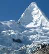
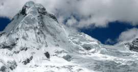
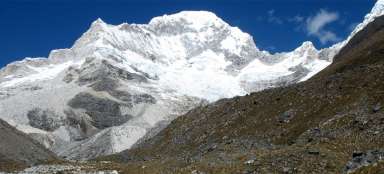
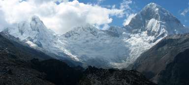
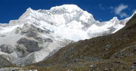
Mountains around Alpamayo
You will say goodbye to the mountains that accompanied you the last two days. The highest is large massif of Nevado Quitaraju (6 036 m asl), dominant is Alpamayo pyramid (5 947 m asl) and between two ridges peeping Nevado Abasraju (5 785 m asl).

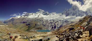
Pond in the halfway
The path rises for a long time along the moraine and then along the rocks and in an hour and something you're already halfway to a small lake (4 533 m asl), where, however, where in good weather, is the ideal place for a short break.

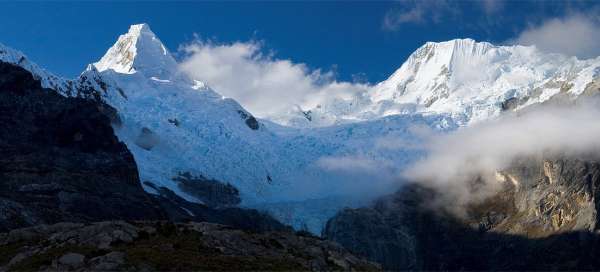
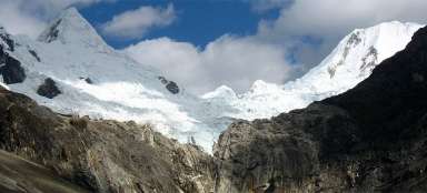
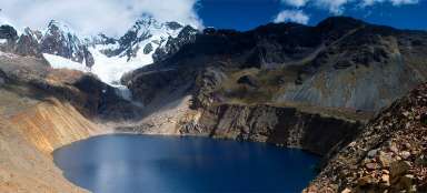
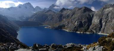
High mountain lake
The path rises increasingly more through the rocky terrain up to the second lake (4 700 m asl), from where begins the worst part of the ascent into the pass. There is also a great view on Nevado Santa Cruz in good weather.

View from the pass Gara Gara
Finally, you've done the last hundred meters of altitude meandering in screes and you stand in a hostile pass Gara Gara (4 820 m asl). It is only a little over two hours ascending from the camp Jancarurish. Finally you see to the other side of the ridge, where is the countryside surprisingly different – only bland peaks smoothed by ancient glacier. However, you overcome through this pass the main ridge of the mountains and farther away to the northwest the countryside gradually decreases until somewhere in the Amazon lowlands.

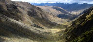
In the valley of Mayobamba
In an hour and a half walk to Gara Gara you are already far in the valley of Mayobamba. You will really feel here like in another world. On the horizon (on the right) is visible lackluster pass, it is Gara Gara, where you were a while ago.

Bofedales in the valley of Mayobamba
The path approaches the bottom of the valley at the southern end of large bofedales. Half-wild cows like grazing here.

Ascent into Mesapata pass (4 460 m asl)
After you cross the creek at about (4 360 m asl), awaits you only a short ascent to the next pass Mesapata (4 445 m asl). Below you is the wide valley of Maybamba and opposite the peak of Cerro Collota (4 716 m asl).

Valley of Mayobamba
There is no path on the map leading through the deserted valley of Mayobamba, but it does not seem impassable.

View from the pass Mesapata
From the pass Mesapata (4 445 m asl) is a beautiful view of the nearby glacial massif of Pucajirca with its highest peak Pucajirca Norte (6 046 m asl). In addition, from there is also visible the lagoon Safuna, where you can undertake a very nice side trip. An ideal place to camp is on the grassy area at the bottom of the valley of Tayapampa.

Articles nearby


Article: Alpamayo BC Trek
Alpamayo BC Trek belongs among one of the most amazing treks in Peru. In addition, most of its route leads through uninhabited… continue reading
Giga List: The most beautiful stages of the Alpamayo BC trek
The trek to Alpamayo BC is considered one of the most beautiful in all of South America. Here you will see not only one of the… continue reading