Article Ascent to Kilimanjaro
Ascent to Kilimanjaro via Machame

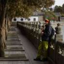


Kilimanjaro, the roof of Africa, the highest free-standing mountain in the world. All this is a great attraction for many tourists and adventurers. We were no exception, and when Tanzania remained open to tourists during the pandemic, it was a clear choice for us. There are several paths to the very top, and we hesitated between the two most popular – Marangu and Machame. The advantage of the Marang trip is that it is a day shorter (5–6 days), less demanding (that's why it is also called Coca-Cola) and sleeps in cottages, so you don't need as many carriers and it comes out cheaper. Although Machame's journey is a bit more challenging (it's called Whiskey), it always leads up, down, up, down, but it has a lot of other advantages that have prevailed in our country. Her profile is ideal for acclimatization, the way back leads to a different way than the one leading up, and it is said to be the way with the most beautiful views as far as nature is concerned. But I could only objectively assess this if I went through them all. :-)
Moshi
One of the most suitable starting points for the ascent is the city of Moshi, which lies just a short distance from Kilimanjaro National Park.

Sunrise
When choosing accommodation, it is good to see if the hotel offers mountain views. Our hotel (East Point Hotel) had a roof terrace with views in all directions.

View of Kilimanjaro
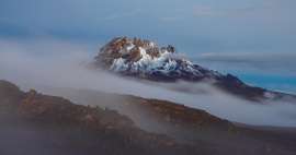
During the day the mountain is usually shrouded in clouds. The best conditions for a nice view are either at night or early in the morning.

Machame entrance gate
In the morning our guide picked us up at the hotel and we set off for the Machame Gate, which is the starting point at an altitude of 1800 m. The journey (with smaller stops to replenish supplies) took about an hour.

Day first
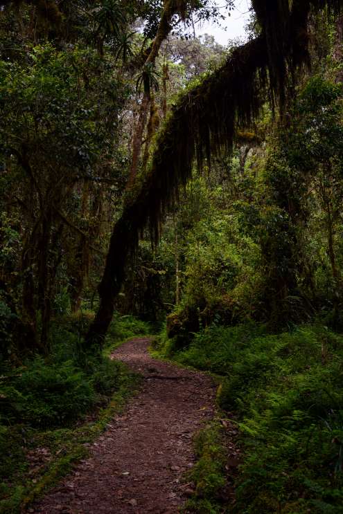
Machame Gate (1800m) → Camp Machame (2835m): (11km, 6–7h) On the first day, the road always climbs a gentle hill and passes through a beautiful rainforest. The pace is sometimes too slow, but the guides will not let us go faster (supposedly due to acclimatization). We constantly listen to their „field field“, which in Swahili means „slowly“. :-)
Guerez
Above the heads in the treetops are walked monkeys with a long hairy tail – guereza (Colobus monkey). In addition to them, we saw a lot of insects, butterflies of different colors, but also a chameleon.

Nonsense
One of the most interesting flowers here is the „impatiens kilimanjari“, popularly called the „elephant trunk“. It does not occur anywhere else in the world than in Kilimanjaro National Park.

Camping Machame
In the early evening we arrived at the first camp Machame at an altitude of 2835m. The weather was beautiful and we had the opportunity to see the top of Kilimanjaro.

Day two
Camp Machame (2835m) → Camp Shira Cave (3750m): (5km, 6h) The next day we went to the next part of the trip right after breakfast. The landscape changed from a forest to a heathland and opened up wonderful views of the surrounding area.

Heath
As we climb higher and higher through the heathland zone, the first clouds appear and also the strange plants of the „old tree“ – senecie. Such huge senecias do not occur anywhere else in the world.

In the clouds
The next day, the terrain is more difficult and also steeper, but the journey itself is shorter.

Heath
We arrived at the Shira Cave campsite shortly after noon, so there was plenty of time to explore the area and relax. The white-necked raven made us company here.

Evening views
The campsite had fantastic views again – especially in the evening after the clouds had melted. On one side towered the summit of Kilimanjaro, on the other side, clouds passed between sharp mountain ridges.

Day three (part one)
Campsite Shira Cave (3750m) → Lava Tower (4600m): (7km, 4h) In the morning, Mount Meru (4562m) appeared, over 60 kilometers away. Then we packed our things again and set off for adventure after breakfast.

Dramatic landscape
The landscape gradually changed from heathland to semi-desert and the snowy roof of Africa stood directly in front of us (almost at hand, but the appearance is deceptive).

Dramatic landscape
The rocky terrain was again a bit more challenging and the altitude was slowly beginning to show.

Lava Tower
The top of the third day was a lava tower with a height of 4600m. There we had lunch, a short rest and began to descend towards the Baranco campsite.

Day three (part two)
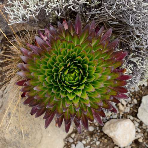
Lava Tower (4600m) → Camp Baranco (3900m): (3km, 2h) Another part of the way led down from the lava tower, which was ideal for acclimatization. There were a lot of lobelias and old men growing around us.
Giant old men
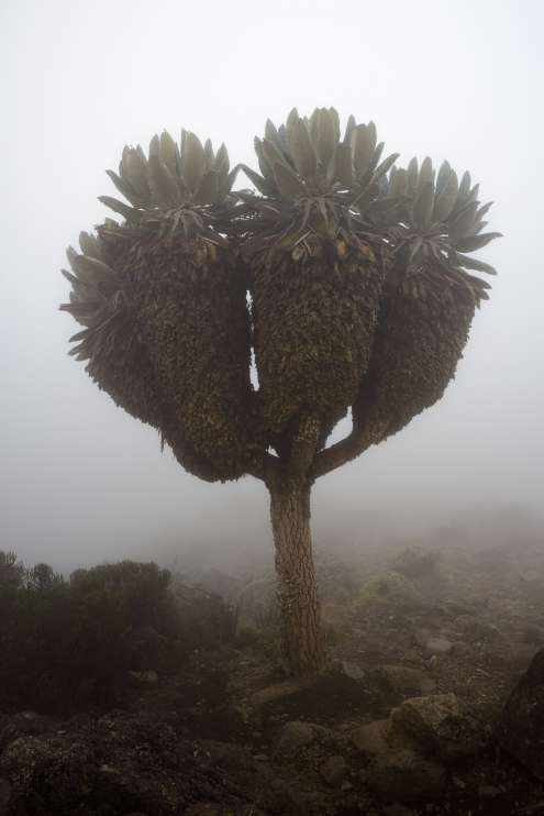
Some specimens reach a height of five meters. However, they are usually about three meters high.
Giant old men
The local vegetation often seems to belong to our planet at all. Especially the giant old men (senecie). There were many of them, especially around the Baranco campsite.

Baranco wall
As we approach the campsite, we see a large wall called Baranco, which is considered to be the most dangerous part of the journey.

Camping Baranco
The surroundings of the Baranco campsite have the most dramatic landscape of all the campsites on the Machame road, on the other hand the peak of Kilimanjaro cannot be seen from here.

Day four
Campsite Baranco (3900m) → Campsite Karanga (3995m): (6km, 4h) After an early breakfast it is time to conquer the wall of Baranco and then continue to the campsite Karanga. The local ravens keep us company again.

Baranco wall
For less experienced trekkers, this part of the journey may seem more challenging, but it is far from extreme and most people do not have much problems here. However, there are several places where you need to hold on with your hands. This is probably the steepest part of the whole Machame journey.

Country
The landscape here is diverse with lots of views of the surrounding mountains or down to the green valley. There are smaller streams with waterfalls and giant stones the size of houses.

Prospects
Weather permitting, beautiful views open up into the valley, which is one of the most challenging routes to Kilimanjaro – the Umbwe route.

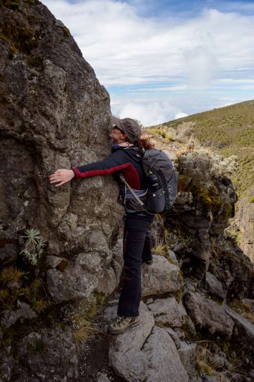
Kissing stone
The most famous place on the Baranco wall is the so-called „Kissing stone“. The stone around which there is a narrow path and to cross it it is necessary to hug this stone.
Views over the Baranco wall
There are also beautiful views upstairs – those that are not shrouded in clouds… :-) The road then continues through moderately demanding terrain around rocks and giant stones.

Camping Karanga
The last part of the route on the fourth day leads down to the valley and then up again to the Karanga campsite. Personally, this part seemed more challenging to me than the Baranco wall itself, but it could be due to fatigue and weather, which turned into drizzle.

New Year's Eve
Despite great fatigue and a slight headache, we decided to wake up before midnight and celebrate the approaching new year 2021. Below us was the city of Moshi and Mount Meru in the distance. Unfortunately, New Year's fireworks were not very clear from this distance.

Day five
Camp Karanga (3995m) → Camp Barafu (4673m): (4km, 4h) On the fifth day we had only a short 4-kilometer section. On this day, however, the weather did not suit us at all and we were hit by heavy rain halfway. Before we could put on our raincoats, all our clothes were soaked. Fortunately, a few hours after arriving at the Barafu camp, it was beautiful again and the beautiful mountain Mawenzi (5149m) appeared to us.

Variants
It is possible to combine the fourth and fifth day and thus save one day of the trip. The advantage is that the whole trek will be a bit cheaper, the disadvantage is shorter acclimatization and rest, which reduces the success of climbing the top. In the end, we were glad that we chose the seven-day variant, so we had extra time to dry our wet clothes. The top glacier was visible from the camp, and it seemed so close that you could climb there in an hour. In fact, it is an elevation gain of more than 1200m and we had about seven hours of climbing. We went to bed shortly after sunset, as the alarm clock was scheduled for 11:30 p.m.

Day six - ascent
Camp Barafu (4600m) → Uhuru (5895m): (5km, 7h) Shortly before midnight we get up and, strengthened by biscuits and tea, we set off to the top. The night march was infinitely long and certainly not easy. The higher we were, the more often we were forced to take breaks. There was more and more snow at the top, and the movement in it was more and more difficult. Around 6 o'clock in the morning we got very exhausted to the Stella point (5756m), where other ascent routes converge (eg the Marangu route) and after a short break we continued – it was „only a short distance“ to the top. After a while of a challenging and slow climb, we watched a beautiful sunrise just below the summit.

Conquering the top
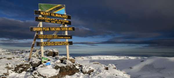
Just a few meters and finally we are greeted by the top sign and we stand on the highest point of Africa – Uhuru (5895m).

Reusch Crater
On the north side we see the crater of the Kira volcano, which is called Reusch. However, it is lower than the top itself – Uhuru.

Glacier
In the distance behind the glacier rises Mount Meru. The remnants of the glacier are melting very quickly and it is possible that they will disappear completely in a few years.

Way down
Uhuru (5895m) → Campsite Mweka (3100m): (11km, 8h) The peak was conquered, but our very difficult and long descent awaits.

Descent
On the way we stopped at the Barafu camp, where we packed up, ate and went on to the Mweka camp. The descent is difficult and gives the knees a lot of work. In general, we pass all zones from the glacier, through the stony desert, heathland to the border of the forest, where the camp is located. Along the way, we pass a lone wheelchair, which is used to transport injured people.

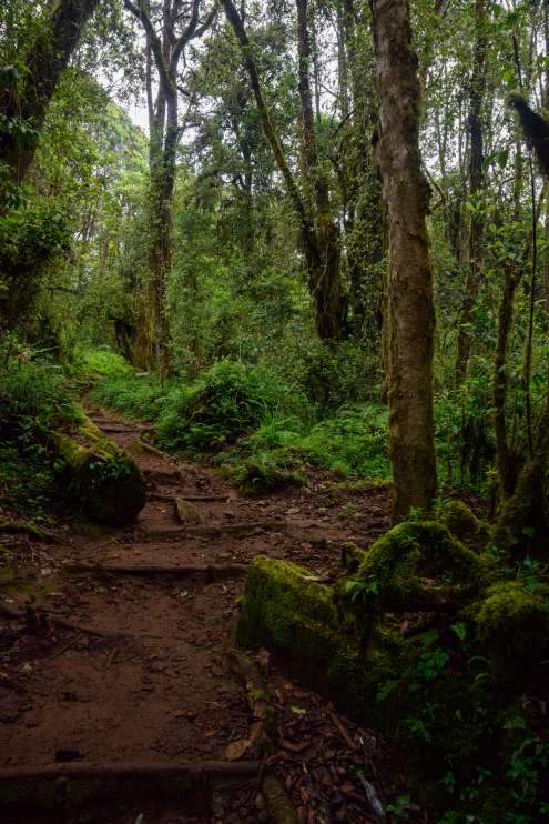
Day seven
Campsite Mweka (3100m) → Gateway of Mweka (1980m): (10km, 3h) The last part of the path leads again through the forest and is not very demanding. Down at the gate, we received a certificate of successful conquest of the summit of Kilimanjaro, then we went to a well-deserved lunch and finally we were taken back to the city of Moshi.
Shimbwe
After a demanding seven-day hike, we didn't want to spend time relaxing in the bustling city of Moshi, so we chose the small village of Shimbwe, where we stayed at Shimbwe Meadows Guest House, from where there were great views of the rooftop of Africa.

Materuni Waterfall
One of the attractions that can be recommended around Kilimanjaro is Materuni Waterfall, located on the edge of Kilimanjaro National Park.

Articles nearby


Giga List: The most beautiful places in northern Tanzania
… continue reading