Trek to the Anaga foothills
Circuit in the mountains above Santa Cruz de Tenerife


Day trip to the hills above the capital Santa Cruz. There is easy access by bus and a half hour drive will transport you to the green jungle and mossy hills all around. The route has a comfortable length of about 8 km and an elevation gain of less than 500 meters. For accuracy, I also give a link to the route in Mapách.cz – https://mapy.cz/s/babubumuko
Lomo de las Casillas
We reached the beginning of the route by bus No. 912 from the central station in Santa Cruz. The journey takes only half an hour, but it is still a sight to see, as the road winds up a steep slope just above the town. Our starting point for the trek was in the village of Lomo de las Casillas.

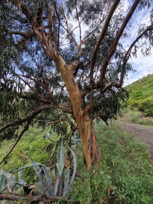
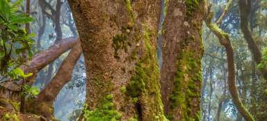
Eucalyptus
From the village, after a while we turn right into the hills. After just a few steps, the green tropical jungle surrounds us, as if we were walking through a tropical greenhouse. At first sight, but also the whiff of the scent, the massive Eucalyptus tree caught our attention. In the middle of the route, we walked through a smaller forest full of that intoxicating, refreshing scent.
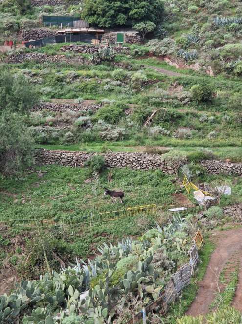
Animal farm
The path leads past the last few buildings and shelters for animals before getting lost in the complete wilderness of the surrounding nature. We pass grazing cows, goats, chickens and a braying donkey.
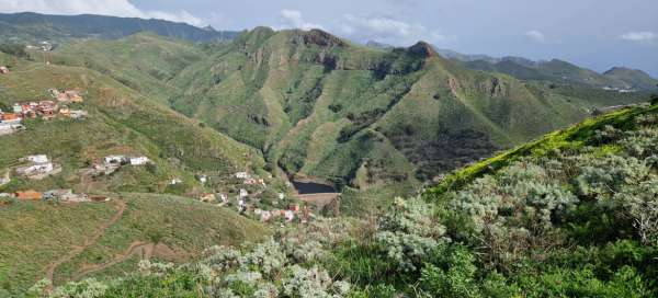
View of Presa de Tahodio
We climb further and further along the road, where the locals with their cars are able to reach their small terraced fields. The spiky green hills of the Anaga nature reserve surround us. From the top of the first hill we can see down the valley to the Presa de Tahodio reservoir.

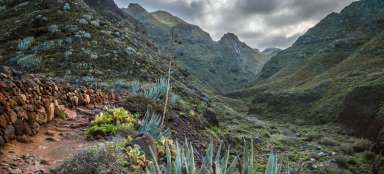
Terrace fields
Looking back at the road where we climbed a while ago, we have a beautiful view of the terraced fields where the cows grazed. From our vantage point from here, it looks like a giant green serpentine snake.

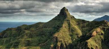
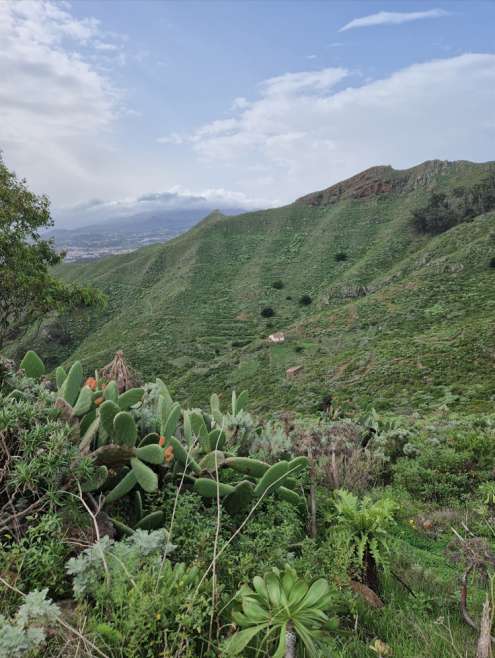
View of the Anagy Mountains
We pass through the pass, where there is also an information sign with the relief of the Anaga mountain range and the names of the individual hills. We also found the Cruz de Carmen viewpoint here, which is the main starting point for most treks in Anaza. We also passed through here a few days ago.

House surrounded by greenery
Our path connected to the red-marked trail Camino de las lecheras. Sometimes a lonely house peeks out from the green wild nature. We slowly descend down the hills towards the town of San Cristobal.
Blooming meadows
This winter has been more rainy than usual, but thanks to that we have seen Tenerife in full bloom. Even the always dry south of the island turned green and grass grew. We have never seen so many species of plants in bloom here before. Even here in the foothills of Anagy, which is always the greenest part of the island, we could admire this yellow carpet.

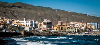
View of Santa Cruz
As we descend, we have a view of Santa Cruz lying below in the vista between the green mountains.

Village under Anaga
On the other side, the horizon is lined with the development of villages around the road leading to Anaga Park.

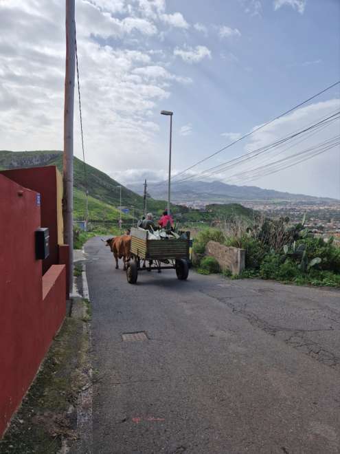
Local operation
While walking through the village of Jardina, we also pass locals on carts pulled by two coffees with massive horns, as they bring their cultivated crops to town.
Route extension
We were already close to civilization, but we hadn't had enough of the greenery yet, so we added a small detour over the mountain. Here we have a view of San Cristobal de La Laguna like in the palm of our hands. Just outside the city is the northern airport, so even the views of the planes are good from here.

The summit of Mesa la Gallardina
The destination of the addition is the top of the Mesa la Gallardina mountain from where we have a view of the Presa de Tabares reservoir.

On the way down the ridge
From the top, it was only a short walk down to the suburbs of Santa Cruz, from where we took the bus back to the city. There were several routes to choose from for the descent, but we liked the ones along the rocky ridge the most.