Hike under Mount Karakol
Inside the Karakolsky Park


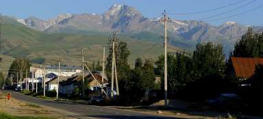
Hike through the Karakol valley to the viewpoint of the highest peak far and wide – Pik Karakol (5,216 m above sea level) is one of the simpler businesses you can take in exploring the national park. The starting point is the same as the march to the beautiful lake Ala kol – in the basecamp Karakol (2,550 m above sea level)
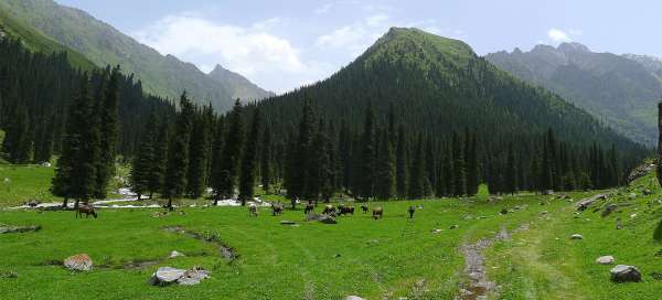
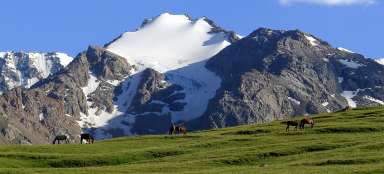
Meadows at the Karakol basecamp
The road from the basecamp leads south along a jeep path, almost along the plain. The only inconvenience are the streams crossing the main road even in nice weather. Good gore-tex shoes are really suitable. This is a look back to the basecamp a few minutes after the start of the tour.

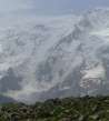
Breathtaking rock walls
The rock walls rise almost a kilometer and a half above the bottom of the valley.

The mouth of the Kültor valley
After about twenty minutes of walking, he comes to the crossroads of the valley. There is a bridge over the river Karakol, so you can take an alternative trip to the Kültor valley, where only a fraction of tourists go.

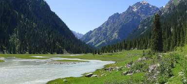
Picturesque Karakol valley
The march from the region is really very pleasant and comfortable – the path leads through meadows above the roaring glacial river Karakol and interesting trees grow around you – Schrenk's spruces

Just before the side valley
Before you enter the forest, where the jeep road ends, you can enjoy another nice view of this picturesque valley.

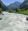
Bridge over a predatory stream
Now you have to cross the river, flowing here from the Teleti pass. Fortunately, there is such a simple bridge made of logs. Anyway, trekking poles for balance are definitely suitable here.

View of the confluence of rivers
From the confluence of the rivers, the frequency of tuistas will decrease significantly, because it will get off the route of the main trek through Těrský Alatau leading through the Teleti pass. If you are not unlucky for a climbing expedition, you may be walking alone for the rest of the day.

Dramatic slopes
From the confluence of the rivers, the last short stage awaits you relatively flat with views of the surrounding dramatic rock walls.

At the gorge
A comfortable, walking trail ends at the gorge. From here, a longer climb to the rocky promontory high above the river awaits you.

Ascent above the gorge
When climbing over the gorge, you can at least enjoy the really picturesque valley of the river Karakol.

The way up the valley
The road is still rising even after overcoming the gorge. On the horizon you can see the fold of the valley, behind which you will finally see the glaciated mountains at the beginning of this valley.

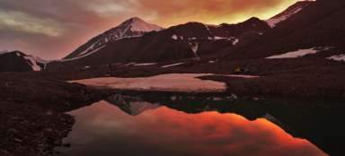
The first view of Pik Karakol
After about two and a half hours of walking, the first breathtaking view of the monumental Karakol Peak opens behind the bend of the valley

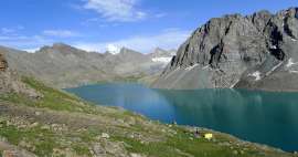
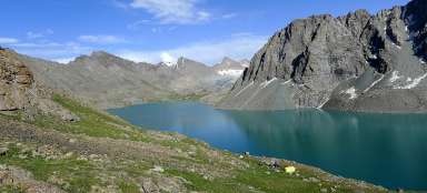
Picturesque lake
In addition to the breathtaking view of Pik Karakol, whose wall exceeds the surroundings by more than two kilometers, you will also find a small picturesque lake.

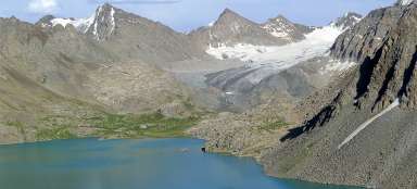
Landscape modeled by a glacier
You are at a height of slightly over three thousand meters above sea level and the surroundings are different here than at the beginning of the march. Tipc spruces have been eradicated and everywhere there are the remains of a receding glacier in the form of huge piles of stones. It is still about seven kilometers from here to the glacier itself, so if you want to walk through the complete valley, you have to count on a whole long day or camp somewhere. If you have sufficient climbing experience and equipment, you do not have to return the same way. You can cross either the Ontor Pass (4,016m), Mareceka (4,140m) or Archalitor (4,190m) and return to the neighboring valleys.

Articles nearby


Article: Karakol trek
Karakol trek is the shortest variant of trips to the Těrský Alatoo mountains. You will head directly to the main valley, which… continue reading