Hike from Jilemnice to Benecko
The first stage of Bukhar's journey


Although Jilemnice is still located in the Krkonoše foothills, it is still an interesting starting point for the southern slopes of the Giant Mountains. The famous Buchar's path begins here, connecting Jilemnice along the red tourist trail with the source of the Elbe. The first stage of this route leads to Benecko, a well-known starting point for cross-country trails in winter. A nice route awaits us through meadows with views mainly to the Giant Mountains and Kotel
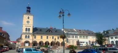
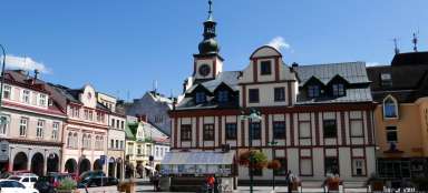
Masaryk Square in Jilemnice
We start from the center of Jilemnice, which is Masaryk Square. In its vicinity there are several options to park for free, or you can park directly on the square

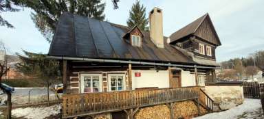
House of Bohumil Hanč
From the square we set off along the red tourist route leading under the castle park. The first attraction on the route is the memorial house of Bohumil Hanč, who tragically died during the famous cross-country races

Folk architecture
Along the way, we come across other nice cottages. These two are located just off the 286 road and are tightly separated from it by a noise barrier, which is not very beautiful.

Turn to Roudnice
Now the worst section of this tour awaits us – first we cross the road No. 14 and after a while we connect directly to the road No. 286, which is quite heavy traffic, because it leads to the famous tourist starting point Horní Mísečky. It is about 1 kilometer. About halfway up, the turnoff rises sharply in the direction of Roudnice and further to Rokytnice nad Jizerou

Dolní Štěpanice
Finally, we come to Dolní Štěpanice, where the road to Benecko is disconnected, but also our route, which continues further through nature and not along the road.

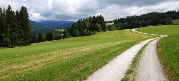
Above Dolní Štěpanicí
The road climbs steeper through the forest at the bottom, so that after a while we ascend to the meadow from where we already have the village in the palm of our hand

View of Bubeník hills
The views are picturesque and there is no place to hurry

Giant Mountains mixed forest
We disappear from the meadows into the forest for a while, but the mixed Giant Mountains is very nice – sometimes you come across an impressive beech. In autumn, it plays with all colors

The first views of the Giant Mountains
After we climb out of the forest, the views to the Krkonoše foothills are slowly beginning to open – Kumburk, for example, is clearly noticeable.

Na Vrších (675m above sea level)
A really picturesque part of the journey begins after we ascend to such a wide plateau – Na Vrších. We are just a short walk from Horní Štepanice

Boiler lookout
A little further on is the official lookout point – Kotelská vyhlídka

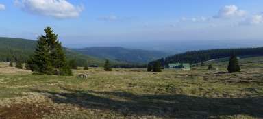
Wide view of the region
Now let's continue up the mountain road. After a while, the Na Vrších location is quite below us. Before we disappear into the forest again for a while, it is definitely worth turning around and enjoying the view

View of Žalý and Benecko
After walking through the forest, the first view of the Žalý and Benecko massifs with a ski slope opens up to us

Chapel of St. Huberta
Just before the goal of this tour is a nice place with the chapel of St. Hubert, Jindra's rocks (next door) and a nice view of Benecko

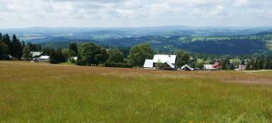
View from Benecko
After eight kilometers of walking and some 400 altitude meters, we come to Benecko. After the peace of the tourist route, where only a minimum of people went, it is super lively here. No wonder there is a huge parking lot, restaurants, etc. We can continue along Buchar's road through Žalý or a significantly shorter green route directly to Rovinka

Articles nearby


Giga List: The most beautiful tours of the Giant Mountains
The Krkonoše Mountains are the highest Czech mountains and not only because of that, they offer great conditions for hiking. In… continue reading