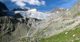
Driving on the Zillertaler Höhenstraße
An adventurous ride over the Ziller Valley


Zillertaler Höhenstraße is a narrow and steep road built on the western side of the valley – basically high above the famous town of Zell am Ziller. It starts in Hippach and ends in Ried am Zillertal. If you run out of energy, you can leave it earlier in three places and go down into the valley. The road is 40 km long with the highest point of 2,041 m above sea level and in total you ascend and descend almost two thousand meters. A total of 29 turns are also waiting for you. The road is narrow with occasional avoidance points. The ride is also complicated by the fact that you can meet a regular bus or trucks supplying mountain alms. However, the views are worth it although there are not many official places where you can stop.
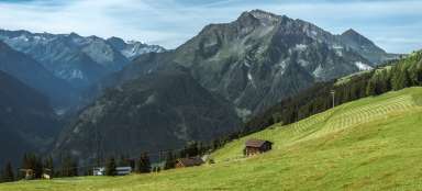
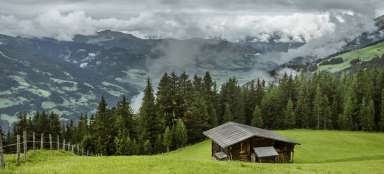
Pensions above Hippach
The road from Hippach rises sharply and in a short time you will pass six serpentines. The local mountain hotels have beautiful views of the valley, but if you forget to buy bread in the valley, driving here is challenging. You can make a short stop in the small car park below the Berghof.

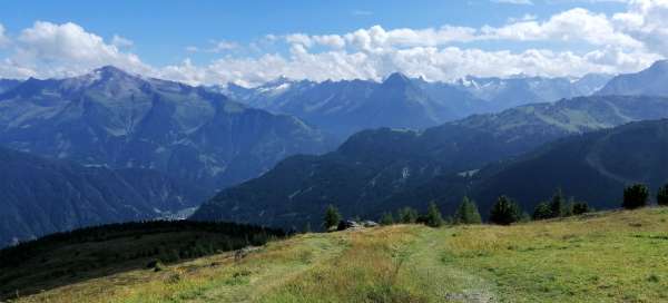
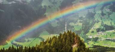
Zillertal valley in the palm of your hand
The view of the beautiful green Zillertal valley is breathtaking

Above the Sidanbach valley
Subsequently, the road turns into a side valley of the Sidanbach stream. The road will stop being so steep, but it will narrow again and from there you will have to deal with mutual avoidance. He will also drive through the toll booth. The passage is 5 Euro per car

View of the side valley
Roads to the side valley lead to the mountain alms – ideal for cycling or as a walk. Parking for such trips is just a short walk in front of the toll booth.

Melchboden
The road then climbs three more bends to the mountain farm Melchboden (2000m). From here there is not only a beautiful view, but also a start for a great hike or just a walk. The bus stops here, so from there you can be sure that you will not meet it

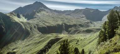
Views from Melchboden
From Melchboden is a really beautiful view of the surrounding mountains. There is also a nice side valley leading to the Gerlos pass (1,628 m above sea level) separating the Zillertal Alps from the Hohe Tauern

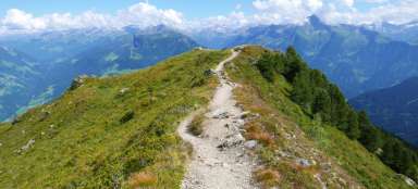
The second prospect
From Melchboden, the road rises only noticeably to 2,041 meters, which is its highest point. After about two kilometers there is another parking lot with a view, but we thought it was nicer from Melchboden

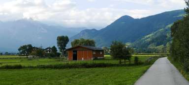
View of Zellberg
From the parking lot there is a distant view of the continuation of the road to a place called Zellberg, where there are other alms and parking lots

Passage through the farm
The road is really narrow in places that you are afraid of hurting the cow's head with a car. Then there are a number of possible variants of the congress, none of which is designated as the main one

Articles nearby


Giga List: The most beautiful mountain road in Tyrol
Thanks to the fact that the southern border of Tyrol is the main alpine ridge, this Austrian federal state offers a lot of… continue reading