Article Desolate Sajlugen
Magic step


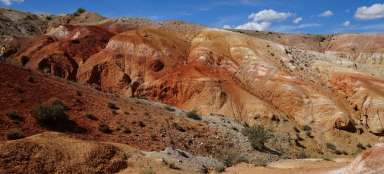
Saylugen National Park is located in the central part of Western Siberia on the Russia-Mongolia-China border. The Russian part of the national park is one of the driest areas of the country, but it is still possible to get wet every day of the trip. This undiscovered piece of Russian wilderness brings tourism to places where many Europeans have not yet set foot, but also local tourists, and in addition to the local Altai and Telengi ethnic groups, only frowning soldiers can be met here.
Documents for entry
“Hooray bureaucracy“
There are no maps available for Saylugen National Park, as well as notes from other travelers based on their orientation. The only information available is from the official website of the national park, the disadvantage of which is that it is Russian. On these pages you will learn that it is necessary to pay the entrance fee to the national park and at the same time you must have a permit to enter the border zone of the Russian Federation. It is necessary to start equipping two months in advance and it is necessary to write in it to which parts of the mountains you are going (Saylugensky nacionalny park). Subsequently, it is necessary to pick it up in the capital of the republic, in this case it is Gorno-Altaysk. After completing the forms, it's time to get to know this amazing corner of the planet.
Way there
Chuysky tract
Chuysky tract is the only way to get to Kosh-Agash, which is the starting point for wandering around Saylugen and is described as one of the most beautiful routes in Russia. It starts in Gorno-Altaysk and it is advisable to set aside the whole day (7 hours) for the whole trip, even though it is written that there are buses running along the route, so in 2017 we did not find any and instead it is appropriate to use marshes ranges around 7500 rubles (8-seater car).
Chuysky tract
View from the highest pass through which the road passes.

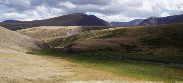
Chuya steppe
View from the mountains to the beginning of the Chuya steppe from the highest point of the road.

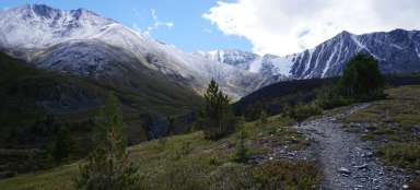
First views of the mountains
Along the way, the first mountain peaks appear in the background and the Chuya steppe in the foreground.

1 day
Start the trek
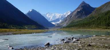
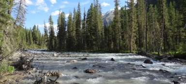
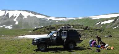
The trek starts from the entrance center to the National Park, which is located about 15 kilometers from Kosh-Agash. Before entering the valley, it is necessary to go through the border control, which will check the permits before entering the mountains. The advantage of the first day of the trek is that it travels along the river all the time and there is no need to carry unnecessary water supplies.
Input
The center of the national park.

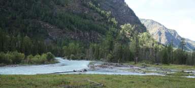
Across the river
The road passes through the river valley and gradually approaches and recedes from its bed.

Local shepherds
The road passes several dwellings of local shepherds, whether Telengi or Altai, who keep mainly cows or horses in the valley.

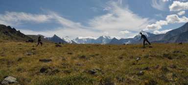
Wandering
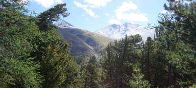
Gradually, with increasing altitude, vegetation also increases.

Growing vegetation
In some places there are also more waterlogged sections where there is thicker grass, but trees are unnecessary to look for.

Determination
At the end of the first day there is a nice place for camping, where there is a shelter as well as an information board and a signpost (the only one during the whole trek).

Day 2
The wind
Day 2 climbs to the highest part of the whole trek, which means climbing to the saddle about 100 – 200 meters above sea level. Throughout the day we wander in a strong wind and finally we are forced to build tents in the valley in a place that does not seem to us as ideal but is the only one.
Border
In the background is the Mongolia-Russian border, near which snow leopards, yaks and argali sheep should move.

Climb
Beginning of the ascent to the saddle

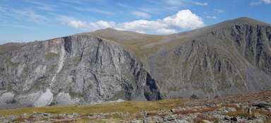
Highest place
The highest point of the trek with a herd of horses.

Top platform
The top plateau in the background with the Mongolian and Chinese borders, we gradually begin to descend into the valley.

Determination
View from the campsite to the valley.

Day 3
Little walking a lot of standing
On the third day, we return to civilization and get to one of the most challenging tasks that awaited us, because „Kosh-Agash – Jazator Highway“ is not nearly as much as we expected and especially there is no signal, so we resort to tracking. The disadvantage of hitchhiking on this road is that only locals travel the stadium, which passes around once an hour and always stop, but they never have a free place in the car, as 6–8 people usually travel there in a 5-seater car. The journey to civilization eventually takes us more than 5 hours, as we have to share. The trek itself on the last day is more or less relaxing and it only descends down the valley and is waded by one larger river.
Valley
The final descent in the valley complemented by beautiful views of the surroundings

Forest
In the foreground you can see one of the few pieces of forest during the trek, with the end of the valley being accompanied by ubiquitous and curious ground squirrels.

Highway
The main road, which the locals call Highway.