Ascent to Ostrý and Velký Kokrháč
Or a walk along the border

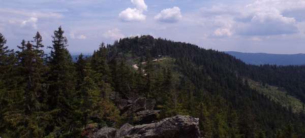


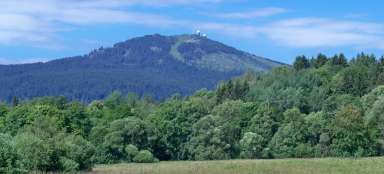
According to many, Ostrý is one of the most beautiful Šumava peaks. Its characteristic silhouette with two peaks (Big Sharp and Little Sharp) is far from recognizable. The Czech-German border passes over the top of Velký Ostrý (the highest point is on the German side), Malý Ostrý lies just a short distance away in Germany. Once we are on Ostrá, it pays to extend the hike along the border ridge trail to Velký Kokrháč. The hike described below is about 18 km long and takes 7 hours.
On the hill
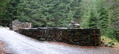
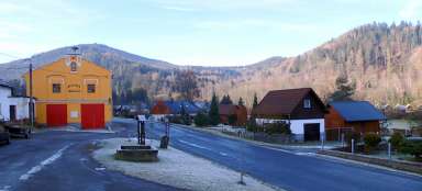
The start and finish of the circuit is in the village of Hamry, at an altitude of about 582 m. From there, a blue-marked hiking trail leads to the top of Ostrý. However, if, for example, it is closed due to breaks in the upper part, it is necessary to find an alternative route. So we do not follow the blue, but the yellow, initially leading in the opposite direction to the blue (the advantage of this route may be that it does not lead so much on asphalt roads, but it also has its disadvantages – see below). The pleasant forest path rises slowly and around it you can often see the remains of old stone walls and walls. After 1.5 km we reach the crossroads Na kopci (741 m above sea level), where we turn left along the green and pass the remains of several buildings, the remains of a long-extinct solitude.

Pod Lovečnou
We will soon reach the asphalt road, which we will leave again after less than 600 meters and start to the right on a steep stony road upwards. After another approximately 600 hundred meters, we have the worst climb behind us and a slightly relaxing section awaits us to the crossroads Pod Lovečnou. At the crossroads, a nicely rounded altitude of 1,000 m is written on the indicator, but in fact we still have some meters left to reach this limit. In front of the crossroads, there is a nice little chapel on the side of the road.

On the border
At the crossroads, a small dilemma awaits us. The green is currently ending here. But until relatively recently, it continued diagonally upwards around the rock formation Kamenná brána to the border ridge. The footpath is still there and very nice (at least in the lower part), but unfortunately it is no longer officially inaccessible, as it passes through the Královský hvozd Natural Monument, where entry is prohibited outside the marked paths. So we have a choice whether we break the entry ban or rather climb the ridge through the forest around the border of the natural monument (another option would be to take a detour along the red asphalt road to the crossroads Stateček and connect there to the blue, but if it is just closed, we would they didn't help much). Anyway, when we climb the ridge, we will reach a footpath zigzagging between the border landmarks and follow it to the left (south).

Under The Big Sharp
The path slowly climbs along the ridge, hit by Hurricane Kyrill years ago. Due to the absence of mature trees, there is a temporary beautiful view of the surrounding hills. Along the path is a series of small, photogenic rocks. Just below the top, we will connect to the blue hiking trail, which will take us all the way up to Velký Ostrý.

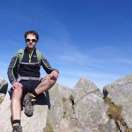
Big Sharp
More precisely, the blue ends at the border with Germany, but from there it is only a few meters to the very peak with an altitude of 1,293 m. The peak with the surrounding area is relatively rocky, but the highest rock with a wooden cross is quite convenient access. Just below the top is a German tourist cottage where it is possible to have a snack.

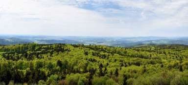
View from the top
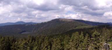
From the top there is a wonderful view in all directions. Towards Germany, the closest is the distinctive peak of Malý Ostrý, in the distance, among other things, the ridge of Velký Javor: [https://www.gigaplaces.com/…velky-javor/], towards Bohemia has a nice view, for example, of the Pancíř ridge with the peaks of Prenet, Můstek and Pancíř. To the southeast in front of us we have a border ridge with another goal today, Velký Kokrháč and then Svaroh: [https://www.gigaplaces.com/…ak-a-svaroh/] and Jezerní hora.

Little Sharp
Before we set off along the ridge to Velký Kokrháč, we will make a short detour to Malý Ostrý, with a height of 1,266 m above sea level only slightly lower than Velký Ostrý. Following the La 3 hiking trail, we descend around the German Mountain Service hut into a shallow saddle between the two peaks to a small chapel. After it we turn left and start to slowly climb to the top of Malý Ostrý.

At the top of Little Sharp
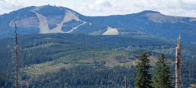
The top again forms a distinctive rock with a large wooden cross. The last part of the ascent is technically a bit more demanding this time than on Velký Ostrý, but it's nothing terrible. However, the top gives a wilder impression, the rocks are more jagged and the depth below them is much greater. Below the summit cross is a memorial plaque with the names of those who fell in World War II and died from the Bavarian Mountain Service. From the top there is a logically similar view from the neighboring Velký Ostrý, with the exception of the view of Bohemia, which is dominated by Velký Ostrý – see the cover photo.

Cross-border hiking trail
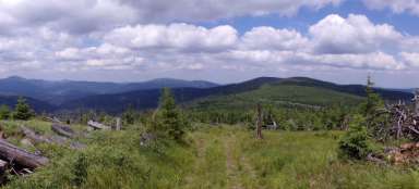
From Malý Ostrý we will return the same way back to the crossroads at Velký Ostrý and from there we continue to the right along the ridge hiking trail Lo 1. One of the most beautiful sections of the hike awaits us. The road leads along a narrow footpath on a slope along the Czech-German border, there are rocks on the left, a steep slope on the right, sometimes the road is secured with a steel rope. And a great view of the German side. We will soon come to a sign informing about the conditions of use of this cross-border trail, among other things we learn from it that crossing state borders is allowed only from 1.5. to 30.9. in the time from 6:00 to 22:00 and from 1.10. to 31.10. in the time from 8:00 to 18:00. From 1.11. to 30.4. border crossing is probably prohibited (?). We must not stay here for more than 7 days and continuing the journey outside the border zone is not allowed. The road is lined with border landmarks, some of which are located in quite accessible places (during the measurement, about every meter of territory was fought for). After about 300 meters, the marked route turns right, down the hill. But we will continue further along the ridge along the now unmarked path.

Continuation along the ridge
The footpath is pleasantly comfortable in places, but sometimes very rocky. In any case, there is no need to be afraid of getting lost. Just follow the bars marking the border, which are very close to each other. In places without mature trees, the view opens up mainly to the German side, and when looking back we can also see the peaks of Velký and Malý Ostrý.

Big Cockerel
After about 3.5 km from Velký Ostrý, we are finally near the top of Velký Kokrháč (1,229 m above sea level). There are several rock gardens in the place, the highest should be the one on which there is a boundary stone with the number 27/4. It pays to climb one of them, again they have a beautiful view. The footpath continues to Svaroh and to the former Juránek's cottage, where it is possible to descend from the ridge along unmarked paths to the asphalt road leading below, leading to the Stateček crossroads (plus approx. 6 km / 2 extra hours). Alternatively, it is possible to descend this path directly from Velký Korháče through the forest, but it is a bit of an obstacle course and it is necessary to be very careful where you step. From the crossroads of Stateček, only the last 4 kilometers along the blue (mostly on asphalt) back to Hamry are waiting for us.

Articles nearby


Giga List: The most beautiful hikes in Šumava
Šumava offers the most peaks of the Czech mountains over a thousand meters above sea level, although most of them are not very… continue reading