Article Ascent to Mittagskogel
Mittelberg - Mittagskogel and back


The Mittagskogel can be reached from Mittelberg relatively easily using the Gletscherexpress tunnel, which takes you to a height of 2,840 m above sea level. From here, it is just over 300 meters above sea level to the top of the Mittagskogel. However, a more valuable performance is to complete the entire ascent on foot. The hike is not very technically demanding, but due to the relatively large elevation gain, expect a total time of about eleven hours.
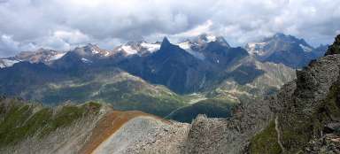
The first part of the output
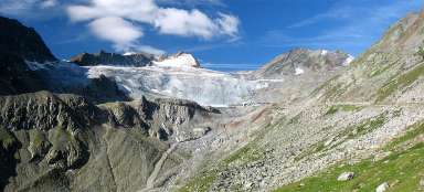
The actual ascent begins at the bottom station of the Gletscherexpress. A car park right next to the station would be offered for parking, but unfortunately there is a sign on the driveway to the car park warning that the car park is intended only for tunnel passengers. It is therefore safer to use the small car park just off the main road next to the Gletscherblick. The first part of the ascent leads through the forest on a steep slope. Soon, however, the trees recede and a view of the valley opens up (the weather was not very favorable for photography). The trail then zigzags here and there for some time and the slope slowly decreases. At the end of August, there are a lot of tasty blueberries in these places.

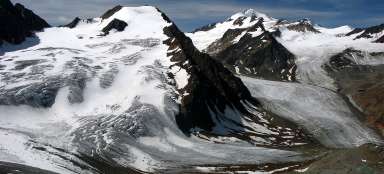
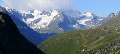
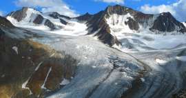
View of Rifflsee
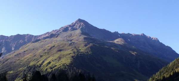
After ascending to a height of approximately 2,200 m above sea level, a „resting“ part of the journey follows. The footpath no longer clicks much here and slowly climbs the mountainside to a height of approximately 2,650 m above sea level. It leads mainly in a grassy slope interrupted by rocky seas. From the road there is a view of the opposite massif with the peaks Grubenkarspitze, Vorderer Eiskastenkopf and others, as well as the lake Rifflsee. The photo is from the early evening return trip, when the Sun appeared for a while among the clouds.

The second part of the output
After about 2 km of gradual ascent, it's time for a more challenging part of the journey – the ascent to the saddle between Mittagskogel and Mitterkamm. The road in this section is full of rubble and stones and in the last part quite steep.

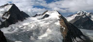
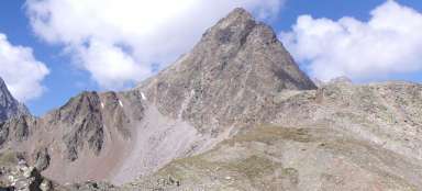
Seat
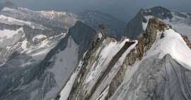
The saddle is at an altitude of about 3,050 m above sea level and it is only a short walk to the top. The photo shows a view towards the upper station of the Gletscherexpress, from where several cable cars lead, incl. cable cars to Hinterer Brunnenkogel (3,440 m above sea level).

The last part of the output
From the crossroads in the saddle, only the last approximately 100 altitude meters await us. In fog and light rain, the road is quite uncomfortable. Red marks on the stones do not always indicate the most suitable path. There are even steel ropes in several places, but these sections can also be bypassed on a more viable route.

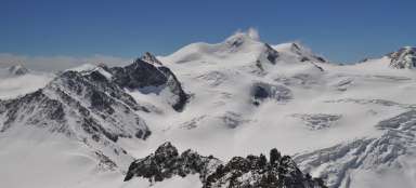
Peak - 3 162 m above sea level
After six hours, the peak is conquered. The clouds do not allow you to enjoy the view of the surroundings, but in good weather it must be beautiful. On the other hand, I assume that in more favorable weather, probably more people come here to use Gletscherexpress, while today I am completely alone. I haven't met a single person on the way all day … isn't that beautiful?

Return trip to Mittelberg
For time reasons, I choose the same path for return as for output. Alternatively, it is probably possible to go to the upper station of the Gletscherexpress and from there to bypass the Grabkogel massif and walk to Mittelberg via the Braunschweiger Hütte hut. And of course in case of emergency it is possible to use Gletscherexpress itself :-)

Articles nearby


Giga List: The most beautiful ascents in the Ötztal Alps
The Ötztal Alps offer hundreds of 3,000 peaks accessible from three main valleys: Ötztal, Pitztal and Kaunertal. It is literally… continue reading
Giga List: The most beautiful mountain ascents in Austria
Austria offers countless amazing mountain ascents, you will also find thousands and thousands of mountains here. Let's take a… continue reading