Ascent to the Pitztaler Jöchl and Polleskogel
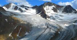
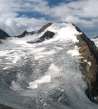
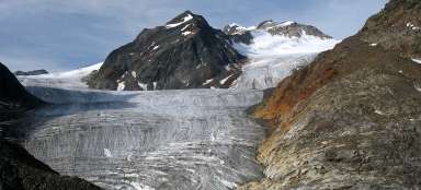
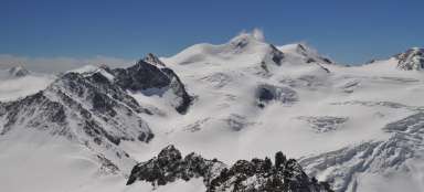
Amazing view to the ice arena


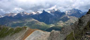
The best of this moto trip around Ötztaler Gletscherstraße is a short ascent to the pass Pitztaler Jöchl (2990 m asl), from where is an amazing view of the ice arena closing smaller, but more dramatic valley of Pitztal. In the distance towers above all this the highest mountain in Tyrol – Wildspitze. Just above the pass is a small peak with rock fractured by the glacier – Polleskogel (3032 m asl). Pitztaler Jöchl is also a tourist connection of Ötztal and Pitztal valleys – so the place where tourists undertake multi-day treks in the Ötztaler Alps.
View of Pitztaler Jöchl
It is only 190 altitude meters from the car park to the pass through debris that remained here after the glacier that was here a few years ago. It at least cleared the way for less technically savvy tourists. Polleskogel looks from this side just like a small rock above the pass.

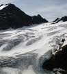
Traverse to the pass
After the ascent of the twists in piles of debris above the glacier begins the most demanding but also the most dangerous part of the hike – the final traverse above the glacier. There is a risk of frequent stones falls from cracked mountain walls, especially in late summer when the ice is melted away the most.

Ascent to the pass
The ascent is sometimes secured with steel ropes, but these can be sometimes damaged by falling stones.

Mainzer Höhenweg
From the pass further leads the ridge of three thousand high peaks, over which leads a challenging ferat path Mainzer Höhenweg.

Look down to the car park
You can clearly see the car park during the ascent and far into the valley of Rettenbachtal leading up to Sölden.

Pitztaler Jöchl (2990 m asl)
After less than an hour you finally ascent into the pass and can enjoy beautiful views of the glaciated giants.

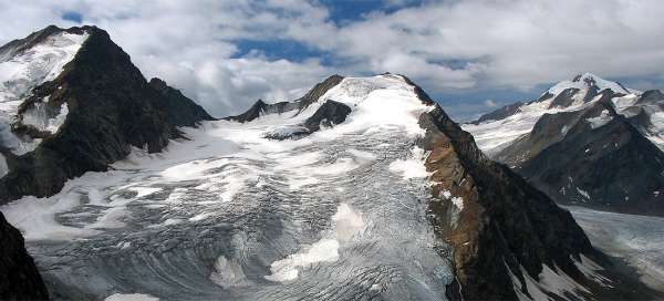
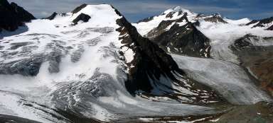
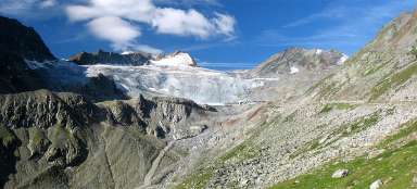
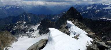
Parade of the ice giants
The view from the pass belongs among the most impressive ones in the whole Ötztal.

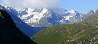
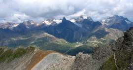
Panorama of the end of Pitztal valley
At stunning location directly above the glacier lies the hut of Braunschweiger. It is much more difficult and longer ascent to the pass from Pitztal valley than from the car park by the ski center. The path to the hut descends along the green hillside of Karleskopf.

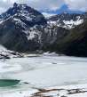
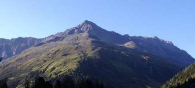
Rifflsee
Another amazing view is towards the mountains towering over the lake Rifflsee – a popular trip place at the end of Pitztal Valley.

Under Polleskogel
Polleskogel is only fissured rock towering above the pass. Even so it attracts for an ascent and offers even higher views.

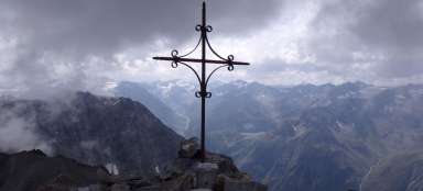
Polleskogel (3032 m asl)
It is only a few minutes to the top from the pass. There is also a small crucifix and excellent view to all directions.
You can go back along the same path or descend down in the direction of Pitztal.

Articles nearby


Article: Trip to the Ötztal ice arena
During your stay in Ötztal valley it is worth to set out for a day trip along the highest located asphalt road in Austria –… continue reading
Giga List: The most beautiful ascents in the Ötztal Alps
The Ötztal Alps offer hundreds of 3,000 peaks accessible from three main valleys: Ötztal, Pitztal and Kaunertal. It is literally… continue reading