Article Ascent to Medelzkopf
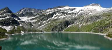
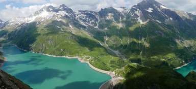
View of two beautiful lakes

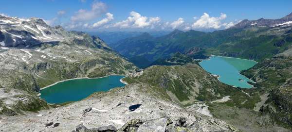


Medelzkopf (2,762 m above sea level) is a peak with a beautiful view of two dam lakes – Weißsee and Tauernmoossee. The ascent from the Kalser Tauern saddle itself is not difficult at all and takes less than an hour. It is a popular destination from Lake Weißsee.
Above the saddle Kalser Tauern
The beginning of the ascent to Medelzkopf is in the saddle Kalser Tauern (2,515 m above sea level), which can be reached either from Lake Weißsee or from the south of Kals. After a few meters of ascent, you already have this flat saddle nicely below you

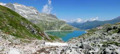
View of Lake Weißsee
When ascending, you can see not only Lake Weißsee, but also the ascent path to the Kalser Tauern saddle

Crossroads by the lake
After about ten minutes of steeper ascent, you will reach a plateau where the road from the Medelz cable car joins. Next door is a nice lake Medelzlacke. Directly opposite you is the pyramid of Medelzkopf. It is hard to believe that it is only half an hour from here to the top

Lake Medelzlacke
Lake Medelzlacke is really photogenic and with a little imagination you can feel like you are at a glacial lagoon in Iceland. In the background are two distinctive 3,000-meter peaks – the closer Hocheiser (3,206 m above sea level) and the well-known Kitzsteinhorn (3,203 m above sea level)

Above the rest platform
After crossing the „resting“ platform, the steepest and most demanding part of the ascent begins with several short steel ropes to hold

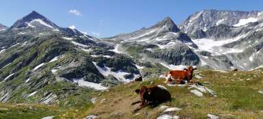
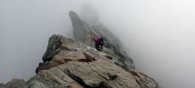
Ascent across the rocky sea
The road is well marked so there is no way to get lost. The most challenging section is the crossing of the rocky sea. Finally, you will occasionally see the top cross, which is a good motivation to complete the ascent

View of the Kalserbach valley
With increasing height, the view opens up to a valley more than 15 kilometers long leading to Kals. Lake Dorfer can also be seen nicely

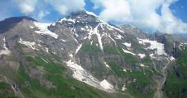
View of the Eiskögele
Quite often the final ascent to the mountain is the most difficult part of the whole ascent – not here. The road turns south and suddenly the rocky sea disappears and there is a grassy slope along which you walk to the top. At the same time, a view opens up of the demanding continuation of the main Alpine ridge leading to the highest mountain in Austria – the Grossglockner. It is not visible from here, the horizon is dominated by Eiskögele (3,426 m above sea level)

The top of Medelzkopf
Just before the top, however, the grass ends and it is a classic boulder-shaped top with a cross, where not many people can fit.

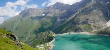
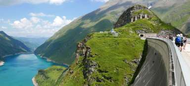
View of two dams
The main reason to climb here is this beautiful view of two dams in one shot

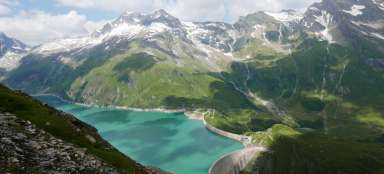
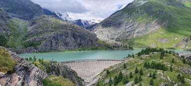
View of the Tauernmoossee
The Hohe Tauern are really beautiful mountains, no matter which direction you look. The descent back is of course a bit faster, the path is the same

Articles nearby


Article: A trip around Lake Weißsee
Lake Weißsee is definitely one of the most beautiful places in the Hohe Tauern. In its vicinity you can make a number of… continue reading
Giga List: Beautiful mountain climbs in the High Taures
The High Tauern is proud of Austria's highest mountain – the Grossglockner, and it is one of the main goals of climbers in this… continue reading