Article Ascent to Fuji
The highest mountain in Japan - 3776 m above sea level


The ascent to the highest mountain in Japan – Fuji, can be done along six access routes. We chose the Subashiri route, which starts at 2000 m above sea level
Arrival to the mountain
At the beginning of our Subashiri trail, we first took a high-speed train to the city of Mishima, which lies west of Tokyo, then changed to a smaller train to the town of Gotemba. Until I paid our rail pass. We also bought a bus ticket that took us to the fifth station of the exit route (Fuji Azami Line Fifth Station) to the village of Minamitsuru-gun in the Yamanashi area at 2000 m. From here we started our ascent.

Climb the forest
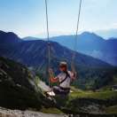
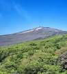
The whole way to the top is very well marked with signs and you really can't get lost. The first part of the path is in the pleasant shade of a dense coniferous forest. The climb is relatively steep along a forest path through tree roots and stone boulders. As the forest recedes, the surroundings turn into a low vegetation of kneeling, and finally the top of the mountain appears to us.

Road through lava rubble
On the way there are numbered stations, where there are cottages for sleeping and some refreshments. Because Fuji is of volcanic origin, the path is about 2/3 of the lava rubble, which often collapses with a larger step underfoot, and the sharp edges of lava fragments can leave an unsightly monument on the hills when tripped.

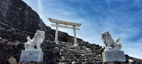
Gate with dragons
We managed the top from below in 4.5 hours from the fifth station at 2000m.nm At the top of the mountain is a sacred gate guarded by stone dragons. You will also find a few cottages for sleeping and shops with snacks or souvenirs – nothing overly kitschy, really only in modest quantities.

Fuji peak
Our entire ascent was accompanied by falling clouds, which followed us, giving the whole way a view from the window of an airplane. The ever-overflowing fluffy clouds below us made up for the fact that we couldn't see the landscape through them at every stop. The timing was exactly one minute, because when I reached the top and took a few photos, the clouds spilled over the top of the mountain from the other side before we climbed and covered the top.

Crater
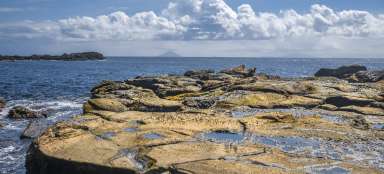
At the top of the mountain you can still go around the entire crater of the volcano. The path leads around the meteorological station, which is located on the mountain and measures both the weather and possible volcanic activity.

Descent road
The descent path is always different from the one upwards. You don't have to pass on a narrowly paved road and the descent road is also adapted to the gently sloping terrain of the rubble. We managed the descent „slippery“ in 1.5 hours. It occurred to our knees that there is less strain when you always slip down the run on a steep soft rubble slope. It's like in soft snow, the free „fall“ of the bottom is only slowed down by rolling the rubble under your feet. On the way, we also met a Japanese army unit, which has a base under the mountain. The last section returns to the wooded path, where the solid ground is already underfoot. Here it makes sense to knock out the mountain of rubble that falls into your shoes on the way down. All that remains is to walk back to the fifth station, from where there is a regular bus back to the city of Gotemba.

Station along the way
Although the route is not technically demanding, it is necessary to take into account the thinning air, which makes the ascent of 1,500 meters altitude much more difficult. After all, the top of Fuji is located at 3 and 3/4 m.

Articles nearby


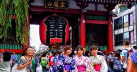
Article: Visit to Japan
Japan offers countless opportunities to travel, but if you are limited in time and still want to see the maximum of these… continue reading
Giga List: The most beautiful ascents to the volcanoes
If you are fascinated by the volcanic landscape and at the same time you like mountain hikes, then the ideal combination is the… continue reading