A trip to the Via Mala gorge
A place that awakens humility from the power of the water element


The Via Mala gorge stretches over six kilometers between the settlements of Thusis and Zillis. It is accessible only in one place. In the past, the gorge was the only access road to the Alps. From these times it also has its name, which suggests the character of the place – Via mala, „Evil Gorge“. It was the most dangerous part of the road. The river Rhine, which is one of the main tributaries of the Rhine, flows through the gorge.
The first look at the gorge
The gorge arouses respect at first sight. Vertical walls towering directly above us and a small, almost tiny Swiss flag hoisted on them. This gives the impression of our own insignificance. At first glance, it can be seen that the water is not only at the bottom of the gorge. Water also flows from all the surrounding rock walls.

Descent into the gorge
To descend to the gorge, you have to pay the entrance fee, go through the turnstile and then go down a large number of stairs.
First look down
We can already look at the bottom of the gorge during the descent. It's a little scary. All the more so because the stairs and descents mark the places and years where the bottom of the gorge used to be. And wonder of the world, the gorge deepens really fast!

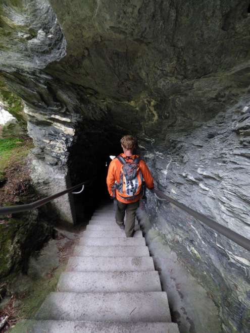
Tunnels
We still go up the stairs, but the closer we are to the bottom of the gorge, the more tunnels carved into the rock we have to go through. Water drips on our heads.
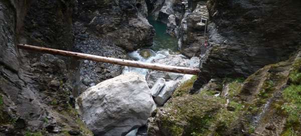
The bottom of the gorge
We reached the bottom of the gorge. The sense of self-insignificance we had when looking at the gorge from above is nothing against the feeling we have now.
White stone
At first glance, everyone is attracted by the white stone at the bottom of the gorge of dark rocks. This stone is made of a different rock than the one commonly found here. Now it is summer and the water in the gorge is scarce, but in spring its amount is many times over. It was the water that brought this stone here. Nobody knows where from, nobody knows when. But now we have a clear idea of what power the water must have here during the peak period.

Bowls
Another peculiarity that we encounter here are excavated bowls. These bowls are formed where the water rotates, forming small eddies, so there is increased erosion.

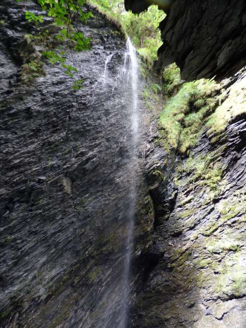
Waterfalls
Water really flows everywhere here. But the most impressive is this waterfall, which flows from a piece of greenery on a vertical wall above us. We also stand under a rock overhang where the road leads. Again, and this time much more, water drips on our heads.
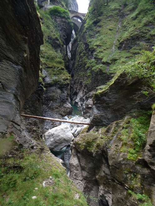
Cannot be overseen
The gorge is so narrow in places that not only is it inaccessible, but it is also impossible to see its bottom.
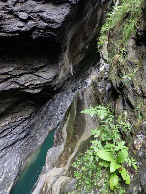
Ferocity
In some places, the ferocity of the river can be seen, which, despite great obstacles, is still moving forward.

Flora
The local flora consists mainly of mosses. We are all the more surprised when we come out of the gorge to find this tree, so typical of the Czech Republic – mountain elm.

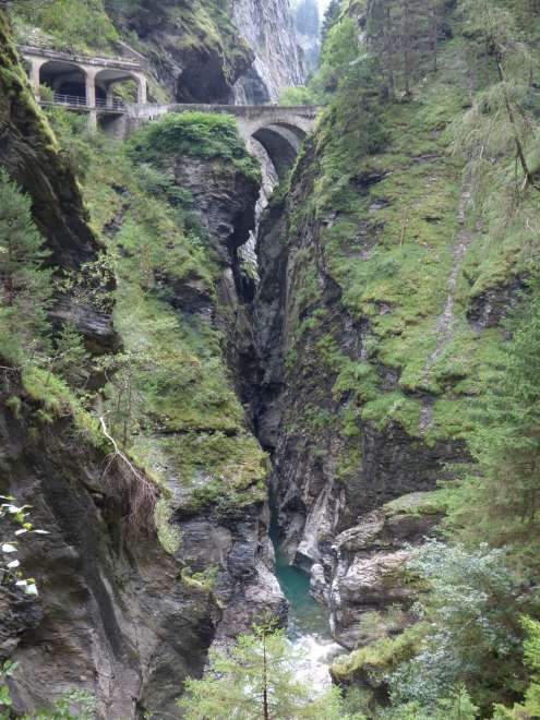
Bridges
The gorge is bridged by two bridges in one place. One takes us to a space carved into the rock, where there is historical information about the local trail. The second time we arrived, it is part of the road.