Ascent to Piz Danis
Road from the town of Lenzerheide, via Piz Denis back to the valley


Lenzerheide, together with the neighboring village of Valbella, is a well-known ski resort in Switzerland. Alpine skiing World Cup races are held here regularly. It is also a good starting point for hiking.
Exit to Piz Scalottas
Our journey began with a chairlift from Lenzerheide to the top of Piz Scalottas to a height of 2321m.nm Of course, more able individuals can conquer this peak in their own way.

View from Piz Scalottas
From the top of Piz Scalottas there is a wonderful view of the surrounding area.

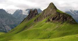
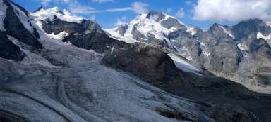
View of Piz Danis
There is also a beautiful view of the destination of our ascent – Mount Piz Danis (2487 m).

Descent phase
Our journey began with a descent into the saddle between the two hills to a height of 2250 m from where we will climb again to the top.

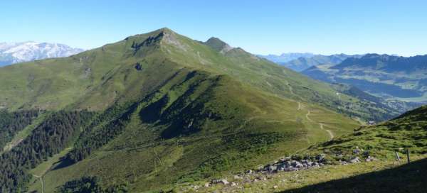
Looking back at Piz Scalottas
We are starting to climb, so it is advisable to look back at Piz Scalottas from where we came out. However, the biggest climb is yet to come.

The road to the top
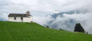
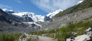
The top of Piz Danis is rocky and the road to it is steep. Along the way, we meet a freely accessible cottage designed for any necessary overnight stays in the mountains.

View from Piz Danis
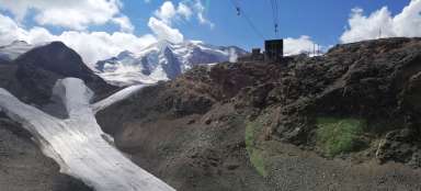
After the ascent itself, a beautiful view awaited us. The photo shows the cable car station to Piz Scalottas and also the town of Lenzerheide.

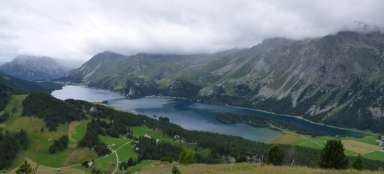
View of the valley
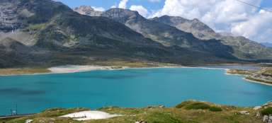
We also have a view of the towns of Lenzerheide and Valbella with Lake Heidsee. Behind the lake you can see the Rothorn massif.

View of Statzen Horn
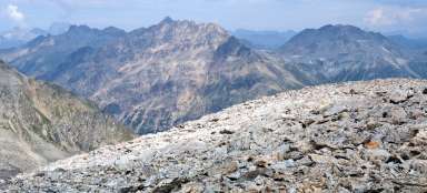
On the opposite side from Piz Scalottas we can see the peak Statzen Horn (2574 m). Very able tourists had the opportunity to climb this mountain as well. Here we can also see the lake and the homestead of the Raschil Alps.

Descent from Piz Danis and a camouflaged lake
When descending with Piz Danis we can see not only numerous pastures with lots of cows, but also a small homestead Alp Raschil, which lies next to a small lake. This lake is blue when viewed from above, but green when viewed from the side so that it almost merges with the surrounding slopes.

Ubiquitous pastures
Most of the grassy mountain slopes are also pastures for cows. In many places, one goes directly through their „paddocks“. These are surrounded by an electric fence, but there are either hooks or turnstiles, so it can usually happen that you meet a cow on the way :)

The inhabitants of the mountains
Along the way, we also came across a few smaller inhabitants of the mountains – a marmot. Mountain meadows are dotted with vulture holes and the local marmots are timid, but when you are quiet, you can also be photographed :)

Road to Lenzerheide
The closer we are to Lenzerheide, the more people we meet. The road here is either gravel or asphalt. We also meet a large number of people on bikes or scooters.

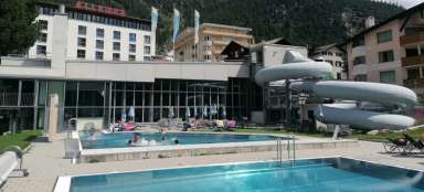
Lake Heidsee
We successfully reached back to Lenzerheide and directly to Lake Heidsee. This 33-hectare lake is mainly used for recreation. It must be added that the people here are much harder than we are. The locals bathed and we sat in sweatshirts on the shore.

Articles nearby


Giga List: The most beautiful tours in Switzerland
Mountainous Switzerland is an absolute paradise for mountain hikers. Almost every corner of the country offers breathtaking hikes… continue reading