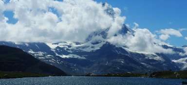
Article Weissmies SE ridge


Saas Grund – Almageller hütte – Weissmies 4017 m – Hoch Saas – Saas Grund, difficulty PD, 4 hours to the top via SE ridge, 2 hours descent via normal, July 2023
Almageller hut
The ascent to the Weissmies from the Almageller hut turned into a surprisingly nice ridge hike. We found the ridge right after the saddle, while normally the first part is walked through a snow field. If we had walked on snow, the ascent time would probably have been reduced by half an hour to an hour, but we were still on the summit at 8:15, happy with the progress.
There is drinking water at the Almageller hütte, which is a relatively rare circumstance, moreover, it flows from the tap, although it drips, like in other huts. I also saw a flush toilet for the first time in a high mountain hut. It is simply because a mountain stream flows right next to the cottage.

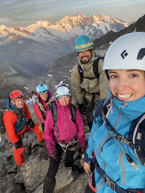
Dear company
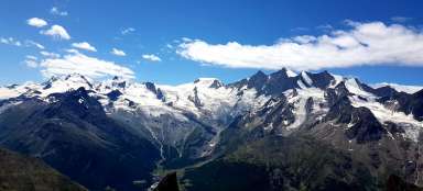
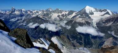
The afternoon waiting at the cottage the day before (we had to leave Saas Grund at 10:00 a.m. due to the reported rain) was cut short by the nice company of three Czechs. The next day we set out in the morning with them, and we are also indebted to them for the fact that we started climbing the ridge while the others were trudging through the snow. In the photo behind us, of course, there is a constellation of 4,000m Allalinhorn, Alphubel, Täschhorn, Dom, Lenzspitze and Nadelhorn – from left to right.
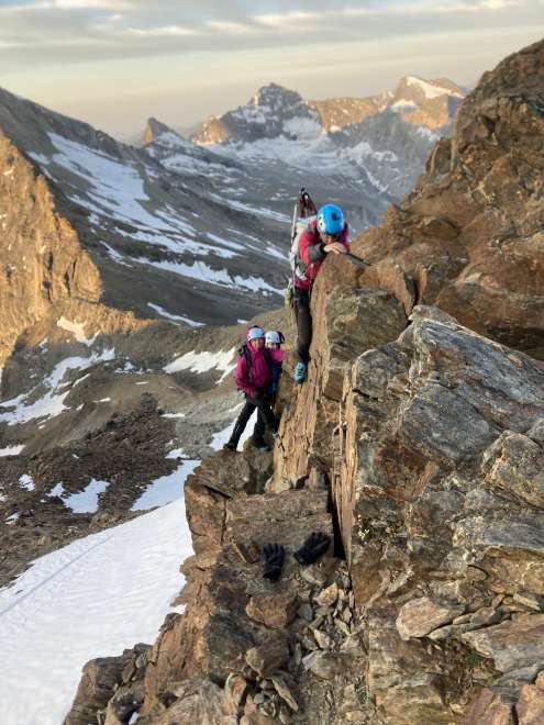
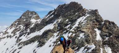
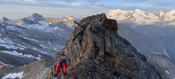
Climb a mountain
The difficulty of climbing the southeast ridge is given as PD, in our opinion it was more like PD+. There were surprisingly many people at the hut, 50 of them went up in the morning. However, we agreed that they would give us breakfast already at 3:45 (officially it was from 4:00), and that way we got ahead of the other groups.
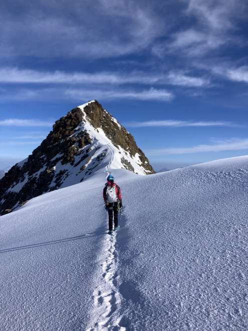
On top
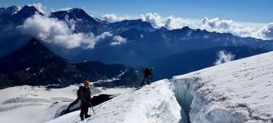
From the crest, one descends to the snow field and then it is only a few tens of meters to the top of Weissmies. There were three Slovaks sitting on the top, who came as normal and when they identified the brothers, they started shouting if we were going to Sněžka. The truth is that as it had fallen the day before, there was fresh hail everywhere and the snow powder was like sugar.
Normal
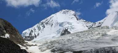
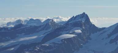
The normal down was well trodden and was easily visible from the top. Two years ago, the glacier broke off here, so it is currently diverted more to the left below the Rottalhorn.

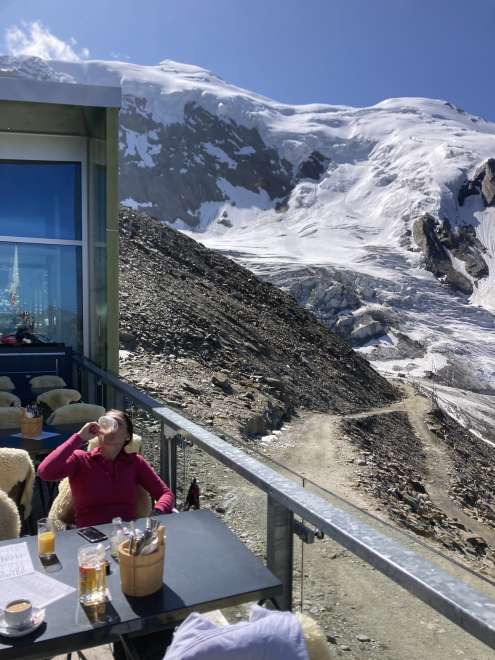
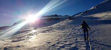
HohSaas
At ten o'clock in the morning, I had not yet sat down with a coffee after crossing the four-thousandth, and I was also satisfied with the corresponding physical load. In short, it was such a rewarding trip. The Weissmies stand out in the background behind me and the Rottalhorn below. It is also possible to recognize where the normal path currently meanders.