Hike Weißkugelhütte - Melag
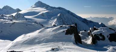
Hike on the viewing balcony


After enjoying the beautiful views around the Weißkugelhütte mountain hut, you will most likely be on your way back to Melago. If you went towards the cottage by the path leading through the valley, it is far better not to return with the same path, but to choose an alternative descent via a scenic path high up in the valley. Instead of zigzags, a gentler descent awaits you (the steeper part is almost at the end near Melag). The descent path is only about 5 km long and you will drop 650 meters in height.
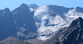
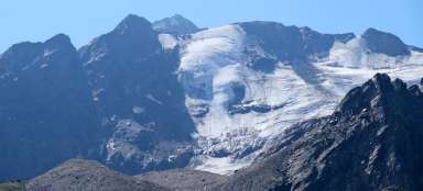
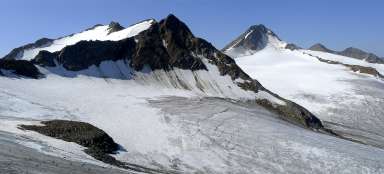
Views around the Weißkugelhütte
The Weißkugelhütte is strategically located on the edge of a number of glaciers and mountain peaks. So you can enjoy the beautiful views from here or take a whole series of interesting views.

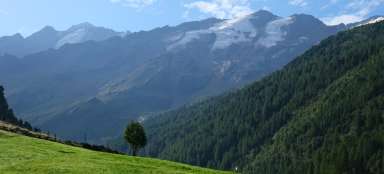
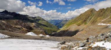
Descent from the Weißkugelhütte
The descent is very comfortable, we go from the beginning through mountain meadows and moors. After about 600 meters we reach the signpost, from where the „normal“ descends in zigzags into the valley. We can see the road below us for a while. We comfortably descend slowly and enjoy the views of the valley. In a moment, we can see the Melageralm mountain cottage far below us, and on the horizon our destination – the mountain village of Melag

Peaks on the other side of the valley
On the other side of the valley, a whole series of tall three-thousand-thousand-thousand-thousand-thousand-meter-high trees rises. All of them are dominated by the local giant – Weisskugel (3,738m), the third highest mountain in Austria. It is not that high within the Italian sheet. Here it is up to 12th position

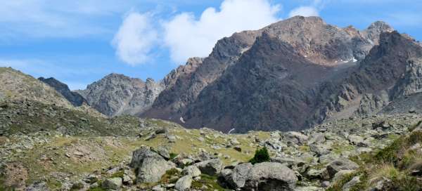
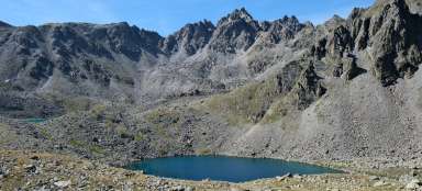
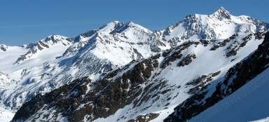
At the second fork
Less than halfway down the descent, we come across the second fork. From there, a path leads up the stream valley with three interesting options: Ascent to the Nockspitze (3,006m) or to the higher Vordere Karlesspitze (3,230m). The third option is the ascent to the pass with a possible transition to the Kaunertal (very difficult way from the pass further – glacier, etc.)

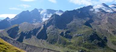
Peaks above a desolate valley
This is how the peaks rising above this desolate side valley look from the crossroads.

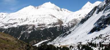
Path across the creek
The path crosses the stream in its mildest part and also on a footbridge, so it is here without any problems.

Lie in sight
The goal is soon in sight, the descent on a good path with a pleasant slope is quickly disappearing.

The final descent
We come to a cross from where the steep descent to the green meadows around the village begins

Articles nearby


Article: The most beautiful hike from Melag
The Langtauferer Tal is one of the most visited valleys of the Ötztal Alps on the Italian side of the mountain range. The most… continue reading